
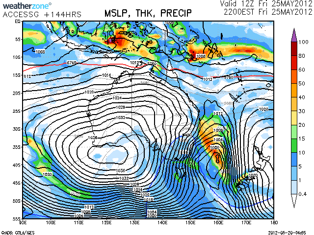
In my blog post last week I hinted at the arrival of a potential snow-bearing weather system, however I have been holding off from posting about this weather system for the last few days.
While it was picked up as a long range prospect over a week ago it hasn’t been terribly exciting as the forecast models have updated and the system approaches. It looks like it’s going to affect us roughly from Thursday to Sunday of this week.
The various models have been waxing and waning with regards to its temperatures & snowfall amount etc, however as of this morning it looks like it’s could be be quite wet and with snowfalls only at higher altitudes. This could potentially benefit NSW resorts more than Vic due to their higher altitudes.
Jane’s Weather has done her first Alpine Forecast for the season, Frog’s Snowatch is less enthused by it & the Weather Nerds are passing commentary as each of the forecast models provides the next update.
This isn’t the bonanza we’re hoping for in this early in the season, indeed if it is followed up with warm temperatures and rain it may not even stick around, but let’s remember that some epic seasons have not got started until well into June.
I will keep you updated as things progress, please use the comments below if you have your own theories on this weather system.
Don’t forget to ‘Like’ aussieskier.com on Facebook for your chance to win a copy of The Powder Bible before 5pm Monday 21st at 5pm AEST. Also follow us on Twitter.
