

UPDATED: Wed Jun 22 8am
Quick update – between 20 and 50cm has fallen in the various resorts. This was totally expected and not really news, what’s news is the new terrain that this fresh snow may open. I’ll report back when I hear.
UPDATED: Tues Jun 21 1pm
Well it huffed, and it puffed, and my roof leaked like a sieve at 3am today. Interestingly it seemed the first, violent band of precipitation moved through very quickly, but it is the follow up showers that are currently making the difference.
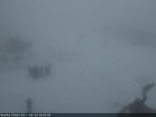
The Buller Village Square Cam makes for good watching, as does the Mountainwatch Live Streaming LBS Cam. I’ve received a few pics from the hill this morning but they all look pretty similar – whiteout fog with a tree or a lift with some fresh snow. Snowguns are running on the LBS cam as well.
Jane’s Weather is predicting the following:
ALPINE FORECAST
REST OF TODAY
Snow, quite persistent, throughout alpine elevations. Winds are cold and strong.
WEDNESDAY
Persistent snow. Turning to drizzly rain/sleet – from early afternoon at lower elevations and late afternoon at higher elevations. Only wet snow on the peaks at night, rain for the rest. Winds are strong.
THURSDAY
Plenty of showers, only as sleet on the peaks. Winds moderating.
FRIDAY
Just the chance of a rain shower – likely to be dry. Lighter winds.
SATURDAY
Plenty of sunshine, dry. Lighter winds.
TOTALS
30 to 40 cm of snow is likely by later Wednesday. After that its 10 mm of rain/wet snow showers to follow before it dries up.
Click Here for the full forecast. Disappointing to note the warming trend later tomorrow into Thursday. The showers are clearly shown on the Weather Chaser’s animation.
But at the moment this isn’t really news to anyone, we knew it would snow, and it did.
How much is the real question, and what lifts will be open for the weekend?? When I saw that Holden and Wombat were showing as closed, not standby this morning I was worried that the foul weather preceding this had washed Baldy away, and it may well have, but there are skiers on LBS at the moment as shown on the cams. Usually lifts on wind hold are shown as ‘Standby’ and not ‘Closed’.
Once we get a read on the snow totals I’ll get my contacts up on the hill to let me know whether we will be skiing new terrain for the weekend.
—
A quick update after writing the below – I just looked at this from the Weather Chaser. I’m a lot more optimistic than I was half an hour ago.
—
Forgive my cynicism, but if you relied on the official Facebook/Twitter channels from the resorts over the weekend & today, you would have gleaned that snow was definitely on the way, it was pretty windy up there, and a few veiled references to terms like ‘misty, showers, damp’ etc – I think I saw the word Rain once. That reference was from Falls Creek, who refrained from describing it as Iconic or Bumper, so extra points there. Buller just refrained from social media altogether over the weekend.
Well the bad news is that it PISSED WITH RAIN (there, I said the R word – Ha!) for most of the weekend, but unless you spoke to someone who went skiing I doubt you would have found that out. One SMS I received this morning said: “Days like this weren’t in the brochure”.
Rain seems to be the Voldemort of snow lovers vocabulary. It’s the term that must not be named, should we invoke it’s presence. I think that’s childish and stupid. We’re skiing in Australia, it rains all the time. Fact. Even great seasons like 2000 and 2004 had downpours strong enough to drench your jocks. Any regular Aussie Skier knows this, so I think it’s time we grew up and embraced it, especially the snow reporters. People might even start believing you. Don the Gore Tex, go out for a few runs, head in for a hot meal and a coffee, then do a few more runs.
Anyway, in true Australian fashion – it always gets worse before it gets better. The good news is that the cold air is only a few hours away and we will be terribly unlucky if we don’t wake up to white webcams and Facebook feeds full of excitement.
Once again I’ve seen some pretty outlandish total snowfall figures being bandied about, and while I believe we will get a top up of the white stuff, I’m not sure that it will be a huge amount, due to the wind speed, speed of the front and warm temps trailing it.
Weatherzone is calling for 15-30cm with low snow levels initially, but raising rapidly prior to the weekend. Frog’s Snowatch is similarly calling for 15-25cm.
Jane’s Weather is a little more optimistic:
ALPINE FORECAST
REST OF TODAY
Light rain at times, falling as sleet on the peaks. A heavy band of rain starts late tonight, heading northeastwards. Winds are gale force with gusts over 100 km/h – see warning.
TUESDAY
A heavy band of rain quickly turns to heavy snow early morning, lowering throughout the alpine by dawn. Persistent snow follows. Winds are cold and gale force with gusts over 100 km/h.
WEDNESDAY
Persistent snow turning to drizzly rain/sleet later. The snow level starts at around 1000 metres in the morning and retreats to the alpine in the afternoon then the peaks at night. Winds are strong.
THURSDAY
Plenty of showers, only as sleet on the peaks. Winds moderating.
FRIDAY
Just the chance of a rain shower – likely to be dry. Lighter winds.
TOTALS
20 to 30 mm of rain/very wet snow to 9am this morning (but little at Baw Baw). Another 5 mm of light rain/very wet snow today. Around 10 mm in the heavy rain before it is all snow – 30 to 40 cm is likely by later Wednesday. After that its only 5 mm of rain/wet snow showers to follow.
Click Here for her full forecast. The Weather Nerds are a little pessimistic about this one as well. The overwhelming sentiment there is that it will all be over too quickly.
From a Buller perspective it’s hard to predict what terrain may open following the snowfall. Things were still looking OK as of about 2pm yesterday, but the rain and wind have continued since then so it all depends on how much damage has been done. As of Saturday morning after the 10cm of unexpected fresh snow, areas like Summit, Shakey Knees, Skyline and Family Run were desperately close to being able to be opened, but I am sure that the recent detrimental weather has played it’s part so that will need to be re-evaluated.
All the excitement will happen in the wee hours of the morning, and I’m hoping we’re all blessed with white webcams for breakfast. The insomniacs amongst us can wear out their Refresh Button on the Buller Village Square Cam. It is one of the few 24/7, illuminated webcams that is perfect for observing the arrival of a weather system.
If you’re up in the mountains yourselves and have any thing to share, please let us know in the comments below:
Remember to ‘Like’ aussieskier.com on the top RHS of this page & follow us on Twitter for the latest updates.
Also you can share this with your friends using the buttons below:
