So you’ve been watching the forecasts, and a front is on it’s way. You’re read here what a waste of time long range forecasts are, but you’ve identified a weather window thanks to some medium/short range forecasts. It’s now D-Day and you want to track what’s going on up in the hills so you can plan an assault on the mountain (or stay away if blue skies are your thing).
Tracking a storm’s arrival and progress can be a good fun way to use up the nervous energy in anticipation of a trip up to the slopes, more so when it’s a big one.
In my opinion the two most fundamental aspects that will denote snowfall are temperature and precipitation. You need a favourable combination of both for snowfalls to happen.
First let’s look at Temperature. Fortunately throughout Australia the BOM has a series of reliable and accurate AWS stations, with one stationed at each major ski area.
They can be found here:
VIC BOM AWS
NSW BOM AWS
In addition to these, weather stations further West can give a good indication of an approaching front, as weather systems typically arrive from West to East.
Mt William in the Grampians is one such AWS. If you see a sudden drop in temperature then a cold front is on its way.
Note that all these sites will load happily on a smartphone as they are text based with minimal imagery. I can’t speak for Android but I look regularly on my iPhone.
Weather Radar shows precipitation heading to the mountains. Again the BOM has a great network of radar sites, but I tend to prefer other companies interpretation of the BOM data as they tend to aggregate multiple sites and give a composite view.
My favourite Radars can be found here:
ski.com.au Weather Radar (courtesy of Weatherzone)
BOM Composite Satellite / Radar can be quite mesmerising when the Alps are getting smashed.
Note that Radar images are obscured by the mountains, so are only useful for tracking precipitation heading for the mountains – you will often see the precipitation appear as if it is disappearing when it hits the mountains, but rest assured it isn’t – in most cases orographic lift will actually increase precipitation when it reaches the higher elevations.
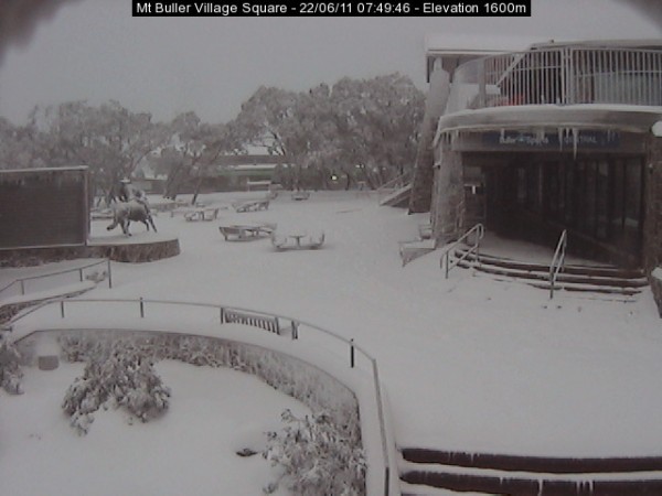
Snow Cams – So once we’ve determined that it’s cold enough, and that there is precipitation on the way, there’s nothing like visual proof. That’s where snowcams came in. The advent of the snow cam in the mid-late 90’s was a game changer for skiers. No longer shrouded by the half truths and marketing spin of Snow Reports in years gone by, we suddenly had our window to our favourite slopes updated at 10 minute intervals. Ski.com.au were among the pioneers of snowcams in Australia having installed and maintained most of the cameras we enjoyed. These are now generally managed by the resorts but a few individuals still maintain their own cams. More modern streaming cams like Mountainwatch are useful as well as you can actually see the snow as it is falling.
Here are the cams I find most useful:
Ski.com.au Snow Cams – the original and still the best.
Buller Village Square Cam – the Buller Village Square Cam is a community effort and is operated by a couple of members of the ski.com.au forum. It is a particularly useful cam as it operates 24/7, over an illuminated area so you can track the progress of the front during the night. Use the slider function under the cam and you can see the snow depth increase thanks to the time lapse function.
Mountainwatch’s Little Buller Spur Live Streaming Cam is useful for watching during the day, as its low altitude means it is often under the fog – vital given the poor visibility that often accompanies a storm.
‘Fletchcam’ is another independently operated webcam situated at Hotham Central. Again it’s open for business 24/7 so makes for useful evening viewing.
On the ground reporting is the final piece of the puzzle. Many people in the alps, whether residents or on holiday will use various forms of Internet communication to broadcast the state of conditions online. The 2 most useful resources I find are Twitter and the ski.com.au forums.
Ski.com.au Weather Forum – With each approaching storm an ‘Observations Thread’ will be started with a range of dates during which the weather is expected. People will post observations, and it is tightly moderated so a good place to get up to date information without wading through rubbish.
Ski.com.au Twitter Pie is another great resource. Naturally you can follow whoever you please on Twitter, but the ski.com.au Twitter Pie aggregates a number of snow loving tweeters into a single feed, which is usually bustling when the flakes are flying.
Please use the comments below to let me know any resources you may happen to use when the snow is imminent, and if you found this article useful please share it with your friends using the buttons below.
Naturally you can follow aussieskier on Twitter as well for the latest snow information.


