Home Blog Page 24

UPDATE – Snow / Weather Update 30 June

UPDATE: June 30 9pm

I’m still not terribly interested in things at the moment, as I won’t be skiing this weekend, but it would seem that the storm approaching mid next week does indeed have some juice attached.

Jane’s Weather has called it early and jumped on board:

ALPINE FORECAST

REST OF TODAY

Sunny then cloud building from west to east, mainly afternoon. Dry.

FRIDAY

Cloud clearing during the afternoon. Dry.

SATURDAY

Dry. Mostly sunny until cloud builds late afternoon.

SUNDAY

Light, patchy rain then proper rain, developing during the afternoon. Falling as snow on the higher slopes, and a wet snow/rain mix around 1500 metres, from the evening.

MONDAY

Snow at times on the higher slopes and a wet snow/rain mix at times around 1500 metres. Turning to snow throughout at night.

HOW MUCH?

Around 10 cm snow up high for Sunday / Monday.

Outlook – Snow in a west to southwest airflow from Tuesday. This one depends on where the upper trough peaks – some models have it here, some towards New Zealand. The potential for big snow falls is high, with 30 to 50 cm all up, not out of the question.

Click Here for the rest of her forecast. Mountainwatch is waiting for the system to close in and the charts to align, as are the Weather Nerds, while Weatherzone is calling for a moderate snowfall.

I’m still pretending that I don’t care, but I’m sure I’ll be glued to the webcams as it unfolds.

Oh and my new skis just arrived. It’s going to be great spending the weekend looking at them. Not.

If you have your own thoughts on the forecast, please contribute in the comments below:

ORIGINALLY POSTED: June 28 10pm

Weather seems to be in a bit of a holding pattern.

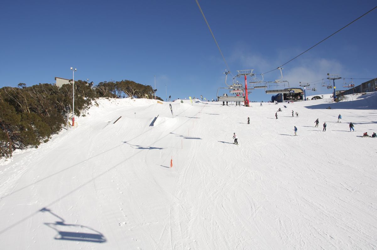
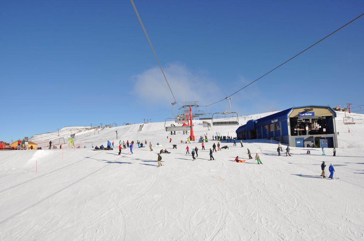
Blue skies during the day and nightly inversions which seem to be giving few opportunities for snowmaking. Cold, clear nights during high pressure are a recipe for inversions at Buller – given the large relief on all flanks of the mountain, the dense, cold air basically runs down the slopes like water and displaces the warm air in the valleys. The AWS is currently showing about 4 degrees C at Buller, but I bet you could make snow at Sawmill right now.

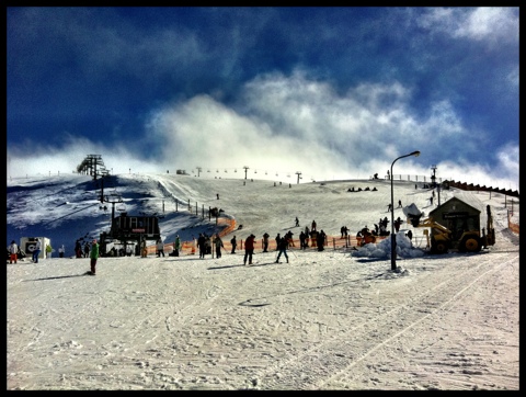
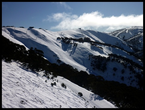
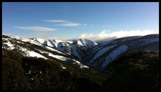
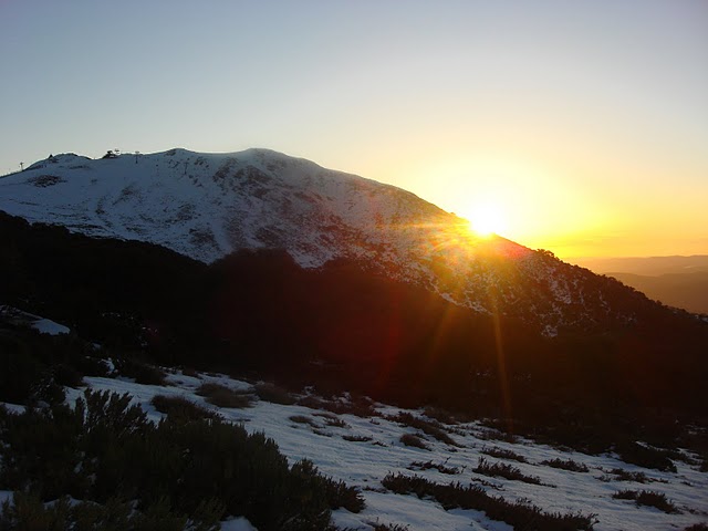
Lorraine Lock from snow-blind went for a snowshoe today and took some great pics.

Buller Sunset
Buller Sunset

Jane’s Weather has confirmed this weather will continue through the week, with a change over the weekend and a chance of snow early this week.

ALPINE FORECAST

REST OF TODAY

Plenty of sunshine. Wispy high cloud at times. Warm day then below freezing overnight.

WEDNESDAY

Plenty of sunshine. Wispy high cloud at times. Warm day then below freezing overnight.

THURSDAY

Cloud building during the day. Dry.

FRIDAY

Cloud clearing during the day. Dry.

SATURDAY

A dry day. Rain slowly starts in the western parts at night / overnight.

Outlook – Rain first then a good amount of snow, on Sunday and Monday. The possibility of further weather systems affecting us in behind this one, with some models indicating a lot of snow next week.

The rest of her forecast is available here. The Weather Nerds are yet to make much sense of the forecast charts.

GFS Forecast
GFS Forecast

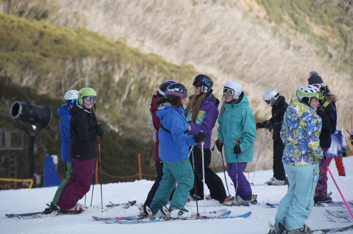
I’m not particularly perturbed by the outlook as I won’t be skiing on the weekend due to attending a wedding, and being the first weekend of School Holidays on limited terrain, it’s probably not a bad weekend to miss, given that it’s the first day for the various squads like Race Club and Team Xtreme that will be skiing in hordes on the few open runs.

In the meantime I’ll be hoping for a few solid nights of snowmaking, despite the increased temperatures of the inversion in some cases the humidity drops enough to allow for snowmaking at temperatures well into the positives.

Hotham Snow Report, Mon 27 June

Noticeably busier with some school holiday crowds around today. Nothing crazy though. Seems to have been an influx of staff as well.

Was quite warm this afternoon and hopefully we don’t see too many inversions this week as there will be a definite need to get the snowmaking going at full effect.

Big D:

20110627-100346.jpg

UPDATE: Buller Snow Report Weekend 25-26 June

UPDATE: 10am Sunday

Firm, fast and sunny this morning. Chilly winds blowing too.

UPDATE: 4pm: Photo Gallery from today:

Bourke St
Bourke St
Bourke St
Bourke St
Shakey Knees
Shakey Knees
Shakey Knees
Shakey Knees
Little Buller Spur
Little Buller Spur
Little Buller Spur
Little Buller Spur
Chicks with Sticks
Chicks with Sticks
Chicks with Sticks
Chicks with Sticks
Chicks with Sticks
Chicks with Sticks

UPDATE: 2 pm: Cloud has come in but the extra humidity means LBS just softening now, skiing is great.

Blogging from the lift: LBS is an ice rink, but Shakey Knees is lovely:

20110625-114853.jpg

20110625-115103.jpg

Early Saturday Update:

20110625-091437.jpg


Quick pre-weekend report: Howqua chair will open for Family Run tomorrow.

Will blog/post pics from the slopes tomorrow.

Hotham Snow Report, Sat 25 June

The clear skies this morning were welcome after yesterday. If it isn’t going to snow it may as well be sunny. Although given it was the start of the Snowsports School hiring clinic it was quite appropriate to see the aspiring instructors standing in the rain/mist on beginner terrain.

Summit was probably the pick of the skiing this morning offering the best surface of what was open.

Could see from Roadrunner that Snake has been groomed and the rest of that area has plenty of tracks from people during the week but it really needs another good storm before it opens by the looks of it.

Summit:

20110625-125253.jpg

Heavenly Valley:

20110625-044703.jpg

Hotham Snow Report, Thu 23 June

UPDATE 5:50pm: the rain/mist has arrived.

Top of Village looking good to go tomorrow morning.
_________________________

Thankfully the rain last night didn’t stick around and this morning it is looking like it will be a great day out there.

The terrain that is open should be in good condition today.

20110623-090835.jpg

Hotham to open Village Chair

Press Release just lobbed from Hotham:

It’s been snowing all day again at Hotham Alpine Resort. Great news on top of the 29cm of fresh snow that fell in the previous 24 hours.

With snowguns firing and an average natural snowdepth of more than 45cm now, Hotham Alpine Resort will open the Village Chairlift on Friday followed by Cobungra Platter (Dinner Plain) on Saturday. This follows the opening of the Roadrunner and Summit Chairlifts today.

As of Saturday, ticket prices will be $95 for adults and $48 for children.

Buller Snow Report 22/6

Its raining. Bugger. Got a few SMS and seen some Facebook updates confirming this.

Oh well, good to see we got a decent fall of snow.

Looking forward to hearing if any further lifts will open on the weekend.

Ok this has been confirmed on Buller’s Facebook

Just a quick one for now – heard that Shakey Knees is a definite for tomorrow, with Summit/Howqua opening soon.

Will keep this post updated as I hear more.

UPDATED: Weather / Snow Forecast Week 20/6

UPDATED: Wed Jun 22 8am

Quick update – between 20 and 50cm has fallen in the various resorts. This was totally expected and not really news, what’s news is the new terrain that this fresh snow may open. I’ll report back when I hear.

UPDATED: Tues Jun 21 1pm

Well it huffed, and it puffed, and my roof leaked like a sieve at 3am today. Interestingly it seemed the first, violent band of precipitation moved through very quickly, but it is the follow up showers that are currently making the difference.

Buller Village - Fresh Snow

The Buller Village Square Cam makes for good watching, as does the Mountainwatch Live Streaming LBS Cam. I’ve received a few pics from the hill this morning but they all look pretty similar – whiteout fog with a tree or a lift with some fresh snow. Snowguns are running on the LBS cam as well.

Jane’s Weather is predicting the following:

ALPINE FORECAST

REST OF TODAY

Snow, quite persistent, throughout alpine elevations. Winds are cold and strong.

WEDNESDAY

Persistent snow. Turning to drizzly rain/sleet – from early afternoon at lower elevations and late afternoon at higher elevations. Only wet snow on the peaks at night, rain for the rest. Winds are strong.

THURSDAY

Plenty of showers, only as sleet on the peaks. Winds moderating.

FRIDAY

Just the chance of a rain shower – likely to be dry. Lighter winds.

SATURDAY

Plenty of sunshine, dry. Lighter winds.

TOTALS

30 to 40 cm of snow is likely by later Wednesday. After that its 10 mm of rain/wet snow showers to follow before it dries up.

Click Here for the full forecast. Disappointing to note the warming trend later tomorrow into Thursday. The showers are clearly shown on the Weather Chaser’s animation.

But at the moment this isn’t really news to anyone, we knew it would snow, and it did.

How much is the real question, and what lifts will be open for the weekend?? When I saw that Holden and Wombat were showing as closed, not standby this morning I was worried that the foul weather preceding this had washed Baldy away, and it may well have, but there are skiers on LBS at the moment as shown on the cams. Usually lifts on wind hold are shown as ‘Standby’ and not ‘Closed’.

Once we get a read on the snow totals I’ll get my contacts up on the hill to let me know whether we will be skiing new terrain for the weekend.

A quick update after writing the below – I just looked at this from the Weather Chaser. I’m a lot more optimistic than I was half an hour ago.

Forgive my cynicism, but if you relied on the official Facebook/Twitter channels from the resorts over the weekend & today, you would have gleaned that snow was definitely on the way, it was pretty windy up there, and a few veiled references to terms like ‘misty, showers, damp’ etc – I think I saw the word Rain once. That reference was from Falls Creek, who refrained from describing it as Iconic or Bumper, so extra points there. Buller just refrained from social media altogether over the weekend.

Well the bad news is that it PISSED WITH RAIN (there, I said the R word – Ha!) for most of the weekend, but unless you spoke to someone who went skiing I doubt you would have found that out. One SMS I received this morning said: “Days like this weren’t in the brochure”.

Bourke St Webcam 20/6/11 9am

Rain seems to be the Voldemort of snow lovers vocabulary. It’s the term that must not be named, should we invoke it’s presence. I think that’s childish and stupid. We’re skiing in Australia, it rains all the time. Fact. Even great seasons like 2000 and 2004 had downpours strong enough to drench your jocks. Any regular Aussie Skier knows this, so I think it’s time we grew up and embraced it, especially the snow reporters. People might even start believing you. Don the Gore Tex, go out for a few runs, head in for a hot meal and a coffee, then do a few more runs.

Anyway, in true Australian fashion – it always gets worse before it gets better. The good news is that the cold air is only a few hours away and we will be terribly unlucky if we don’t wake up to white webcams and Facebook feeds full of excitement.

Once again I’ve seen some pretty outlandish total snowfall figures being bandied about, and while I believe we will get a top up of the white stuff, I’m not sure that it will be a huge amount, due to the wind speed, speed of the front and warm temps trailing it.

Weatherzone is calling for 15-30cm with low snow levels initially, but raising rapidly prior to the weekend. Frog’s Snowatch is similarly calling for 15-25cm.

Jane’s Weather is a little more optimistic:

ALPINE FORECAST

REST OF TODAY

Light rain at times, falling as sleet on the peaks. A heavy band of rain starts late tonight, heading northeastwards. Winds are gale force with gusts over 100 km/h – see warning.

TUESDAY

A heavy band of rain quickly turns to heavy snow early morning, lowering throughout the alpine by dawn. Persistent snow follows. Winds are cold and gale force with gusts over 100 km/h.

WEDNESDAY

Persistent snow turning to drizzly rain/sleet later. The snow level starts at around 1000 metres in the morning and retreats to the alpine in the afternoon then the peaks at night. Winds are strong.

THURSDAY

Plenty of showers, only as sleet on the peaks. Winds moderating.

FRIDAY

Just the chance of a rain shower – likely to be dry. Lighter winds.

TOTALS

20 to 30 mm of rain/very wet snow to 9am this morning (but little at Baw Baw). Another 5 mm of light rain/very wet snow today. Around 10 mm in the heavy rain before it is all snow – 30 to 40 cm is likely by later Wednesday. After that its only 5 mm of rain/wet snow showers to follow.

Click Here for her full forecast. The Weather Nerds are a little pessimistic about this one as well. The overwhelming sentiment there is that it will all be over too quickly.

From a Buller perspective it’s hard to predict what terrain may open following the snowfall. Things were still looking OK as of about 2pm yesterday, but the rain and wind have continued since then so it all depends on how much damage has been done. As of Saturday morning after the 10cm of unexpected fresh snow, areas like Summit, Shakey Knees, Skyline and Family Run were desperately close to being able to be opened, but I am sure that the recent detrimental weather has played it’s part so that will need to be re-evaluated.

All the excitement will happen in the wee hours of the morning, and I’m hoping we’re all blessed with white webcams for breakfast. The insomniacs amongst us can wear out their Refresh Button on the Buller Village Square Cam. It is one of the few 24/7, illuminated webcams that is perfect for observing the arrival of a weather system.

If you’re up in the mountains yourselves and have any thing to share, please let us know in the comments below:

Remember to ‘Like’ aussieskier.com on the top RHS of this page & follow us on Twitter for the latest updates.

Also you can share this with your friends using the buttons below:

How To Track A Snow Storm

So you’ve been watching the forecasts, and a front is on it’s way. You’re read here what a waste of time long range forecasts are, but you’ve identified a weather window thanks to some medium/short range forecasts. It’s now D-Day and you want to track what’s going on up in the hills so you can plan an assault on the mountain (or stay away if blue skies are your thing).

Tracking a storm’s arrival and progress can be a good fun way to use up the nervous energy in anticipation of a trip up to the slopes, more so when it’s a big one.

In my opinion the two most fundamental aspects that will denote snowfall are temperature and precipitation. You need a favourable combination of both for snowfalls to happen.

First let’s look at Temperature. Fortunately throughout Australia the BOM has a series of reliable and accurate AWS stations, with one stationed at each major ski area.

They can be found here:
VIC BOM AWS
NSW BOM AWS
In addition to these, weather stations further West can give a good indication of an approaching front, as weather systems typically arrive from West to East.
Mt William in the Grampians is one such AWS. If you see a sudden drop in temperature then a cold front is on its way.

Note that all these sites will load happily on a smartphone as they are text based with minimal imagery. I can’t speak for Android but I look regularly on my iPhone.

Weather Radar shows precipitation heading to the mountains. Again the BOM has a great network of radar sites, but I tend to prefer other companies interpretation of the BOM data as they tend to aggregate multiple sites and give a composite view.

My favourite Radars can be found here:
ski.com.au Weather Radar (courtesy of Weatherzone)
BOM Composite Satellite / Radar can be quite mesmerising when the Alps are getting smashed.

Note that Radar images are obscured by the mountains, so are only useful for tracking precipitation heading for the mountains – you will often see the precipitation appear as if it is disappearing when it hits the mountains, but rest assured it isn’t – in most cases orographic lift will actually increase precipitation when it reaches the higher elevations.

Snow Cams – So once we’ve determined that it’s cold enough, and that there is precipitation on the way, there’s nothing like visual proof. That’s where snowcams came in. The advent of the snow cam in the mid-late 90’s was a game changer for skiers. No longer shrouded by the half truths and marketing spin of Snow Reports in years gone by, we suddenly had our window to our favourite slopes updated at 10 minute intervals. Ski.com.au were among the pioneers of snowcams in Australia having installed and maintained most of the cameras we enjoyed. These are now generally managed by the resorts but a few individuals still maintain their own cams. More modern streaming cams like Mountainwatch are useful as well as you can actually see the snow as it is falling.

Here are the cams I find most useful:

Ski.com.au Snow Cams – the original and still the best.
Buller Village Square Cam – the Buller Village Square Cam is a community effort and is operated by a couple of members of the ski.com.au forum. It is a particularly useful cam as it operates 24/7, over an illuminated area so you can track the progress of the front during the night. Use the slider function under the cam and you can see the snow depth increase thanks to the time lapse function.
Mountainwatch’s Little Buller Spur Live Streaming Cam is useful for watching during the day, as its low altitude means it is often under the fog – vital given the poor visibility that often accompanies a storm.
‘Fletchcam’ is another independently operated webcam situated at Hotham Central. Again it’s open for business 24/7 so makes for useful evening viewing.

On the ground reporting is the final piece of the puzzle. Many people in the alps, whether residents or on holiday will use various forms of Internet communication to broadcast the state of conditions online. The 2 most useful resources I find are Twitter and the ski.com.au forums.

Ski.com.au Weather Forum – With each approaching storm an ‘Observations Thread’ will be started with a range of dates during which the weather is expected. People will post observations, and it is tightly moderated so a good place to get up to date information without wading through rubbish.
Ski.com.au Twitter Pie is another great resource. Naturally you can follow whoever you please on Twitter, but the ski.com.au Twitter Pie aggregates a number of snow loving tweeters into a single feed, which is usually bustling when the flakes are flying.

Please use the comments below to let me know any resources you may happen to use when the snow is imminent, and if you found this article useful please share it with your friends using the buttons below.

Naturally you can follow aussieskier on Twitter as well for the latest snow information.

Chicks with Stix 2011 – Girls only Skiing Program

0

Hi All, ‘Mrs Aussieskier’ here.

I’d love to let you all know about Chicks with Stix – a grass-roots, FREE skiing program for young girls to provide them with coaching, encouragement & confidence in skiing & freestyle skiing. The CwS team is an amazing and inspirational bunch, and I asked my friend Lorraine Lock from snow-blind to let us know a little more about the program:

CwS Airtime
CwS Airtime

CHICKS WITH STIX

by chicks, for chicks, with chicks…..no Toms, Dicks or Harrys need apply !

The Australian ski fields are set for a high-octane dose of girl-power this season with an exciting and totally unique program, “Chicks with Stix” [CwS] designed specifically for females, rolling out onto the slopes.

Spearheaded by one of this country’s most proficient freestyle skiers – athlete, coach and international judge Zoe Jaboor, Chicks with Stix provides much needed encouragement and opportunities for more young girls to become involved in skiing – bumps, freeride, slopestyle and big mountain.

“My aim is to infect girls with a passion for this sport because it’s fun and exciting and challenging. I really understand first-hand the benefits of freestyle skiing for teens. It provides an outlet for self-expression, social connection, self esteem and fitness. All that while having some serious fun at the same time!” says Zoe.

Under the guidance of some of Australia’s most experienced female riders, including current skiing World Champion (Slopestyle) Anna Segal, Olympian (SkiX) Katya Crema, and champion Big Mountain skier Natalie Segal, girls in the CwS program will have an opportunity to watch and learn and improve their skills, in a safe and non-threatening environment.

Anna, Zoe, Katie, Katya & Nat - Chicks with Stix

“Skiing with boys can be intimidating and competing is even more intimidating! In existing event formats, the courses mostly cater for developed male athletes and do not accommodate female progression. Major freeski events are geared towards getting shots of the best male skiers going the biggest, rather than encouraging the girls. This means the courses are bigger and gnarlier which makes competing in these events for the first time scary, dangerous and very uninviting to girl skiers”, says Zoe.

But recent results from international competitions like the Olympics, the Winter X-Games and the FIS World Cup Circuit seem to indicate that our female riders have what it takes to take up the challenge and become world-class competitors. In fact, the girls outnumber the boys when it comes to medal tallies and world championships!

Just think of it – Lydia Lassila, Alisa Camplin, Torah Bright……..

The CwS coaches are carving it up as well ! In early 2011 Anna Segal won Gold at the inaugural FIS Fresstyle World Ski Championships in Park City, Utah. Her little sister Nat is on the highly competitive Big Mountain/Freeride circuit and Olympian Katya Crema finished her recent season ranked 18th worldwide in SkiX. Zoe is Australia’s most highly accreditated freestyle judge.

“Our plan is for CwS to be a feeder into the Olympic and FIS World Cup pathway and it’s my desire to help channel girls into that, if that’s where they want to go,” says Zoe.

And the Australian governing body, the SSA, couldn’t agree more.

“CWS is an exciting initiative and one which complements the tremendous success of our Australian Female Wintersport athletes over a long period of time,” says CEO Michael Kennedy.

Skiing is one of Australia’s largest participation sports and one of the few that are truly Gender neutral.

“CWS provides female athletes an opportunity to explore their abilities in a supportive, complimentary environment which ultimately brings out the best in athletes. With the emergence of new disciplines such as Half Pipe and Slopestyle onto the Olympic Games program, CWS may well be one of the programs where Ski & Snowboard Australia will uncover our next Gold medal hero!” said Kennedy.

The program will run at home-mountain Mt Buller and then hit the road, traveling to Thredbo, Perisher and Hotham. The format includes regular weekend coaching sessions, ‘encouragement’ awards and an end-of-season “chix only throwdown” competition at Mt Buller.

“We want to get those girls comfortable in competing and giving it their best shot. I am passionate about demonstrating to other girls what’s possible and to open up women’s skiing and the opportunity to compete to the younger generations,” says Zoe.

“My journey through freestyle skiing has taken me all over the world – judging, competing and coaching. I intend to be a judge at the next Winter Olympics in Sochi, in 2014 and I can’t see any reason why there shouldn’t be more Australian female athletes following in my steps,” she said.

Current dates for the FREE programs are:

June 25th, Mt Buller
July 9th, Mt Buller
July 16th, Mt Hotham
July 23rd, Mt Buller

August 13rd Thredbo
August 21st Perisher

Mt Baw Baw (TBC)

September 4th, Mt Buller (Throwdown) TBC

Keep an eye on the website for the latest dates, times & locations

For more information contact :
Lorraine Lock
0415 461 360
[email protected]

CwS online at :
https://chickswithstix-skiing.blogspot.com/
https://www.facebook.com/chickswithstix?ref=ts

Chicks with Stix
Chicks with Stix