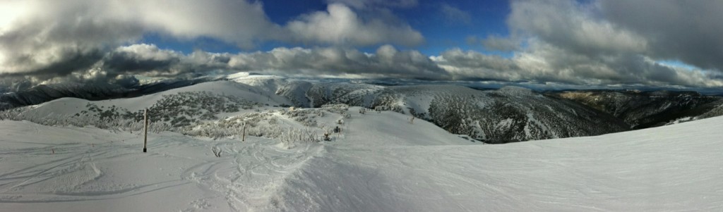
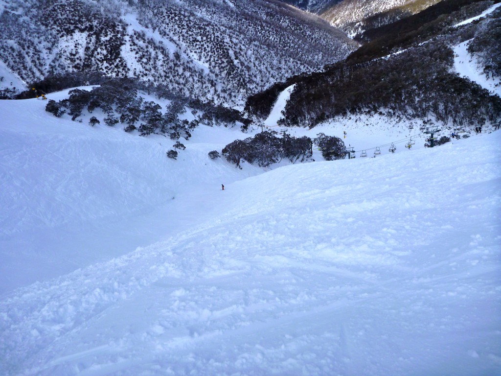
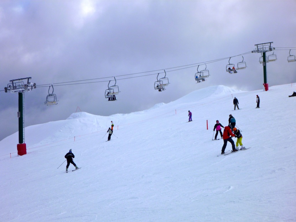
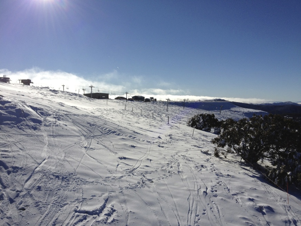
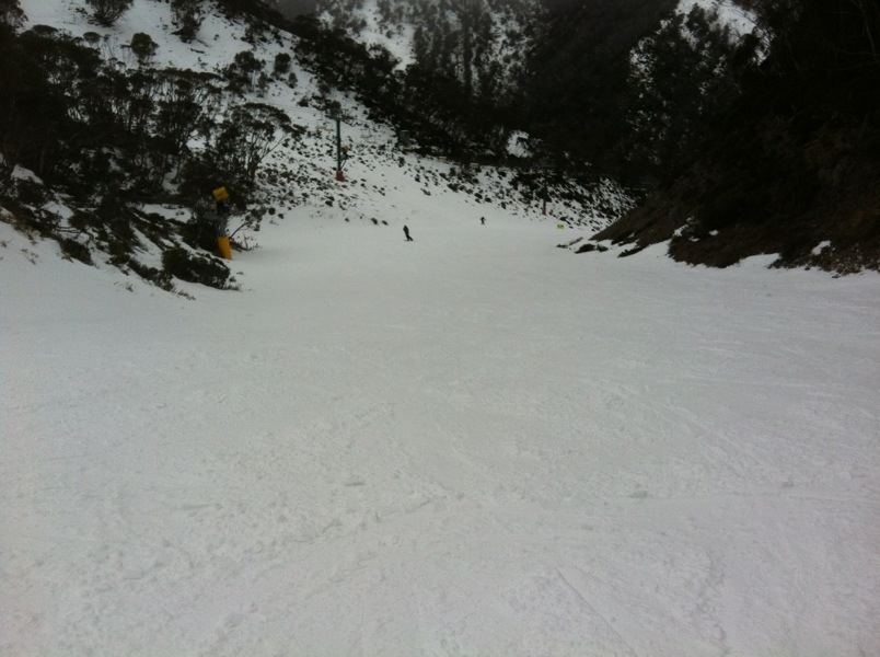
After another storm rolled through over the weekend things are looking really good. It’s crazy to think that it’s only the start of July. The riding has been fantastic, plenty of fresh tracks to be had and for those not really interested in that sort of thing the groomers with their packed surface were excellent as well.
The weather has been pretty hostile at times and it was good to get a little respite this afternoon to be able to get some pics to show how things are looking. The last time I looked the snow has rolled back in for the evening so things should be good again tomorrow.
Click pics to enlarge:
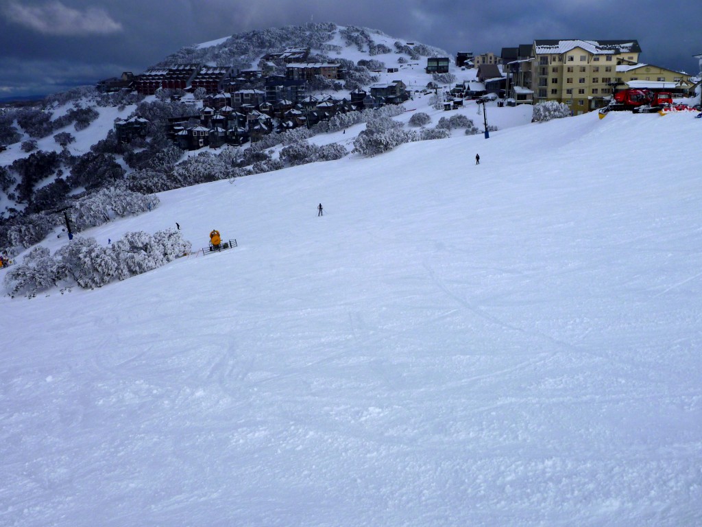
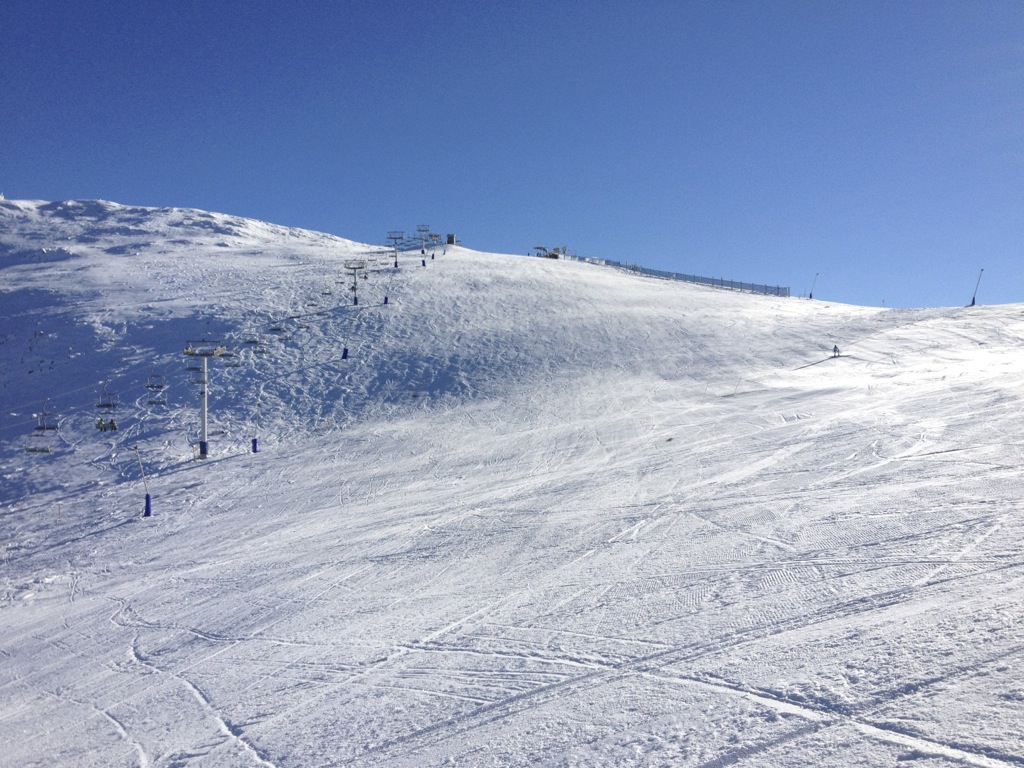
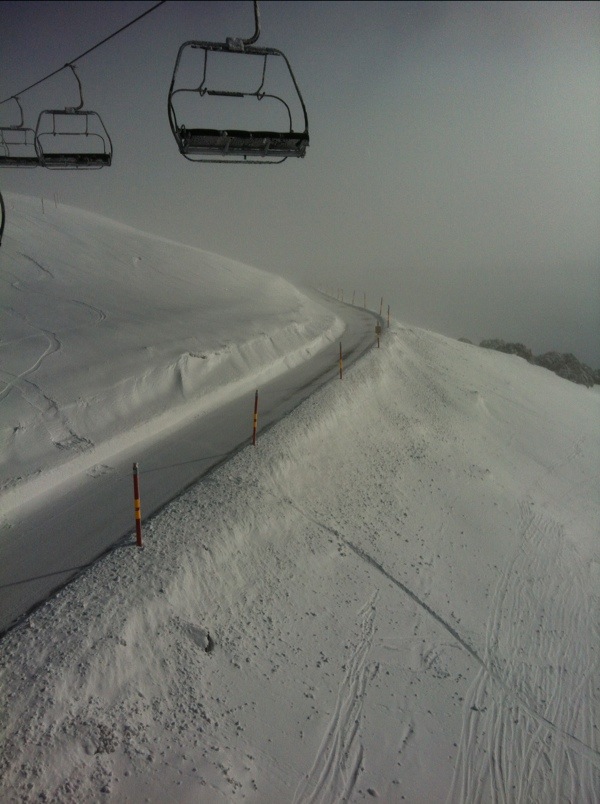
Slalom Gully/Imagine
Imagine
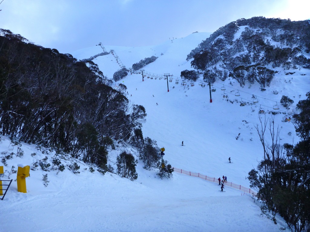
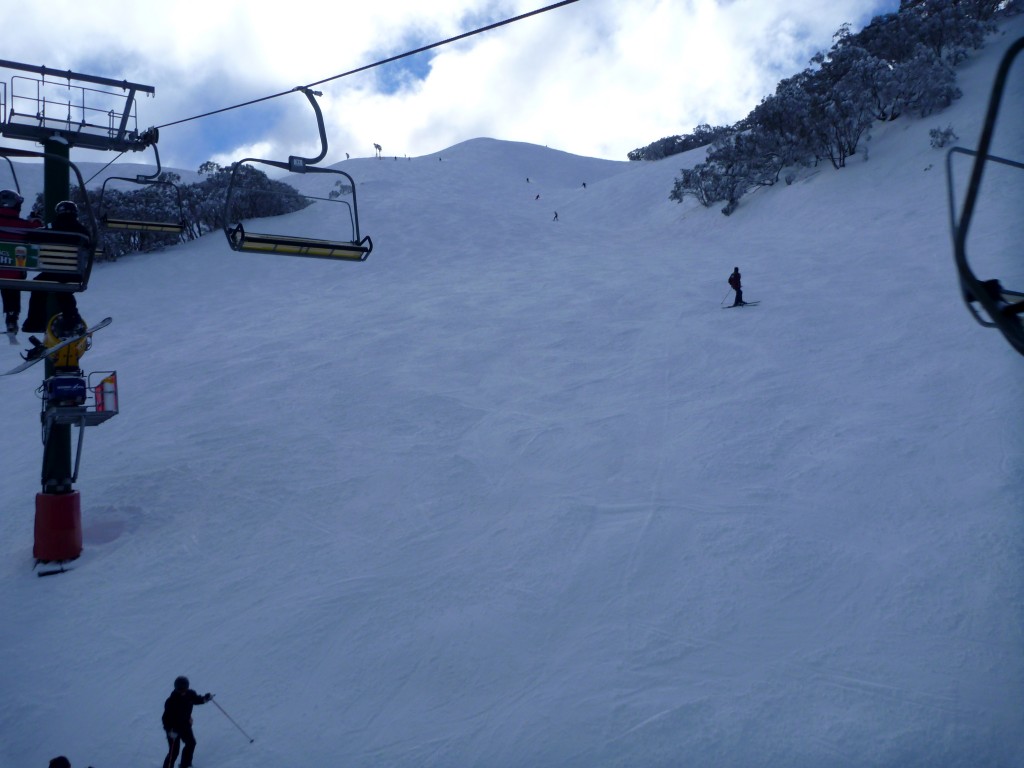
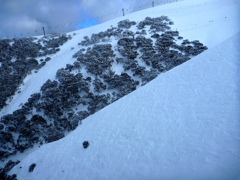
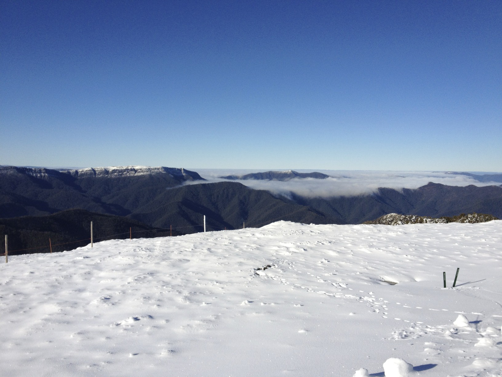
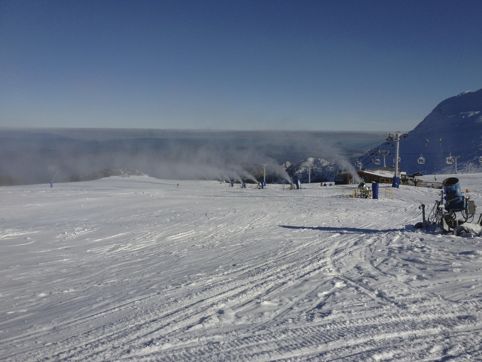
Looking left off HV
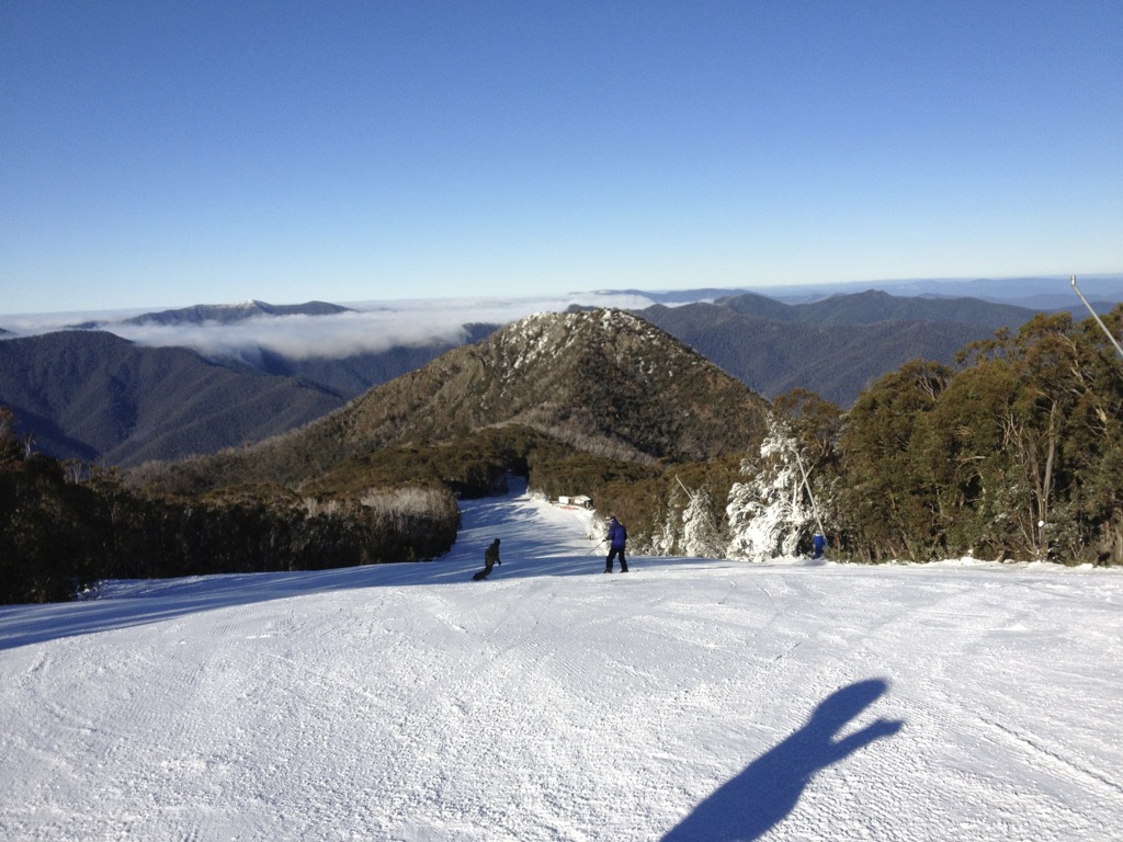
Gunbarrel
Cornice Pitch
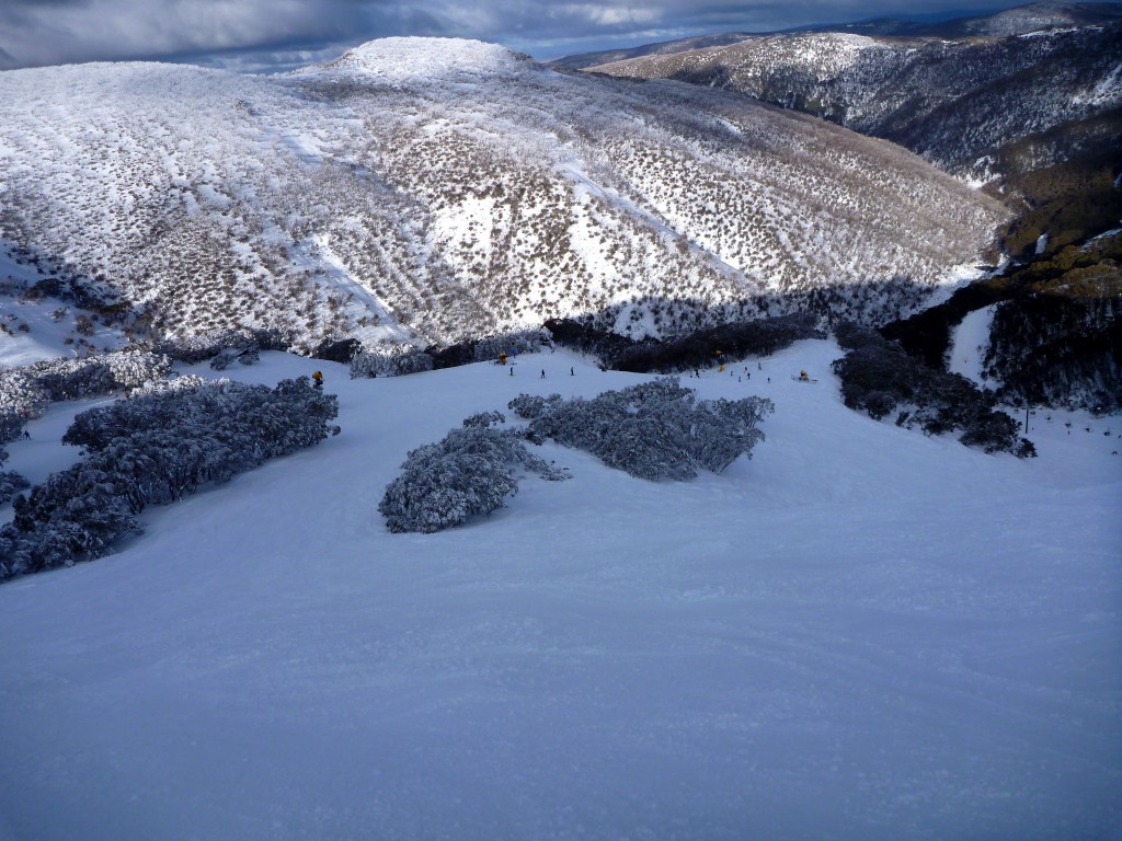
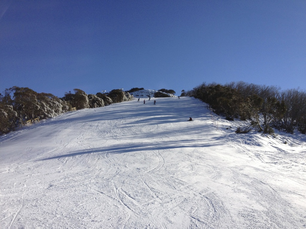
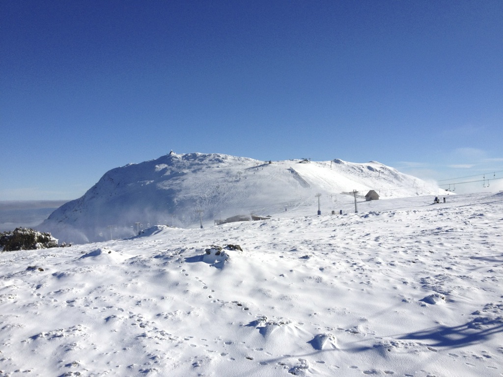
Spargo’s/One Tree
Sun Run
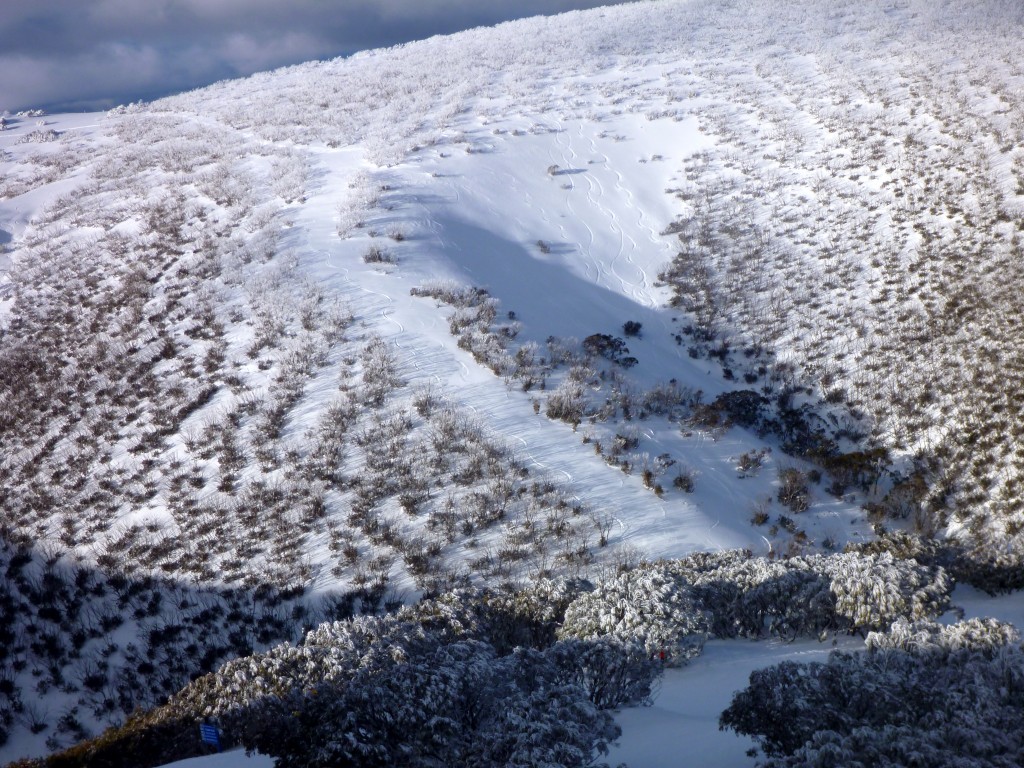
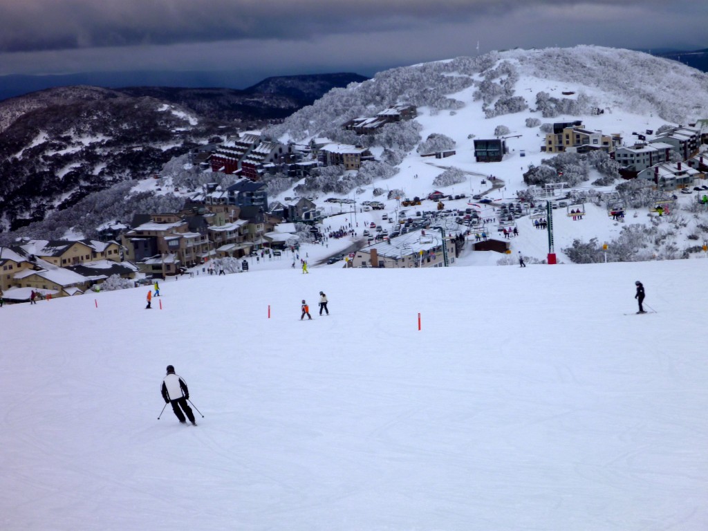
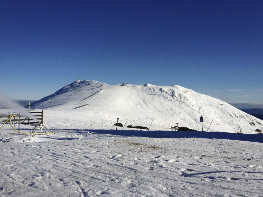
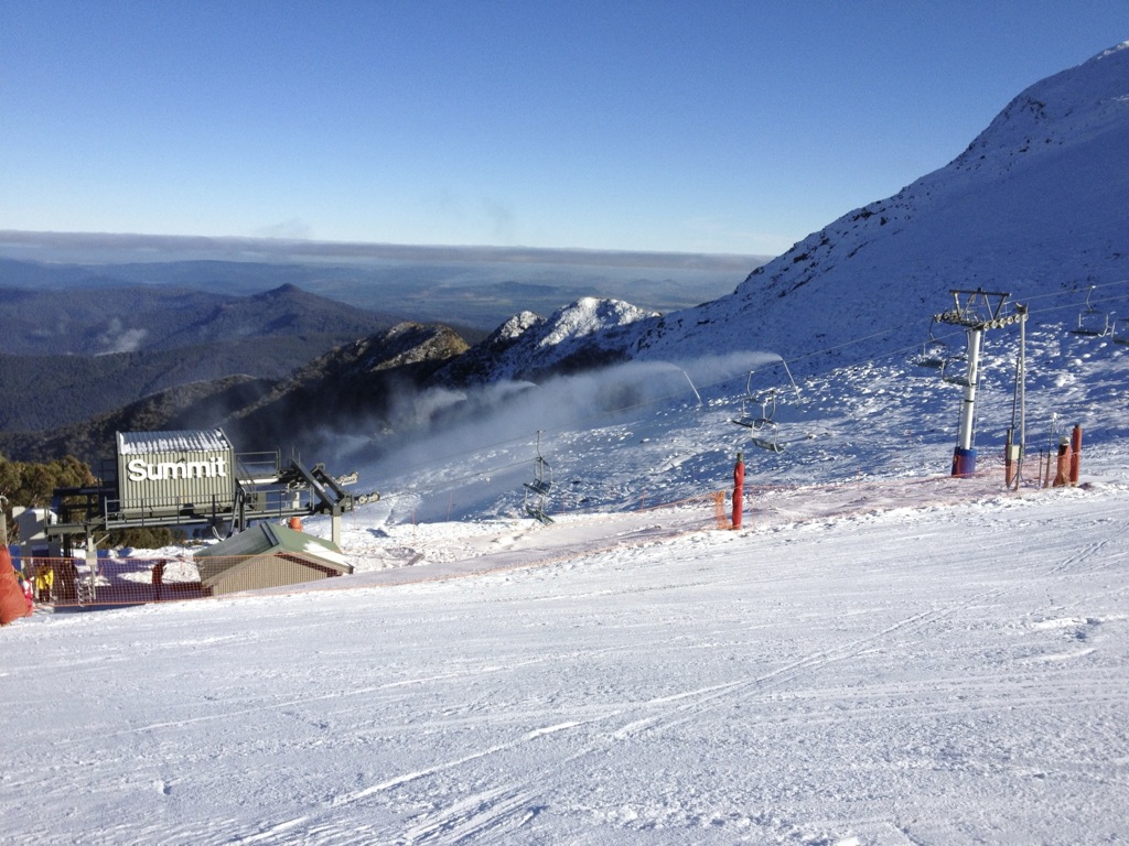
Summit/Summit Terrain Park
Summit
Looking out at the Orchard, it can’t be far away. Same goes for the Summit Terrain Park.
Enormous thanks to everyone who has been tagging their Instagrams with #aussieskier – keep them rolling in and check them out on aussieskier.com/social and also our Facebook Page
Underwhelming is a word that I would use to describe the weekend, and I fear with the snow that is falling while I type this word-heavy but picture-light report it will become somewhat redundant by Monday morning.
Late last week many forecasts were calling for up to 40cm of fresh snow, and while I did not believe that we would get that much I was still anticipating 15cm or so and perhaps some new terrain.
The warm pre-frontal rain period did some damage on Thursday night and the weather moved in with a vengeance on Friday afternoon. The drive to Buller on Friday evening was a sodden affair, raining for the entire trip, and we were treated to a spectacular lightning show over the alps as we were coming in to Mansfield.
As we made our way up the mountain the rain turned to snow quite low down on the road, chains were being fitted at the plough shed and the snow was consistent at White Bridge. As we ascended the mountain the snowfall became heavier and it was particularly strong as we reached the Village. However a glance at the radar showed that it was a narrow band of intense precipitation with not much behind it. 6cm of snow fell relatively quickly but by the time we finished dinner at around 9:30pm it was all over. Accompanying this front was a drop in temperature which led to a good night of snowmaking.
We got out early on Saturday morning as we knew it was the first day for all the squads – MBRC, TBR & Team Extreme so we were keen to get a few laps in before they made their way up the hill. Little Buller Spur skied well until the hordes arrived, and we very much surprised ourselves with some great skiing up on the Summit in the few centimetres of fresh snow. The poor visibility was a definite bonus as nobody was able to see what we were doing and follow us, so we had the particular areas we had chosen all to ourselves. Light snow showers came in & out throughout the day but didn’t really add up to anything. Of note was the very low crowds – apart from the aforementioned squads there were very few skiers on the mountain which was a big surprise as the weekend marked the start of the Victorian school holidays. Some of the speculation in the bar that evening was whether it was due to skiers lost to Falls Creek & Hotham due to their vastly cheaper season passes but in my opinion it is too early to tell, next weekend will be interesting to see as it is traditionally much busier. The other topic of conversation was the lines to pick up tickets and season passes – apparently the system went down at all three Victorian resorts and this led to long lines and frustrated customers.
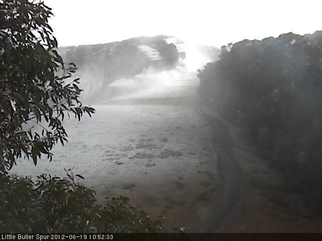
Waking up this morning to see 1cm on the report, and much larger numbers at the other resorts did not make us want to spring out of bed, so we made a leisurely start to the day, and found that the nice snow we experienced yesterday had become an icy crust, so we didn’t last too long. We could see a tasty band of precipitation approaching on the radar but our estimate of the timing was that it would arrive too late – if you look at the last few frames of today’s Little Buller Spur camera you will see that it arrived between 4 and 5pm. So we packed up and headed off the hill to drive home – again the entire drive was in constant rain, though it was great to know this was falling as snow on the mountain.
Skyline opened midweek but had to be closed due to the warm weather on Thurs night, so I would suggest this will open again if tonight’s snow keeps up, also Shakey Knees has to be close – I was told by a snowmaker on Tuesday that it was very nearly able to be open. Also looking at the new Burnt Hut Cam, that area will be getting close and I’m sure the lift co would be desperate to get the new lift open for the school holidays.
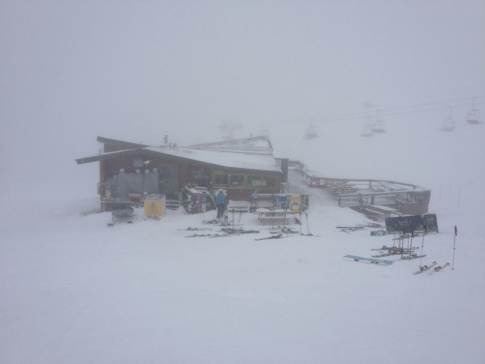
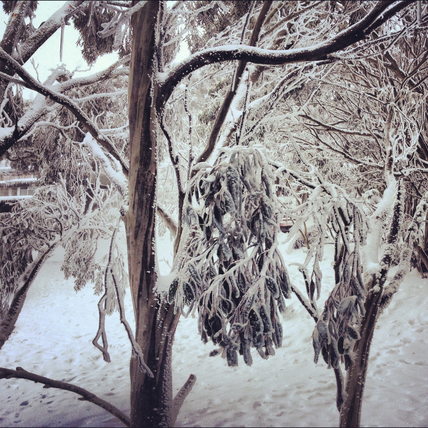
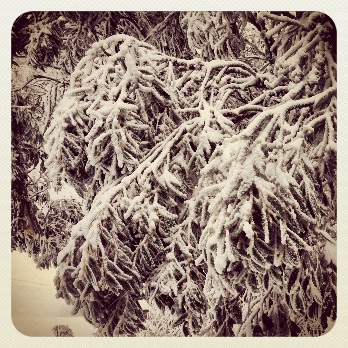
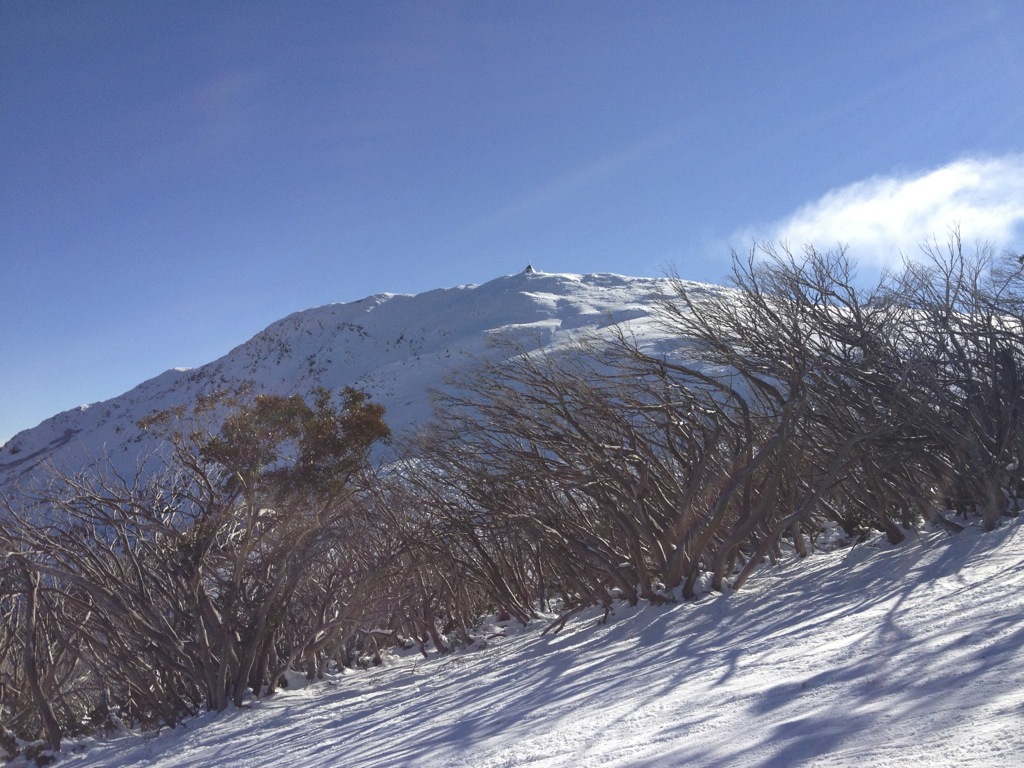
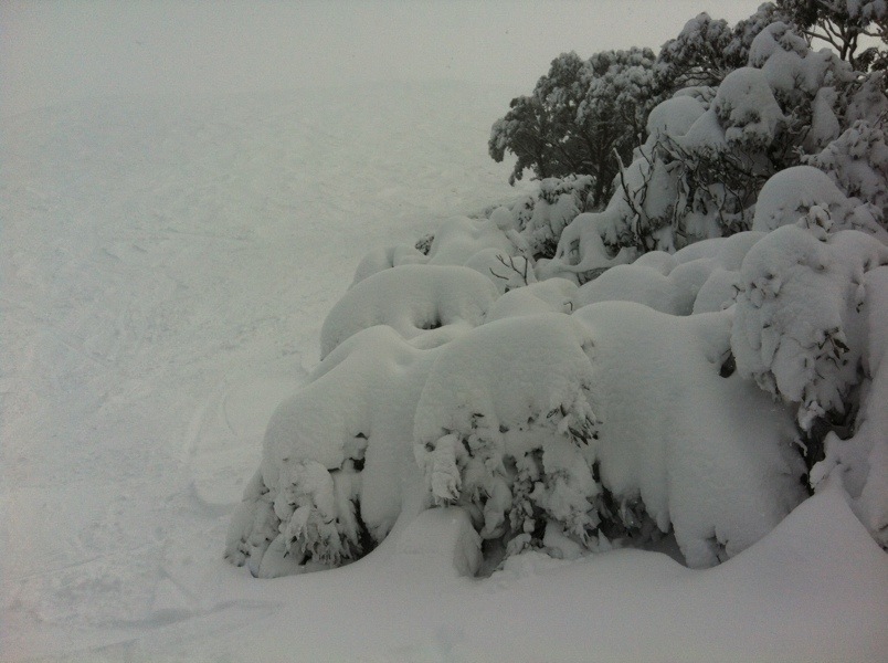
Very few photos due to poor visibility all weekend. I also got a great pic of a dude in green stretch pants & rear entry boots in Koflers but I fear it may drive people away from the site! Half of the pics are wannabe-arty-farty pics of snow gums as you could see f*** all up on the mountain.
Koflers, Sat LunchtimeFrozen SnowgumsWombat on SundayMore frozen gumsIncoming!
I’ve now settled in to watch Le Tour and can’t wait for the Alps – last year’s viewing was great as we had driven many of the roads during the road trip in our Chamonix 2011 adventure. I’ve also got one eye on the radar and another on the Buller Village Square snowcam, watching the steps disappear. I’m also seeing updates on Facebook of snow down to Mirimbah and cars sliding off the road so I’m sure that the people skiing tomorrow will have a better day than I had today.
Thanks to everyone who submitted Instagrams over the weekend with the #aussieskier hashtag – unfortunately a big storm in the US knocked out the Instagram servers and in a domino effect the Instagram plugin I use couldn’t deal with that and crashed the whole site! It also meant that a few were missed from being automatically posted on the Facebook Page, but everything is visible on aussieskier.com/social.
After what has been a warm & windy night in the mountains the cold is approaching – it was spelled out clearly in Jane Bunn’s Forecast that this one was going to start as rain and transition to snow during today. Texts from Buller and Facebook Updates from Hotham are suggesting that the temperatures are right on the borderline & that it is snowing up high.
Some good news is that the Buller Mountainwatch LBS Cam now seems to be working again – this is a very useful camera in storm times as it is often below the clouds.
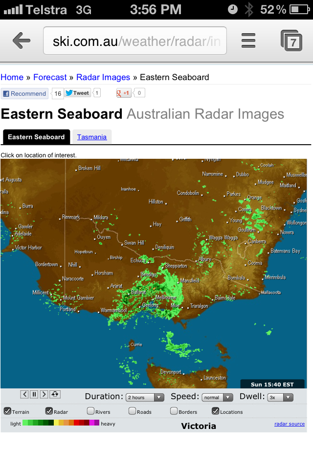
Once again all the resources in my ‘How To Track A Snow Storm‘ post are most relevant today. Click through to get access to all the web links to keep you informed as the storm approaches.
The approach of the cold air is visible in the all-knowing Weather Chaser Satellite/Radar – you can see the speckled cloud marching across from the Vic/SA border quite nicely.
Mountainwatch’s ‘Grasshopper’ has also done a dodgy photoshop on the Satellite picture showing the key points:
As I mentioned below in the early part of this post while the main pundits have been calling for decent snow amounts, the guys in the ski.com.au Weather forum have been less optimistic about the amounts of snow set to fall, and they have also concurred with my earlier thought that this system could favour Vic over NSW, and even in a more micro-scale it could further favour the southern resorts like Buller/Baw Baw.
Personally, I’m happy that it’s going to snow, but I’m not pushing the hype-meter into ‘extreme’ due to these doubts – in my opinion this will be a nice little snowfall that will get a bit more terrain open and will be welcomed by the hordes of school holiday makers arriving in the mountains in the coming days.
I will be up at Buller for the weekend and I would love for those in the other mountains over the weekend to keep us posted with updates on our Facebook Page and also tag some Instagrams with #aussieskier to appear on https://aussieskier.com/social
Don’t forget to ‘Like’ us on Facebook and Follow us on Twitter for the latest from this storm. I will update this forecast daily, or as required if anything changes.
Eagle-eyed readers will see a change to the homepage and an additional Gear section – I will be working hard on that in the coming weeks, reviewing as much as I can. Also if you have used any of the featured gear please add your own reviews, and contact me on [email protected] if you would like a particular item added.
Finally I’ve done a huge amount of ‘under the bonnet’ work on the website to speed it up – for the nerds who are interested it basically involves caching and offloading much of the content to a CDN. For the non nerds – it will load faster and piss you off less. 🙂
[divider] ORIGINAL POST: Wed 27th June 2012 5pm:
After a bout of fine midweek weather to top off the snowfalls of the weekend, we have another weather system incoming that is forecasted to bring some more snow to the Alps.
Jane’s Weather is usually the first of my many bookmarks that I check out when there is a sniff of incoming weather. Here is her take:
A high pressure system is moving to our east, continuing the dry weather for now.
A cold and snowy outbreak is coming this weekend. A front moves through on Friday, introducing a cold and unstable airmass. This is driven by a low pressure system that will move across Tasmania on Saturday. It eases with a high coming closer on Monday.
Expect persistent snow through the weekend. Freeze levels lower well below 1200 metres after a wet rain/snow mix on Thursday night and Friday day.
It is rare to see such tight consensus from the major Australian snow forecasting pundits, and while the BOM is less specific when dealing with snow amounts, their forecast concurs that we will see snowfall across this period. Their 4 Day Forecast chart is also quite a pretty sight.
However the vibe in the ski.com.au Weather Forum is a little tempered due to questions over the amount of precipitation on offer.
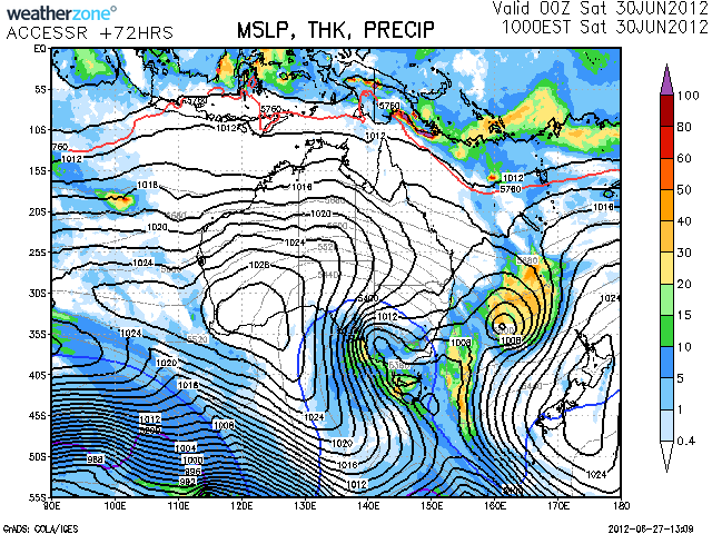
One of the forecast charts posted there is quite indicative of this – showing that the MSLP and Thicknesses are consistent with a good winter weather system but the precipitation numbers are not indicating a huge dump:
Snow Forecast Sat June 30 2012
Most of the charts shown on the forum page indicate much of the moisture to the South, so in this case this system could slightly favour the Victorian resorts over NSW.
I will be up at Buller for the weekend and I would love for those in the other mountains over the weekend to keep us posted with updates on our Facebook Page and also tag some Instagrams with #aussieskier to appear on https://aussieskier.com/social
Don’t forget to ‘Like’ us on Facebook and Follow us on Twitter for the latest from this storm. I will update this forecast daily, or as required if anything changes.
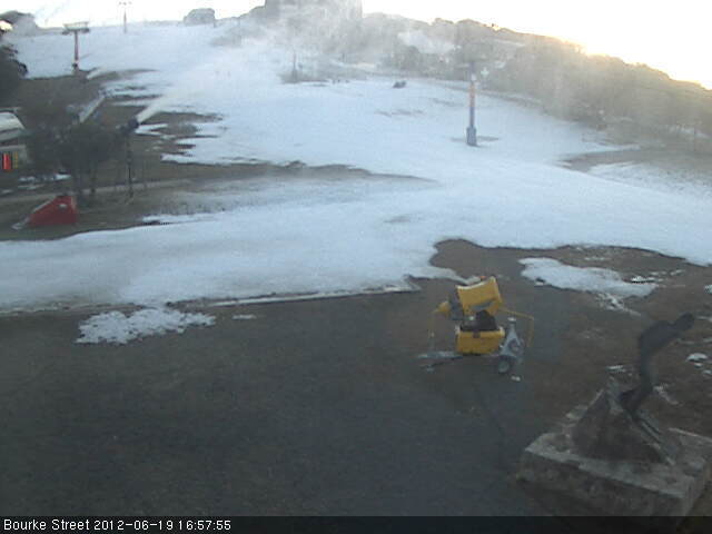
After a yet another miserable, drizzly/rainy day on Monday I was very surprised leaving the Whitt last night to cold, clear skies and snow guns blazing. The snow crossing Bourke St was particularly firm and the road glazed which let to a slippery slide home.
This morning we woke to beautiful blue skies, cold weather and snowmaking running on the upper mountain.
Little Buller Spur was in perfect nick, but the quick transition from slush to frozen had left Summit, Family/Boomerang etc in a pretty rough state. I had a couple of great laps with my nephew and will be heading down to Melbourne shortly.
Some pics from this morning:
Bourke St – Mt Buller – June 26 2012Summit – Mt Buller – June 26 2012Mt Buller – June 26 2012Little Buller Spur – Mt Buller – June 26 2012Little Buller Spur – Mt Buller – June 26 2012
Mt Buller – June 26 2012Summit – Mt Buller – June 26 2012Koflers Snowmaking – Mt Buller – June 26 2012Summit – Mt Buller – June 26 2012Howqua Snowmaking – Mt Buller – June 26 2012Howqua Snowmaking – Mt Buller – June 26 2012
It looks like some more snow is approaching at the end of the week – again when I return to Melbourne I will have a closer look and give my take on the situation either this evening or tomorrow morning.
Plenty of pics from aussieskier.com around the resorts have been tagging Instagram pics to appear on aussieskier.com/social and also facebook.com/aussieskier – many thanks to you all and keep them coming!
After the snowfall of Thursday and Friday I was definitely keen to check out the newly-whitened hill and see what had been covered. Due to some poor luck with the previous snowfalls there was virtually zero natural snow for the fortnight prior and skiing was on an expertly-maintained strip of man made snow on Bourke St. So 30cm of fresh snow augmented by snowmaking in the cold temperatures were definitely welcomed.
Arrival on Friday night was a chilly affair with the snowguns blaring on Bourke St:
We woke up to a lovely vista from our bedroom window on Saturday morning:
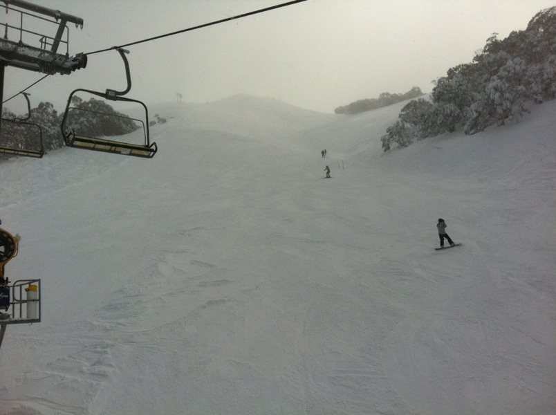
Saturday morning was cold & snow showers persisted for much of the day, with the snowguns on until around lunchtime capitalising on the temperature. Little Buller Spur was in good condition as was Wombat, but we got the tip from ‘Safety Sam’ who is head of Ski Patrol that there were some freshies to be had on skier’s right of the Summit, so we headed up there and were not disappointed.
[raw][/raw]
[raw][/raw]
After lunch we were keen to do some exploring around the mountain on our touring gear to see how various areas were looking so we switched over and headed back to the Summit. Summit slide was an amusing affair, the first few turns were nice but about halfway down it became quite hollow, so it was time to put the skins on and get out of there:
[raw][/raw]
We climbed diagonally across the Boggy Creek area, and climbed up to Tirol to use some of the $200 loaded on our Season Passes, and then decided to check out Burnt Hut Spur. At that point unfortunately the dreaded Westerly had kicked in which led to freezing but wet conditions as only Buller can deliver, but we were well dressed for the conditions so decided to persist. It meant the skiing down was ‘wet freshies’ but still more fun than countless laps of Little Buller.
[raw][/raw]
Skinning out was a pretty basic affair, straight up a snowmobile track and only took 15 minutes – by that stage we were pretty soaked and headed home. Burnt Hut is hardly an exciting affair but it was nice to get out & about and also get some exercise for the afternoon. I reckon Summit Slide needs a good 30cm to get ready, but Burnt Hut probably only needs 10-15cm more, or some solid nights of snowmaking. I know they will be dead keen to get the new lift up & running.
After a lovely dinner at Grimus we weren’t keen to head out in the morning drizzle and when we finally did it was pretty miserable so we made a beeline for the safe haven of Koflers
We were pleasantly surprised when we went out again, the visibility had improved, the snow had softened and the crowds were starting to disperse as is usual on a Sunday afternoon, and we had a number of great laps on Little Buller Spur and Wombat. The snow was nice & soft but not too bumpy, perfect for me to figure out how my gimped-out knee is going to cope this year. I was skiing with my physio’s brother & mother, something tells me I’m going to be using her services quite a bit this year.
We also checked out Family Run – cover was pretty good and we also got to Howqua which opened earlier today and has brand new chairs. Mixed feelings on the new safety bar arrangement – they have a spring loaded flap that pushes down on your thighs which is designed to keep children safe on the chair. Naturally this will make parents feel more comfortable, but I personally find safety bars themselves claustrophobic, even more so when they have footrests and I think the new child-flaps further impinge on personal space. Guess I’ll just ride it with the bar up when I can. The good news is that the padding is excellent – far more comfortable than before, and also the seat position is far more upright, I was never a fan of the ‘reclined’ position of the previous chairs.
I need to give my most profound thanks to aussieskier.com readers for really embracing the #aussieskier / Instagram pictures over the weekend – literally dozens of photos were tagged this weekend to appear on aussieskier.com/social and also facebook.com/aussieskier.
As you can see I’ve taken a few photos this weekend with the Viddy app and would love to see more of that action from aussieskier.com readers. I’m in discussions with a ski brand to have a prize pack for the best Viddy video during the School Holidays – stay tuned for more details.
I will have a bit of a slide tomorrow morning – may not write a full blog, perhaps just Instagrams and in the afternoon I will be attending the Draft Alpine Resorts Strategic Plan 2012 Workshop & will report back from that. Details are at: https://www.arcc.vic.gov.au/draftARSP2012.htm
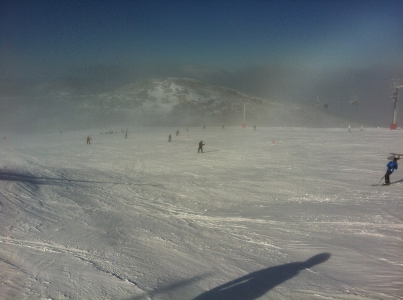
An absolutely fantastic day out there today. Started out with clear blue sky which lasted until about lunchtime before closing in with some more snow.
The riding was really good. The groomers were great fun, Imagine was my pick, offering a great surface. There was plenty of chopped up snow available and it was also excellent.
It was certainly busier than during the week but even HV had nothing more than a minute or two wait.
Here are some pics from around the hill. Imagine looking very different from last Wednesday!
Great Alpine Road:
Summit:
Sundowner:
Slalom Gully:
Imagine:
All set to continue as well.
If you are in the mountains over the weekend please keep us posted with updates on our Facebook Page and also tag some Instagrams with #aussieskier to appear on https://aussieskier.com/social – be sure to check it out as pics & videos have been uploaded today from the mountains.
Yesterday’s NW feed continued to deliver, and by later in the evening it was NSW’s turn to receive as well.
Temperatures were not cold but the precipitation was prolific and as they are usually want to do in a NW, Hotham and Falls Creek reported 48cm and 30cm of new snow respectively. Buller was lower at 18cm but as of this morning the flow has shifted SW which is traditionally where Buller is more reliable for receiving snow and you can clearly see this by scrolling the ‘slider’ on the Buller Village Square Cam and the Little Buller Spur cam – I have received SMSs in the last few minutes saying how hard it is snowing.
The NSW resorts are reporting 25cm of new snow.
Hotham will be opening Heavenly tomorrow, and at Buller Wombat and Holden are expected to open but this has been delayed due to de-icing.
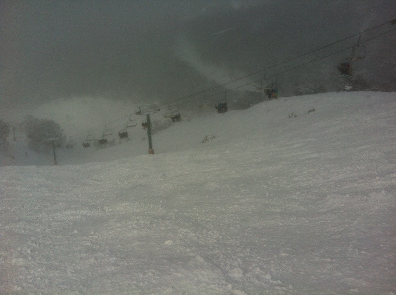
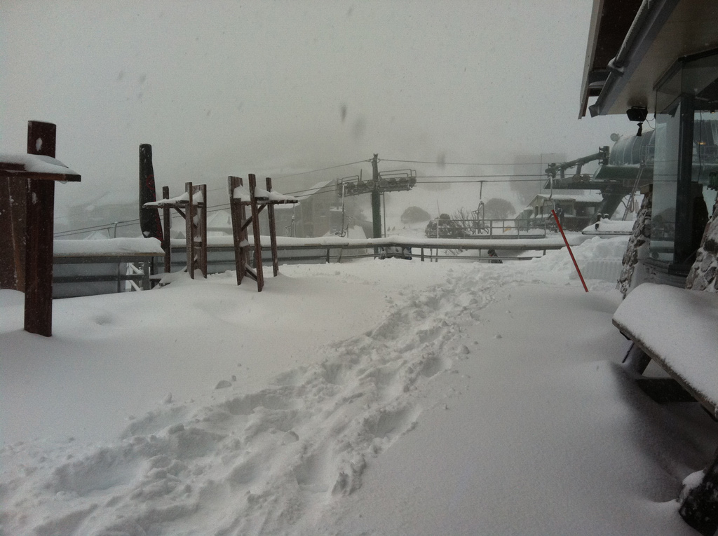
Some of the Hotham team were out ‘product testing’ on Heavenly, check out this shot of Imagine:
‘Imagine’ at Hotham June 22 2012Hotham Swindlers Deck
I am heading up this afternoon so will add some pictures to aussieskier.com/social this evening and of course skiing tomorrow. We will take our touring gear up to Buller so we can go for a good look around and continue to report back through the weekend.
If you are in the mountains today & over the weekend please keep us posted with updates on our Facebook Page and also tag some Instagrams with #aussieskier to appear on https://aussieskier.com/social – be sure to check it out as pics & videos have been uploaded today from the mountains.
Here is a little slideshow from Hotham just sent to me by an aussieskier.com reader – enjoy:
[divider]
ORIGINALLY POSTED: Thu 21 June 3pm
After going to bed with rain on the roof, mild temperatures and clear pre-frontal weather on the radar I was fully expecting rainfall prior to the snowfalls that have been forecast this week.
I was pleasantly surprised to see snow on the ground at 7:30am on the cams and continuing. Even down low at the Vic resorts was looking white which is fantastic. In my opinion this is ‘bonus snow’ prior to the expected embedded fronts and it’s very welcome.
My sources at Buller are reporting 8-10cm, Hotham is reporting 13cm as of 2pm and Falls Creek 16cm. My Buller source has also said that as of typing this (2:50pm) that it was a little wet earlier but is now puking.
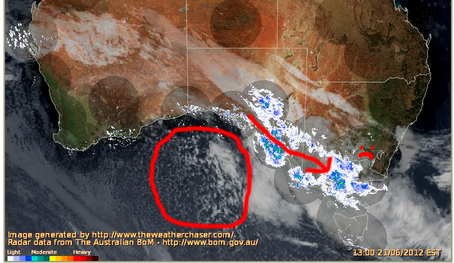
At this stage it is a very moist NW flow that is hitting the resorts, and what is of much interest is that it is Vic only, nothing so far in the NSW resorts.
You can clearly see the moisture is from the trough extending towards WA which also explains the mild temperatures, the arrow denoting the direction of travel, also showing it being pushed south of the NSW resorts – 🙁
There have been a couple of tweets bemoaning this and also a pic uploaded to aussieskier.com/social mentioning as such in the caption – but you will also see what I have circled what is currently in the Bight.
It is an embedded cold front that I have been watching form via the animation, and this is the punch we have all been wanting. Speckled cloud denotes cold air and I recommending tracking this one as it approaches the mountains, this is where the fun will really begin.
I will be up at Buller for the weekend and I would love for those in the mountains over Today/Tomorrow to keep us posted with updates on our Facebook Page and also tag some Instagrams with #aussieskier to appear on https://aussieskier.com/social – be sure to check it out as pics & videos have been uploaded today from the mountains.
There really hasn’t been much to report on the past week. A lack of snow falls of any significance hasn’t really changed the lie of the land.
The weather updates from Richard have been very interesting reading as have Jane’s tweets. Hopefully this front gets HV up and going. If the full 80cm comes through it would have to be go time on that part of the mountain.
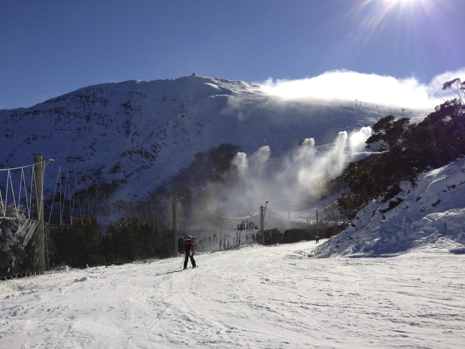
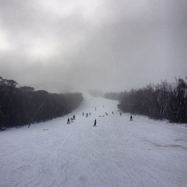
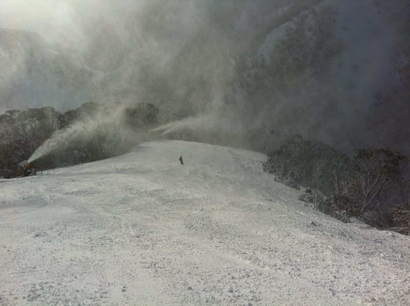
The past couple of days have been a mix of clear sky and solid fog. The windchill has made it freezing. The cloud rolled in right on lunch time today. Visibility up top was not good and combined with the surface on the summit below the road was definitely the preferred option.
Last night the hill looked awesome with seemingly every fan gun pumping. The super low humidity helping the cause. Goes to show that if conditions are right there is no holding back.
All is on track for decent snow Thursday night into Friday. Biggest news is that the front on Sunday seems to be fading. Instead we are looking at an extended period of very cold temperatures for snowmaking.
I’ll only update this page again if something drastic happens in the forecast. In the meantime I will start a new Snow Report post once the weather starts hitting – keep an eye on the Facebook Page as well for small details that don’t warrant a blog update.
I will be up at Buller for the weekend and I would love for those in the mountains over Thursday/Friday to keep us posted with updates on our Facebook Page and also tag some Instagrams with #aussieskier to appear on https://aussieskier.com/social
24 hours later and ‘steady as she goes’ in terms of this snow forecast.
I mentioned yesterday that The Frog and Weatherzone were still biding their time with regard to this forecast, however today both sites are ‘on board’ and predicting snow totals that are roughly in line with the rest of the weather forecasters.
Jane’s Weather has pretty much reiterated her forecast from yesterday, and when the Weather Nerds are discussing an incoming system the key words that lead to disappointment are ‘Downgrade’ and ‘Fizzer’ – both of which are conspicuously absent from today’s discussions, although there are signs of the Sunday front weakening ever so slightly.
AccessR Snow Forecast
Grasshopper/Mountainwatch is positive but correctly mentioning that pinning your hopes on a large snowfall figure can lead to disappointment due to microclimates and how this storm exactly arrives and interacts with the topography. There is not much to dislike on the BOM Alpine Forecast either.
Meanwhile a ‘clipper’ cold front swept through last night delivering Baw Baw a few centimetres (they have uploaded some pics to aussieskier.com/social – check it out) and it has also dropped the temperatures in the hills – Buller made snow last night, and still looks to be going on the Summit, while I just got an SMS from your Hotham blogger saying the guns have just gone on at Big D.
I will be up at Buller for the weekend and I would love for those in the mountains over Thursday/Friday to keep us posted with updates on our Facebook Page and also tag some Instagrams with #aussieskier to appear on https://aussieskier.com/social
After a series of weird & weak fronts this looks to be a traditional low pressure system with embedded cold fronts that will deliver decent snowfalls to all the ski areas, and be followed by a SW blast of cold weather so the snowguns can capitalise in its wake.
It will be a season-starter for places like Buller & Lake Mountain & also has the potential for the NSW resorts and Falls/Hotham to open up significant terrain, perhaps all but the lowest areas & spots that require the most snow.
As you will know from my previous snow forecast this one has been on the cards for a while, but as with all weather systems it’s prudent to not get too excited too early. However everything has remained on track and I think it’s now appropriate to call it for what it is.
Unlike the previous systems which have brought snow (or not in Buller’s case) from a weird South East flow, or in the case of this weekend a weak westerly, we are currently looking at a deep low pressure system south of Tasmania, rotating clockwise with at least two cold fronts embedded, with a high parked off WA rotating counterclockwise pumping in the cold air. This is what will keep the temperatures cold and also assist snowmaking.
Everyone is in a similar boat – ie: previously hinting that something is coming but not willing to put their balls on the line, though as of today they are all on Board:
The Frog & Weatherzone are still reluctant to call for large snow totals but I suspect this will change: The Frog Weatherzone
There are a few terms that I hate, ‘Bumper Season‘ being one of them, but another is describing any kind of snowfall as a ‘Dump’ however at this stage it is looking entirely deserving of that moniker. Projected snowfalls are in the 30-50cm range, and to top things off looking into the distance there is the possibility of a follow-up storm mid-next week which The Weather Nerds have been keeping their eye on. Naturally this is speculative but we will keep an eye on it as it approaches.
I suspect this week will involve a lot of refreshing of forecasts, poring over the charts and reloading snow-cams. I’m really hoping that the Buller AWS gets fixed before this weekend, I feel blind without it! I also think that The Weather Chaser composite satellite/radar will be a great tool to watch the approach of this system.
All the tools you need to track an incoming snow storm are available in this post from last year.
I will be up at Buller for the weekend and I would love for those in the mountains over Thursday/Friday to keep us posted with updates on our Facebook Page and also tag some Instagrams with #aussieskier to appear on https://aussieskier.com/social
I will be up at Buller for the weekend and I would love for those in the mountains over Thursday/Friday to keep us posted with updates on our Facebook Page and also tag some Instagrams with #aussieskier to appear on https://aussieskier.com/social