

UPDATED: Fri 22 June 12pm
It snowed.
Yesterday’s NW feed continued to deliver, and by later in the evening it was NSW’s turn to receive as well.
Temperatures were not cold but the precipitation was prolific and as they are usually want to do in a NW, Hotham and Falls Creek reported 48cm and 30cm of new snow respectively. Buller was lower at 18cm but as of this morning the flow has shifted SW which is traditionally where Buller is more reliable for receiving snow and you can clearly see this by scrolling the ‘slider’ on the Buller Village Square Cam and the Little Buller Spur cam – I have received SMSs in the last few minutes saying how hard it is snowing.
The NSW resorts are reporting 25cm of new snow.
Hotham will be opening Heavenly tomorrow, and at Buller Wombat and Holden are expected to open but this has been delayed due to de-icing.
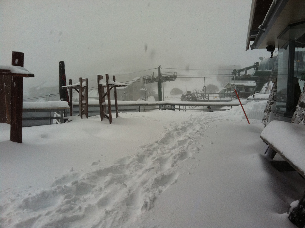
Some of the Hotham team were out ‘product testing’ on Heavenly, check out this shot of Imagine:
I am heading up this afternoon so will add some pictures to aussieskier.com/social this evening and of course skiing tomorrow. We will take our touring gear up to Buller so we can go for a good look around and continue to report back through the weekend.
If you are in the mountains today & over the weekend please keep us posted with updates on our Facebook Page and also tag some Instagrams with #aussieskier to appear on https://aussieskier.com/social – be sure to check it out as pics & videos have been uploaded today from the mountains.
Don’t forget to ‘Like’ us on Facebook and Follow us on Twitter for the latest from this storm.
[divider]
UPDATED: Thu 21 June 6:30pm:
Here is a little slideshow from Hotham just sent to me by an aussieskier.com reader – enjoy:


[divider]
ORIGINALLY POSTED: Thu 21 June 3pm
After going to bed with rain on the roof, mild temperatures and clear pre-frontal weather on the radar I was fully expecting rainfall prior to the snowfalls that have been forecast this week.
I was pleasantly surprised to see snow on the ground at 7:30am on the cams and continuing. Even down low at the Vic resorts was looking white which is fantastic. In my opinion this is ‘bonus snow’ prior to the expected embedded fronts and it’s very welcome.
My sources at Buller are reporting 8-10cm, Hotham is reporting 13cm as of 2pm and Falls Creek 16cm. My Buller source has also said that as of typing this (2:50pm) that it was a little wet earlier but is now puking.
At this stage it is a very moist NW flow that is hitting the resorts, and what is of much interest is that it is Vic only, nothing so far in the NSW resorts.
See my dodgy crop/photoshop from The Weather Chaser’s Radar (which I have been glued to all morning)
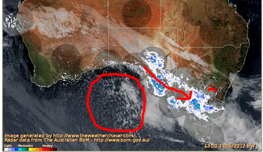
You can clearly see the moisture is from the trough extending towards WA which also explains the mild temperatures, the arrow denoting the direction of travel, also showing it being pushed south of the NSW resorts – 🙁
There have been a couple of tweets bemoaning this and also a pic uploaded to aussieskier.com/social mentioning as such in the caption – but you will also see what I have circled what is currently in the Bight.
It is an embedded cold front that I have been watching form via the animation, and this is the punch we have all been wanting. Speckled cloud denotes cold air and I recommending tracking this one as it approaches the mountains, this is where the fun will really begin.
I will be up at Buller for the weekend and I would love for those in the mountains over Today/Tomorrow to keep us posted with updates on our Facebook Page and also tag some Instagrams with #aussieskier to appear on https://aussieskier.com/social – be sure to check it out as pics & videos have been uploaded today from the mountains.
Don’t forget to ‘Like’ us on Facebook and Follow us on Twitter for the latest from this storm.
