

UPDATE: Wed June 20th 3:30pm
Very brief update.
All is on track for decent snow Thursday night into Friday. Biggest news is that the front on Sunday seems to be fading. Instead we are looking at an extended period of very cold temperatures for snowmaking.
I’ll only update this page again if something drastic happens in the forecast. In the meantime I will start a new Snow Report post once the weather starts hitting – keep an eye on the Facebook Page as well for small details that don’t warrant a blog update.
I will be up at Buller for the weekend and I would love for those in the mountains over Thursday/Friday to keep us posted with updates on our Facebook Page and also tag some Instagrams with #aussieskier to appear on https://aussieskier.com/social
Don’t forget to ‘Like’ us on Facebook and Follow us on Twitter for the latest from this storm.
[divider]
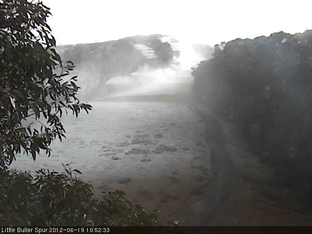
UPDATE: Tues June 19th 3pm
24 hours later and ‘steady as she goes’ in terms of this snow forecast.
I mentioned yesterday that The Frog and Weatherzone were still biding their time with regard to this forecast, however today both sites are ‘on board’ and predicting snow totals that are roughly in line with the rest of the weather forecasters.
Jane’s Weather has pretty much reiterated her forecast from yesterday, and when the Weather Nerds are discussing an incoming system the key words that lead to disappointment are ‘Downgrade’ and ‘Fizzer’ – both of which are conspicuously absent from today’s discussions, although there are signs of the Sunday front weakening ever so slightly.
Grasshopper/Mountainwatch is positive but correctly mentioning that pinning your hopes on a large snowfall figure can lead to disappointment due to microclimates and how this storm exactly arrives and interacts with the topography. There is not much to dislike on the BOM Alpine Forecast either.
Meanwhile a ‘clipper’ cold front swept through last night delivering Baw Baw a few centimetres (they have uploaded some pics to aussieskier.com/social – check it out) and it has also dropped the temperatures in the hills – Buller made snow last night, and still looks to be going on the Summit, while I just got an SMS from your Hotham blogger saying the guns have just gone on at Big D.
Don’t forget to ‘Like’ us on Facebook and Follow us on Twitter for the latest from this storm.
I will be up at Buller for the weekend and I would love for those in the mountains over Thursday/Friday to keep us posted with updates on our Facebook Page and also tag some Instagrams with #aussieskier to appear on https://aussieskier.com/social
I’ve also been playing with some Instagrams from our overseas adventures – check them out here.
[divider]
ORIGINAL POST: Mon June 18th 3pm:
The Snow Forecast for this weekend looks good.
After a series of weird & weak fronts this looks to be a traditional low pressure system with embedded cold fronts that will deliver decent snowfalls to all the ski areas, and be followed by a SW blast of cold weather so the snowguns can capitalise in its wake.
It will be a season-starter for places like Buller & Lake Mountain & also has the potential for the NSW resorts and Falls/Hotham to open up significant terrain, perhaps all but the lowest areas & spots that require the most snow.
As you will know from my previous snow forecast this one has been on the cards for a while, but as with all weather systems it’s prudent to not get too excited too early. However everything has remained on track and I think it’s now appropriate to call it for what it is.
Unlike the previous systems which have brought snow (or not in Buller’s case) from a weird South East flow, or in the case of this weekend a weak westerly, we are currently looking at a deep low pressure system south of Tasmania, rotating clockwise with at least two cold fronts embedded, with a high parked off WA rotating counterclockwise pumping in the cold air. This is what will keep the temperatures cold and also assist snowmaking.


(Images as posted by ‘Claude Cat’ on ski.com.au forums)
Everyone is in a similar boat – ie: previously hinting that something is coming but not willing to put their balls on the line, though as of today they are all on Board:
Jane’s Weather
Grasshopper/Mountainwatch
BOM
The Weather Nerds
The Frog & Weatherzone are still reluctant to call for large snow totals but I suspect this will change:
The Frog
Weatherzone
There are a few terms that I hate, ‘Bumper Season‘ being one of them, but another is describing any kind of snowfall as a ‘Dump’ however at this stage it is looking entirely deserving of that moniker. Projected snowfalls are in the 30-50cm range, and to top things off looking into the distance there is the possibility of a follow-up storm mid-next week which The Weather Nerds have been keeping their eye on. Naturally this is speculative but we will keep an eye on it as it approaches.
I suspect this week will involve a lot of refreshing of forecasts, poring over the charts and reloading snow-cams. I’m really hoping that the Buller AWS gets fixed before this weekend, I feel blind without it! I also think that The Weather Chaser composite satellite/radar will be a great tool to watch the approach of this system.
All the tools you need to track an incoming snow storm are available in this post from last year.
I will be up at Buller for the weekend and I would love for those in the mountains over Thursday/Friday to keep us posted with updates on our Facebook Page and also tag some Instagrams with #aussieskier to appear on https://aussieskier.com/social
Don’t forget to ‘Like’ us on Facebook and Follow us on Twitter for the latest from this storm.
