
 Hotham")
UPDATE: Friday 11:30am
Last update before the long weekend – in a couple of hours we will be in the car on the way up to the hill.
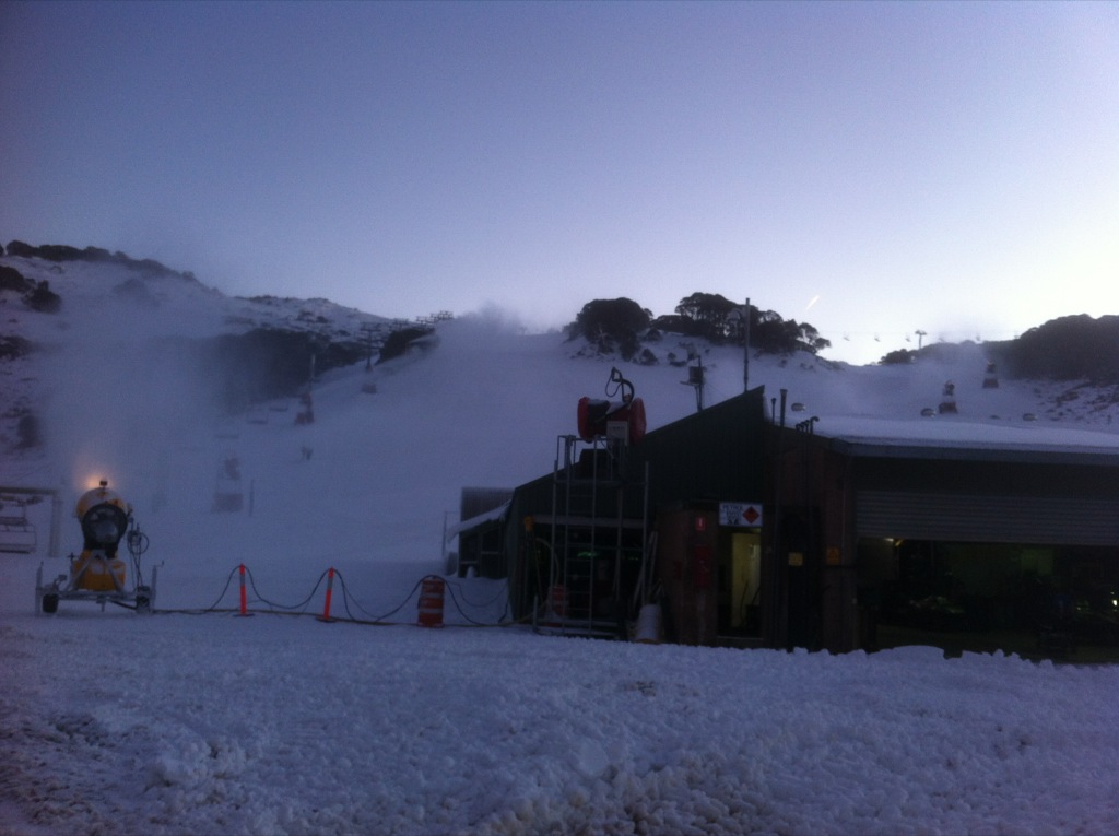
Snowmaking has been the story of the last couple of days with the resors all publishing pics of the guns in action:
In addition to this snowmaking pic Hotham has announced that they have added the Summit Quad to their openings:
Falls Creek have taken delivery of some new guns plus a Kassbohrer Winch Cat and have been putting them through their paces – Lifts open for the weekend will be Towers, Falls Express and Towers:
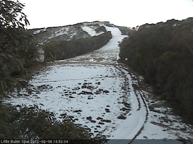
Buller is snowmaking madly in order to have an offering for the long weekend:
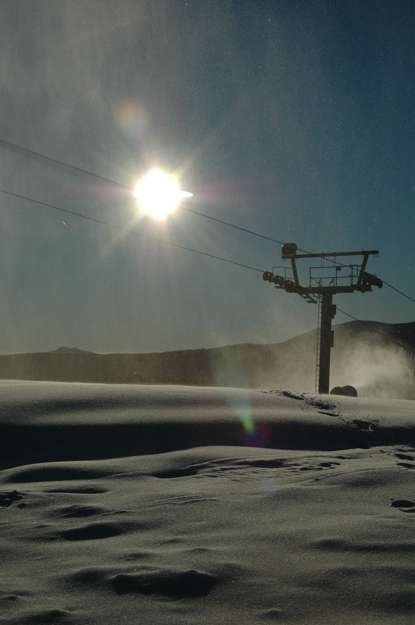
Also a good pic came in via Instagram this morning, check out on the RHS —>
The word from the hill is that there will be lifts running tomorrow no matter what, even if for sightseeing, and if the temperatures allow there will be skiing if/when remotely possible. You can see from using the slider on the Bourke St Webcam that even though the fringes do melt during the day there has definitely been a gain over the last few days. I know it’s a bit sad to get excited about a slowly growing patch on a green run, but hey, it’s all we’ve got!
I’ll soon be in the car and will take some Instagram pics once we get closer so keep an eye on aussieskier.com/social for that.
Also don’t forget to ENTER our COMPETITION to WIN 2 copies of The Powder Bible per resort! Tag an ACTION video or FAMILY & FRIENDS picture with #aussieskier plus the resort name to win. More details here.
All pics & clips can be seen on aussieskier.com/social
Also Like us on Facebook and Follow us on Twitter to be kept updated with the latest from the mountains.
UPDATE: Wednesday 5:50pm
While Hotham & Falls have capitalised on the recent snowfalls unfortunately Buller is looking a little like the poor cousin and reliant on snowmaking to open this weekend. It is interesting looking at the cams – while up high Falls & Hotham look great, the lower reaches are still a way off being in shape.
Hotham have already announced their opening weekend plans (click here) – in summary Big D, Summit and Upper Playground will be open. Falls have yet to announce their plans but I would estimate they will open Towers, Drovers plus Falls Express to service Wombat’s Ramble. Looking at the cams, Ruined Castle is still a little way off and I would expect Scott’s to be in the same boat.
Baw Baw is also looking great and I bet they are excited for the long weekend.
As the storm moves away a high pressure takes over until early next week, this will move very slowly and pump in cold air from the SW that will allow snowmaking plus the chance of some snow showers on the Fri/Sat. BOM report is showing some good, cold overnight temperatures with Jane’s Weather estimating the next weather system to affect us will arrive on about Wednesday.
An eagle-eyed twitter follower spotted the snowmaking being turned on in the last Boggy Creek cam image of the day:

And if you look extremely hard you can see them on Wombat as well:
And minutes after this Buller posted a pic on Facebook of a gun firing at the top of Shakey Knees:

Naturally Buller is pretty much starting from scratch so I wouldn’t expect an announcement on lifts for the next little while.
What I do know is that they will be busting an absolute gut to make it happen.
If you’re up in the mountains please share your photos with us on aussieskier.com/social – just tag your Instagram pics or Viddy movies with the hashtag #aussieskier
Also Like us on Facebook and Follow us on Twitter to be kept updated with the latest from the mountains.
UPDATE: Tuesday 4:30pm
After a wild night of weather in the mountains with see-sawing temperatures I was keen to check out the webcams this morning to see what the storm had delivered. Everywhere looked white. Except Buller. Even Baw Baw had received a nice dump of snow.
I’ve always know that Buller does not do well with storms from the SE, so I emailed Jane Bunn from Jane’s Weather to find out why. Her response:
Unfortunately for Buller it was the location that was the problem.
This system was a deep low centre just off Mallacoota, moving northeastwards. It had a stream of tropical moisture coming down and wrapping around, and this sent rain across Victoria from the southeast. Anything coming in from the southeast has a lot of high terrain to get over first before it can hit Buller.
So, it was a case of drying out as the precipitation moved across the ranges, from late last night when the air was cold enough.
This is clear by looking at the rainfall totals on a map. You can literally draw a line from just north of Hotham and Falls, through to just north of Baw Baw, where the totals reduce dramatically.
We have always know that Buller has fared poorly from an SE system, but what confused me was why Baw Baw received snow when Buller didn’t. Buller & Baw Baw are usually brothers in arms when it comes to benefiting from SW storms while Falls & Hotham do well from the NW and Thredbo from the SE.
So armed with the information from Jane and questioning this particular disparity I decided to dispel this illusion and actually look at a map.
This is what I found: (Click to enlarge & excuse my dodgy photoshop please)

As you can see there is basically bugger all high ground to the SE of Baw Baw, whereas denoted by the length of the arrow Buller is particularly deep into the alps from that orientation and therefore in a total ‘rain shadow’.
Either way it’s a good outcome from all the other mountains apart from Buller – we should be seeing plenty of skiing on opening weekend. I got a call from Hotham’s Marketing Department saying how excited they are with this snowfall, they have also done a lot of snow farming and will be announcing later in the week what they are planning to open.
If you’re up in the mountains please share your photos with us on aussieskier.com/social – just tag your Instagram pics or Viddy movies with the hashtag #aussieskier
—-
 Perisher Resort")
With the Queen’s Birthday Long Weekend approaching that is the traditional Opening of the Australian ski resorts, all eyes are turned towards the weather.
Perisher opened Front Valley on Saturday thanks to its altitude and topography, whose snowmaking is actually assisted by inversions, but the upside-down airmass elsewhere in the alps did not allow snowmaking to add to the natural snow that fell on May 25th.
I have had it since confirmed that Buller was hell-bent on opening last Thursday, they pushed snow into the load and unload stations of Blue Bullet 1 but were thwarted both by the inversion but also the power going out due to a fallen tree – this timeframe coincided with what would have been the prime snowmaking window for that weekend but they were unable to capitalise.
Fast forward a week and I feel like we are in the same boat – a weather system is approaching, we have encouraging forecasts being thrown around for tomorrow & the excitement is building. The last storm was a particularly complex one, and readers of this blog will remember that I was rather negative and didn’t believe that it would be cold enough to snow.
One pundit who remained firm in her forecast of 20-30cm was Jane Bunn from Jane’s Weather, and as a result received the accolades from Aussie snow followers once it was proven to be correct. She has again predicted up to 30-40cm for tomorrow’s storm, so understandably when she published this on Twitter & Facebook this morning it was incredibly well received. Once again this is a complex weather system – not your usual SW Arctic Blast, and requires analysis from experienced eyes.
The Weather Nerds are not as confident on the timing of the arrival of the cold, they believe it will be later tomorrow instead of Jane’s prediction of tonight. Frog’s Snowatch is a little more conservative with a call of 5-15cm tomorrow, starting with a high 1700-1800m snow level and falling to 1500m later. Weatherzone Snow is up & running for the winter which is great – their synopsis is very similar to The Frog. The Vic BOM is more generic in its description, but it’s worth noting that even though they whip up a lot of hysteria with the word ‘Blizzards’, this term is meant to describe high winds accompanying Snowfalls. I’ve seen them call for ‘Snow Showers’ and receive over 30cm.
However it is still quite warm in the Alps with rain due prior to the cold air, and as regular readers of this blog will know that I’m familiar with the term ‘it always gets worse before it gets better’ – in the case of Buller and it’s thin snowpack this could well melt just about everything that’s there, but if 20cm arrives tomorrow with a few nights of snowmaking to follow then I am pretty confident we will be skiing on the weekend.
Rather than cluttering the blog with new reports on this weather system I will keep updating this post with new information – I will add this at the top of the post.
If you’re up in the mountains please share your photos with us on aussieskier.com/social – just tag your Instagram pics or Viddy movies with the hashtag #aussieskier
Also Like us on Facebook and Follow us on Twitter to be kept updated with the latest from the mountains.
