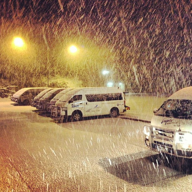
As Bill Lawry was fond of saying in the cricket commentary ‘It’s all happening!!!!’
The first part of the current weather system was living up to the F-word epithet levelled at it – FIZZER
Lows that form over the Tasman Sea, also known as East Coast Lows (ECL) are a fickle beast, in some cases they can deliver huge amounts of snow, and in other cases they are an extremely cruel mistress.
Over the weekend there were some flakes up high, but nothing substantial, and a few brief snowmaking windows. Enough for the team at Mt Buller to get Bourke St going so massive kudos to them. However the various Internet forecasters that we love to reference were consistent in their predictions of a reasonable fall of snow on the weekend and it all sadly fell short.
Even this morning – I got up and drove to work, my car said 8 degrees, it was raining, but when I checked the webcams it was a massive WTF. Above zero in the Alps. Great.
Later this afternoon info started streaming in from Baw Baw that it was dumping hard. This was no surprise as the southerly aspect of this system is tailor made to deliver snow to BB & we were all excited for them. Then we heard Lake Mountain was snowing, right on the last snowcam image of the day at 5pm, and around 6 my phone exploded. It started dumping at Buller. Facebook and Instagram went nuts and within an hour there was good photographic evidence of at least 10cm of fresh.
No forecaster has really been accurate with the progress of this system, but the undisputed Queen of the Victorian snow forecast scene – Jane Bunn from Jane’s Weather has the following to say:
A deep low continues to churn, out over the Tasman Sea – while one last surge from a trough arrived today. This increased the precipitation, but a temperature gradient developed. It was warm in the east, and cold in the west, so Baw Baw saw the snow today. The cold air over the west is pushing through tonight, so there should be around 10 cm by Wednesday morning, but isolated falls of 20 cm are possible.
It clears up on Wednesday afternoon as the next high moves overhead. Cold air remains, so we should have some sunshine and cold nights.
So what does this mean?
Simply – a little more natural snow, plus good snowmaking weather later in the week. I’ve not heard anything official, but by the weekend I would expect to be seeing a number of snowmaking runs open at the various Vic resorts. For Buller I would imagine they will be putting their efforts towards getting Little Buller Spur open, plus one of Shakey Knees or Summit.
I don’t think the skiing this weekend is going to be mindblowing, but worthwile, even more so if you’re the proud owner of a discounted season pass.
Here’s a bunch of the images that have popped up in our Instagram/Facebook feed this evening:
(Click the image for the Instagram website & follow the users!)
https://instagram.com/p/apwnnAyMEo/
https://instagram.com/p/apwgxah5-f/
https://instagram.com/p/apyd3yB5_k/
https://instagram.com/p/ap7qrPh506/
Keep checking in on aussieskier.com and aussieskier.com/social for the latest on this storm, and if you’re in the Alps hashtag your Instagrams with #aussieskier – they will appear on aussieskier.com/social and be re-published on our Facebook Page with full attribution and a link to your original image – a great way to build your Instagram fanbase.


