
UPDATED: Sunday June 18th 2pm
Drenched:
UPDATED: Sunday June 19th 12pm
There’s no way of sugar coating this, it’s pissing with rain.
It was one of those mornings where you wake up, hear the rain on the window and roll over for another half hour.
Eventually the guilt of laziness got the better of us and we headed out. My thighs were wet by the top of Holden chair and we headed straight for the sanctuary of Koflers, and will likely head straight back!
However the good news is that the cover is great for this time of year, and Tuesday is shaping up as a positive with a snow bearing storm on it’s way.
Remember folks, it always gets worse before it gets better!
UPDATED: Saturday June 18th 6pm
Not much happened in the afternoon, after swearing at 2 1960’s spec toilets over lunch we went back out for a ski but unfortunately the weather closed in and we packed it in again. The pants I have here this weekend are not at all waterproof, my good ones will be fixed this week, so rain wasn’t really an option. I did manage to fix the toilets this evening. However fortunately it wasn’t damaging the cover, and we are still ahead of where we were before last night’s snow.
There looks to be a little more rain on the way tomorrow and Monday, and then a strong cold front arriving in the early hours of Tuesday morning. This looks good for approx 30cm of snow which will be very welcomed for the school holidays.
Jane’s Weather sees the situation as follows:
ALPINE AREAS
Saturday: Showers, falling as rain through most elevations – only wet snow on the peaks from this afternoon. 2 to 5 mm of rain, 10 mm for Baw Baw.
Sunday: Showers, falling as rain through most elevations – only wet snow on the peaks. A period of rain at night – falling as a rain/snow mix on higher slopes. 5 to 10 mm of rain/wet snow.
Monday: The chance of rain showers. 2 to 5 mm of rain.
Overnight Monday and Tuesday: Rain starts Monday night and turns to heavy snow by early Tuesday (pre-dawn), lowering throughout the alpine. Snow showers follow from Tuesday afternoon. Around 10 mm of rain then 30 to 40 cm of snow by Wednesday/Thursday.
Click here for her full report.
The Weather Nerds are getting particularly excited about the prospect of the weather early next week, but Snowatch is a little more circumspect at this stage.
So fingers crossed that the forecasts rains remain light, and that we do receive a good coating on Tues/Wed. If that was the case I would expect Summit, Family, Shakey Knees and Skyline at Buller to open as a bare minimum.
—
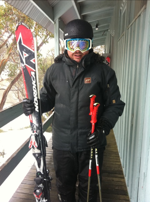
We arrived at 8pm to the welcome sight of fresh snow on the ground and in the air, and the snow guns blasting. I would estimate there was 10cm of fresh had fallen.
We knew that warm temps were on the way and when we woke up things looked a little soggy outside, with a misty sleet in the air.
We made our way up to Little Buller and were pleasantly surprised – the snow was a little sticky but we’ve had a few runs now an the snow was smooth and the run deserted, a pleasant change from last weekend. I’ll keep this updated through the weekend.
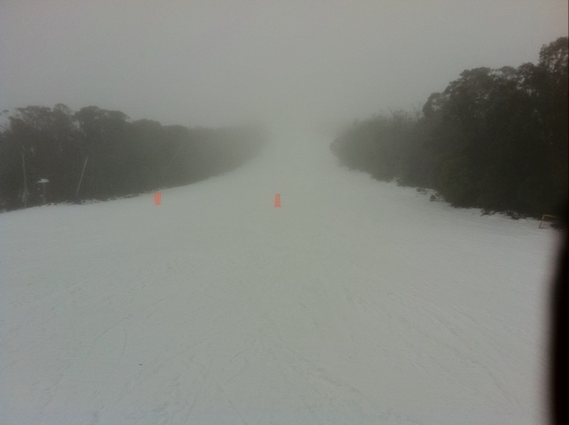
Deserted LBS:
Breakfast:
If you did get out on the mountain this weekend, let us know how it was in the comments below.
Remember to ‘Like’ aussieskier.com on the top RHS of this page & follow us on Twitter for the latest updates.
Also you can share this with your friends using the buttons below:
