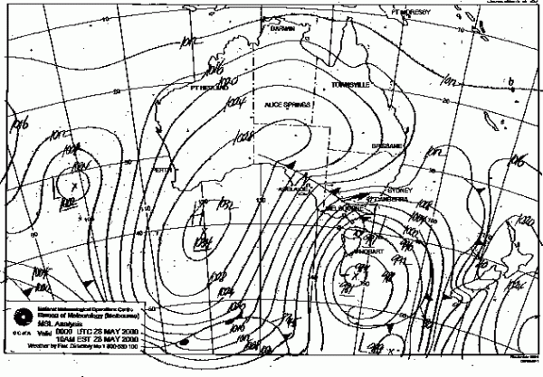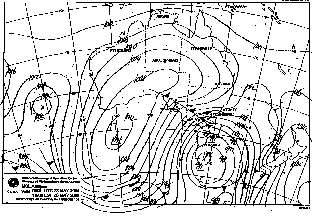
In a post earlier in the week I covered what a futile question it is to ask “Is it going to be a good season?”, I feel it’s quite the opposite when it comes to Medium and Short range forecasting, and if you are someone that’s flexible with their time you can use this knowledge to make the most of the conditions on the mountains.
I don’t profess to be an expert as I don’t have that flexibility – I go to the snow every weekend, and don’t generally ski midweek, however I still do like watching the weather charts as systems unfold and observing their effects on the mountains.
Things have come a long way. As a child and into my teens, it was pretty simple. You would watch the weather forecast at the end of the evening news. If Melbourne’s weather was forecast to be 12C (or below) and raining, that generally meant snow. 13C was borderline, and 14C would only mean snow if the wind was from the S or SW. Thursday’s news had a Snow Report and that was it. If you were lucky, you knew someone up in the mountains that you could call, otherwise you read the total fiction that was snow reporting pre-Internet, and arrived at the snow uninformed and unprepared.
So, where to start? Ground Zero for this kind of information is ski.com.au’s Weather Forum. Back in the late 90’s, thanks to the proliferation of the Internet, experimental weather models and charts were published on the net, concepts that were hitherto only available to weather and climate professionals. Forum members began accessing these charts and predicting snowfalls, with a reasonable degree of accuracy. ‘The Frog’ was one such forum member who gained notoriety for his snow forecasting and has branched out with his own successful venture ‘Snowatch‘.
These amateur forecasters do not have the responsibilities of an organisation such as the BOM, and also due to having such a narrow scope, can concentrate their efforts on smaller areas and outcomes.
The Weather Forum remains as a ‘one stop shop’ for these forecasts. It is tightly moderated to allow efficient access to relevant information, and careful to denote the difference between opinions and fact. When a forum member sees a likely feature on a weather chart they will generally start a ‘Predictions’ thread that is tied to a specific time frame. Other members then comment on the prediction, and as each forecast model updates, they will post the latest charts to see if it is intensifying or more likely to become a fizzer. Then as the system approaches an ‘Observations’ thread will start for the likely timeframe and people on the ground will post their comments, plus links to weather station data, radar, satellite and live cams. It’s an effective approach and I am certain plenty of successful ski trips have been planned around it. However the crowd does not suffer fools gladly, so please don’t register and then post ‘What’s the weather going to be like at Thredbo on September 3?’. You’ll wish you hadn’t.
Readers of this blog will also see that I often post links to Jane’s Weather. Jane Bunn is a TV weather forecaster for the WIN network and publishes a daily blog on Victorian weather, and during the winter months adds an Alpine Forecast, which I find is an excellent summary. I asked Jane for the resources she uses to come up with her Alpine forecast and she kindly responded:
EC, ACCESS and US are the three models I utilise the most. I generally go with the scenario that seems the most likely, weighted by how the models are doing with today’s conditions.
EC is usually the most likely, but I wouldn’t ignore something on ACCESS if the others don’t have it. US is great in the short term (up to 3 days), and I would very rarely take the US forecast in the long run over the others. While the US definitely shows too much precipitation overall, that can often be the right ballpark amount for the mountains, in a system that brings a lot.
The main part of forecasting snow is working out when the precipitation will fall and how cold the airmass will be over that time period.
Thanks Jane for your comment, and links to the resources she mentions are available in this thread.
So what resources do I use? I am more focused on the short range than medium range – given that my days in the snow are fixed and I’m not trying to plan anything, I don’t see the need to look too far out. But on a daily basis I would check the following resources: (Note these are mainly for Victoria but NSW equivalents exist)
ski.com.au Weather Forum – https://forums.ski.com.au/forums/ubbthreads.php?ubb=postlist&Board=6
BOM Alpine Forecast – https://www.bom.gov.au/vic/forecasts/alpine.shtml
Weatherzone Snow Forecast – https://www.weatherzone.com.au/snow/
Jane’s Weather – https://janesweather.com
ski.com.au / Weatherzone Radar https://ski.com.au/weather/radar/index.html
BOM AWS – https://www.bom.gov.au/vic/observations/vicall.shtml
ski.com.au Village Square Cam – particularly useful for watching snowfall overnight – https://ski.com.au/snowcams/australia/vic/buller/buller8.html
Mountainwatch LBS Live Streaming Cam – https://www.mountainwatch.com/Cameras/Australia/Mount%20Buller?cameraId=20014
Please post in the comments the resources you use to maximise the chances of good conditions on your trip:
One of the first ever posts on this blog was Snow on the Go which was focused on snow information for your smartphone. Naturally a year is a long time in technology so I will post a revised version shortly.


