In case you hadn’t noticed, I’m really getting in to Instagram.
It seemed a natural fit when I was looking for a deeper social media integration at aussieskier.com – as it stands I have a reliable band of snow reporters throughout the mountains who have been MMSing me from the slopes for a number of years, but if I’m not available or near a computer it can be hard to get them to the site straight away which I feel bad about if someone has gone to the effort, so I was looking for a solution that made it possible to automate this.
After all the main purpose of this site is honest snow reporting, and what better way than to have instantaneous pictures available both here and on Facebook?
Plus it opens up the possibility to any Australian skier who would like to contribute and help out their fellow skiers. I’m enjoying the community feel, and truly loved seeing pictures pop up from people I have never met – while I appreciate the help of my friends it was very gratifying to have total strangers contribute.
So the combination of Instagram and the hashtag #aussieskier was the obvious solution – from a technology point of view it’s working perfectly and once the season is in full swing I look forward to seeing more pictures arrive on a regular basis. Naturally this site is more Victorian focused due to my location & influence but I would love to see the pics roll in from NSW as well!
#aussieskieradventures on Instagram
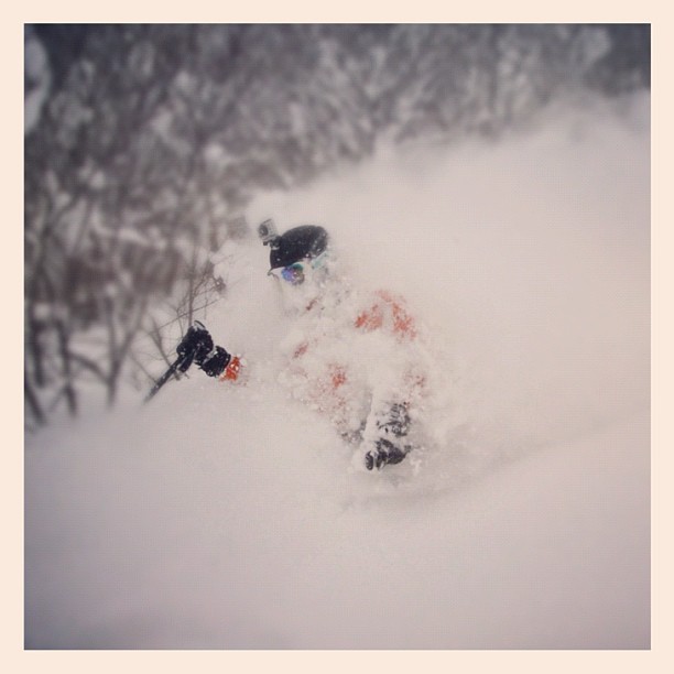
So while #aussieskier is working well (apart from the odd prank shot or two, but I guess I have to expect that!) and I will post plenty of pics through this Australian season, I have also been going through my photo archives from various overseas ski trips and selecting the best pictures and uploading them to Instagram under #aussieskieradventures – check out the gallery below, or follow me on @aussieskier & I hope you enjoy!
(Click to enlarge, scroll with arrow keys)
[instapress tag=”aussieskieradventures” piccount=”0″ size=”200″ effect=”fancybox” title=”1″]
The last few days have been funny in the snow forecast corner of the Internet.
It’s early season and we’re all keen. Dead keen. Weather was clearly incoming for this weekend, and man didn’t we know about it!
But the funny thing is that this system is marginal at best and all the forecasting outlets were responsible in conveying that. Jane, Weatherzone, The Frog, BOM etc were all in agreeance – light snow, only up high.
Yet every snow enthusiast with a Facebook page jumped on the absolute upside of the most optimistic forecast and went berserk – it was mainly the snow totals from Jane’s Weather that people quoted – paying no regard to the snow levels, of which 80% of Victorian skiing happened to dwell below. It was pretty funny. I think the best was an iPhone screen grab of a Weather app that showed ‘Snowflakes Icon’ for today with a temperature range of 2-4 degrees. Much of what I learned at University would tell you that it’s impossible.
BUT IT HAD A SNOWFLAKE ICON GODDAMMIT! TO HELL WITH THE LAWS OF PHYSICS!!
Anyway it looks like there was a dribble around the traps today, the trough that Jane’s Weather was mentioning didn’t seem to push far south enough according to The Weather Chase Composite Radar, and the Weather Nerds were using the dreaded ‘F’ word – Fizzer. Another front coming through on Monday could deliver a few cm but it looks minor at best.
All the while I was wondering if I was a misery-guts for not joining in the chorus – if there’s one thing I’ve learned it’s that shouting about snowfall brings website hits, but I also think it’s my responsibility to bring a measured tone to things. Don’t get me wrong, if it looks like a ripper I will be on the bandwagon as much as anything, but I just couldn’t see the reality behind the hype this week.
Which brings us to next week. At this stage it looks like a good quality low pressure system will roll in around Friday / Saturday – Jane’s Weather has made the early call of 20-30cm, while the Weather Nerds are cautiously on board and riding the bumps that come with each update of the computer models.
I tend to be less speculative so I will wait until Mon or Tues to get a real handle on the situation but at this early stage it looks like this one may be worth of a little bit of hype.
So that’s my Saturday evening rant over for now. I think I need a glass of red.
Productive day at Costco buying up all the supplies for the lodge, really hoping next weekend is the start of a string of good ski weekends all the way until October.
Thanks to the guys who posted Instagram pics from Buller & Perisher today – they are on http//aussieskier.com/social/ – keep them rolling in!
UPDATE: 3:30pm Thu 14th June:
A quick look at the webcams is showing the conditions aren’t exactly ideal today. Temperatures are above zero at all Vic resorts and the radar shows incoming precipitation.
Jane’s Weather has downgraded her snow totals ever so slightly but again it’s the altitudes that tell the story, starting at 1700m, lowering to 1500 by Sunday and then lower again on Mon/Tues which is good news.
With The Frog and Weatherzone in rough agreeance but less optimistic on the snow totals.
Just for reference, the highest lifted points at Buller & Falls are almost identical at approx 1780m with Hotham 80m higher at 1860m, so I think overall we can expect modest snow totals at the upper levels of most resorts but can’t guarantee snow down to the bottom lifts, except perhaps on Monday night into Tuesday but hoping the precipitation hasn’t dried up by then.
Again there is talk of a stronger system late next week but we will let that approach before discussing the specifics.
—
Originally posted 11:45am Wed 13th June:
Leaving Buller on Monday the forecast for the end of the week was for rain and we left wondering how our little ‘brazillian’ strip of snow would cope, the consensus was that it wouldn’t be pretty and we would reconvene again once snow had fallen.
Once again the dreaded inversion has hampered snowmaking, yesterday was the coldest morning so far this year in Melbourne but temperatures wavered around zero or above at all the Vic resorts thanks to an upside-down atmosphere.
Falls Creek Webcam Wed 13th June 2012
However since yesterday the forecasts for this weekend have improved somewhat and I see a number of Facebook posts this morning proclaiming decent snowfall for the weekend.
That would be a very welcome outcome indeed but I still feel that the calls could be a shade premature due to the marginal temperatures and therefore snow levels.
It is dry until Thursday afternoon with a high to our southeast.
A cold front crosses Victoria tomorrow, driven by a deep low over the Bight. A trough or low should cross NSW on Saturday, then another cold front moves through on Sunday, with that deep low passing near Tasmania.
Freeze levels are warm now. They should drop to about 1700 metres on Thursday night, then lower to 1500 metres for Saturday. Sunday and Monday are cold and may see snow falling throughout the alpine.
How much…
5 to 10 cm up high for the Thursday/Friday cold front.
Saturday’s trough may bring only a few cm, but could be 10 to 15 cm (if it comes near enough).
5 to 10 cm from the Sunday/Monday cold front.
However when you scroll down a little further you see that the snowlines being quoted in the 1500-1700m range which dampens the enthusiasm somewhat – for reference the altitudes at Vic resorts are in the 1400m-1800m range so it looks like NSW could be the main beneficiary. Weatherzone has a similar outlook on the snow levels but has forecasted lower snow totals, with The Frog/Snowatch in agreement. The Weather Nerds are also calling for modest snow amounts of 10-15cm again at higher elevations.
So I think at this stage it’s welcome that we are set to receive some snowfalls at higher elevations, but at the same time it’s prudent to reserve the extreme optimism until mid-next week when all indications are that we will receive a far stronger cold front. This one has The Weather Nerds far more excited, and personally I’m looking forward to a system where the cold temperatures and moisture are contained together in a ‘traditional’ winter pattern instead of wishing for tropical moisture to magically combine with a wandering pool of cold air. Jane’s Weather also mentions “Signs of a big, strong, cold low late in the week.” while The Frog’s 8-14 day forecast has picked it up and is quoting 1100m-1200m snow levels which is great.
So we have two weather events to keep an eye on over the next ten or so days, which you can keep an eye on with the tools linked in my ‘How to track a Snow Storm‘ post
I won’t be skiing this weekend but will be up every weekend henceforth. Your Hotham blogger has been flat out with the resort opening but has mentioned that they will get a report up this afternoon so keep an eye out for that.
If you’re up in the mountains please share your photos with us on aussieskier.com/social – just tag your Instagram pics or Viddy movies with the hashtag #aussieskier. You can see the latest pics & videos on the RHS of this page.
After a relatively busy opening weekend it is now really quiet. Given we haven’t seen any new snow for a few days things are holding up reasonably well. If you stick to the groomed parts of the run then it’s decent enough.
Getting Road Runner open was a good effort. It’s nice to have something a bit longer and steeper to ride. Hopefully the Village Loop isn’t far away either thanks to the efforts of the snowmaking crew.
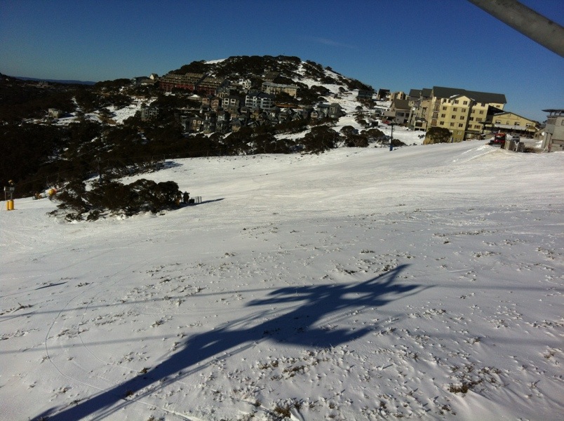
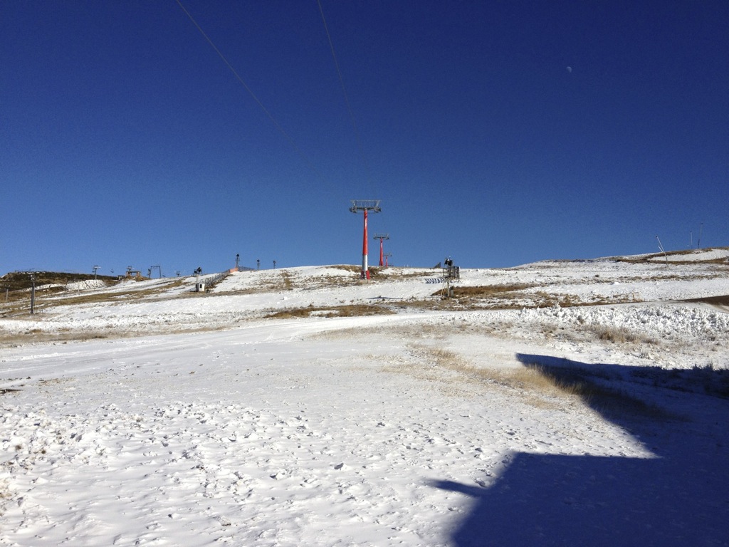
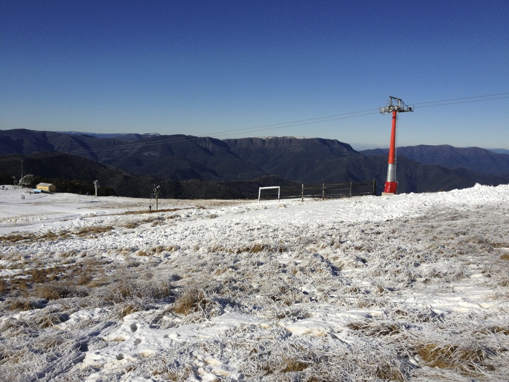
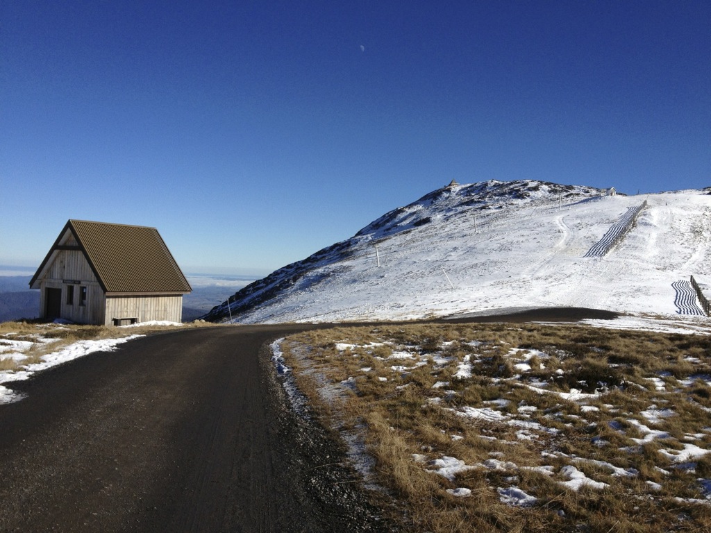
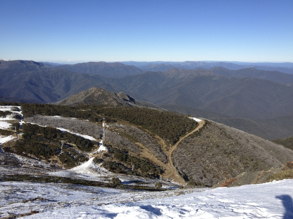
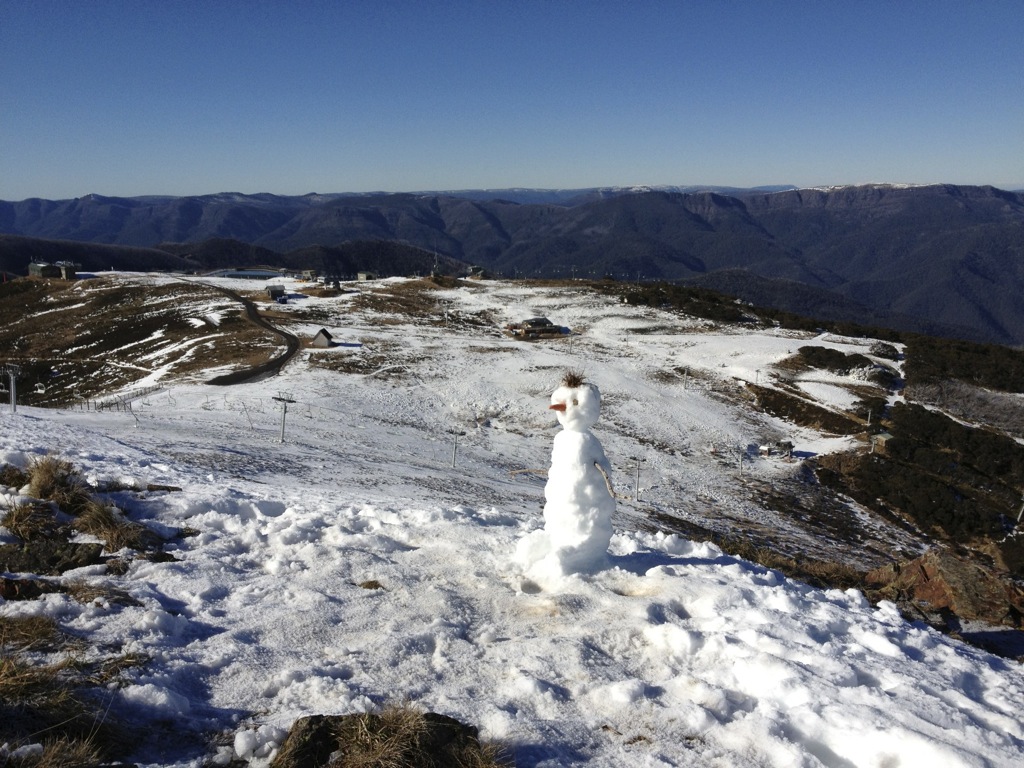
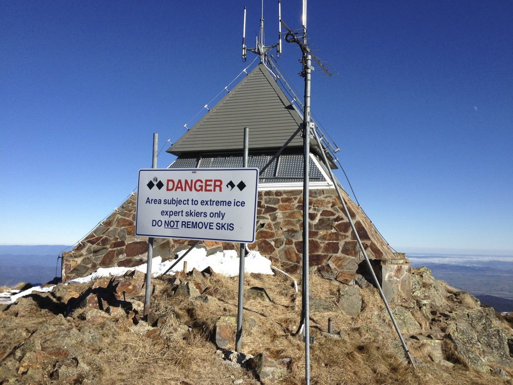
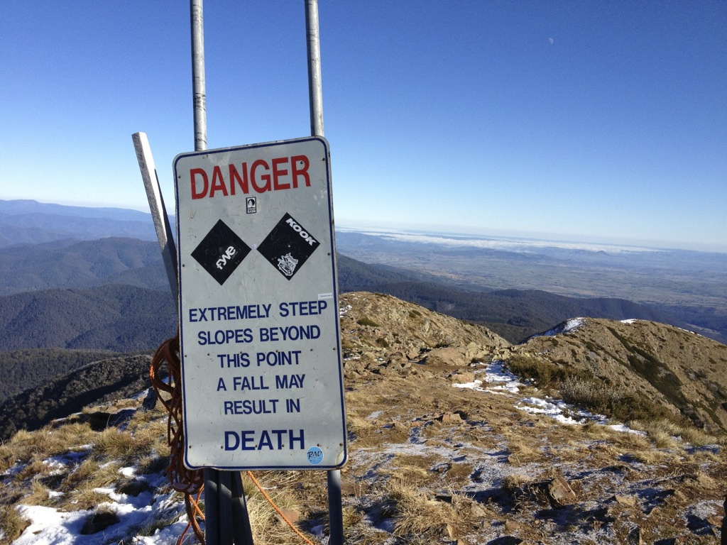
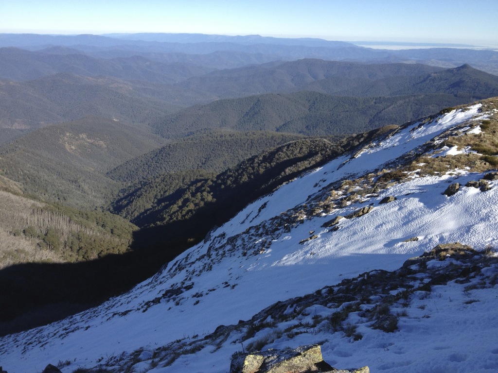
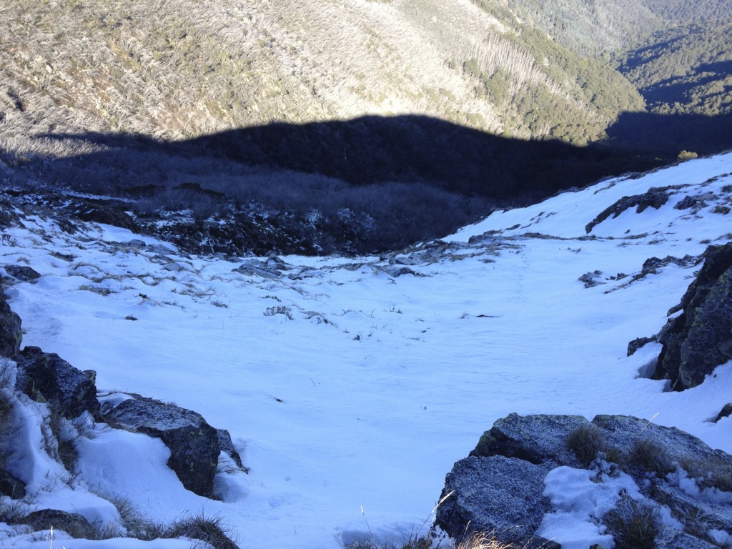
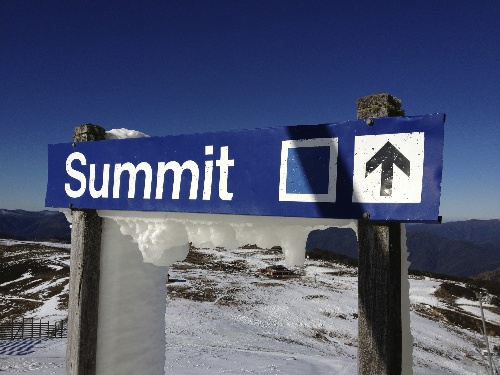
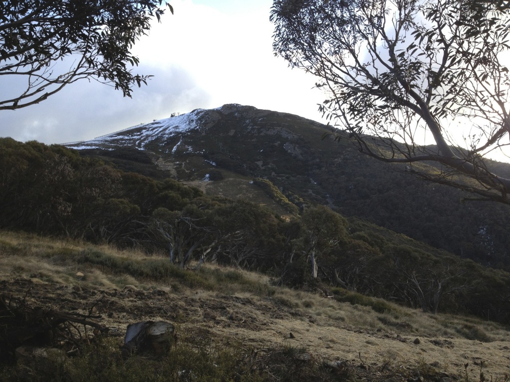
Half a dozen runs of Bourke St was plenty for the weekend but it was a lovely day so we decided to take a walk to the Summit:
(Click to enlarge)
Bourke StBaldyBaldyBaldySummitHoar Frost near HowquaSummitSummitSummitSummitFamily RunSnowmanBacksideSummit HutDon't FallChutesChutesSummit
Also, Jane’s Weather is forecasting a return to wintry weather with a series of cold fronts following some warm, wet weather in the leadup to next weekend.
So it looks like a weekend off for us, which is not unusual, and hopefully a snowy pattern will get us going for the following weekends.
If you’re up in the mountains please share your photos with us on aussieskier.com/social – just tag your Instagram pics or Viddy movies with the hashtag #aussieskier. You can see the latest pics & videos on the RHS of this page.
After the excitement that generally coincides with an imminent ski season, followed by the disappointment of no snow falling at Buller due to the most recent storm’s SE orientation, it was finally time to head up to the mountain.
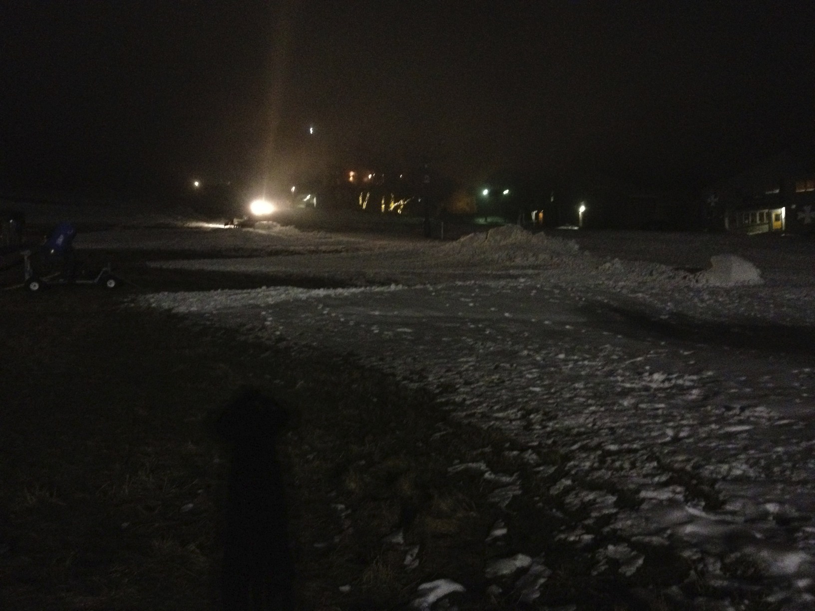
We arrived at a reasonable hour on Friday night and the cats were out madly pushing the snowmaking whales around to get Bourke St open for the weekend. The snow on Bourke St was essentially the result of two nights’ worth of snowmaking, and in typical Buller fashion the hardworking crews were able to make something out of virtually nothing & get some skiing happening on Opening Weekend, though I can’t lie and say that there wasn’t any envy when seeing the pics roll in from the other resorts.
Bourke St Construction - Mt BullerBourke St Construction - Mt BullerBourke St Construction - Mt Buller
Drinks at The Whitt, then Grimus and finally Kooroora was the order of the evening, the Friday of opening weekend is my most enjoyable of the season, catching up with friends and hearing about their summer adventures without the critical mass of feral crowds you get the following night.
This is all that really needs to be said:
That's Amore
After a late night we weren’t really tempted by the skiing on Bourke St so we spent the morning at the lodge recovering but finally went on a search for coffee & had a bit of a look around:
Bourke St
Another night out followed but a little less crazy, and it was finally time to ski this afternoon.
Bourke St is what it is, and it was fun to be on skis again, but the big news was testing the new RFID system. For those who have skied overseas the system is familiar & works well. I was told that the gates contain readers on both sides of the gates so the ticket doesn’t necessarily be on the left of the body – this was welcome after encountering some RFID gates in Japan where you essentially had to dry-hump the reader to get through.
The system worked smoothly and I think it’s a great addition – not only does it mean that skiers can totally avoid a ticket office for their season, but the data generated by the company will assist them in making good decisions with lift upgrades in the future etc. Also there is an element of revenue protection which is good too, it’s nice to know that as a holder of the most expensive season pass in the country that the freeloader element will be greatly reduced.
We also used some of the $200 credit loaded on our pass at ABOM for afternoon tea, again the system works well.
Locked & LoadedBourke St
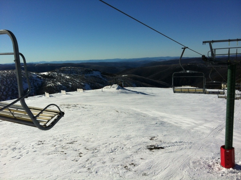
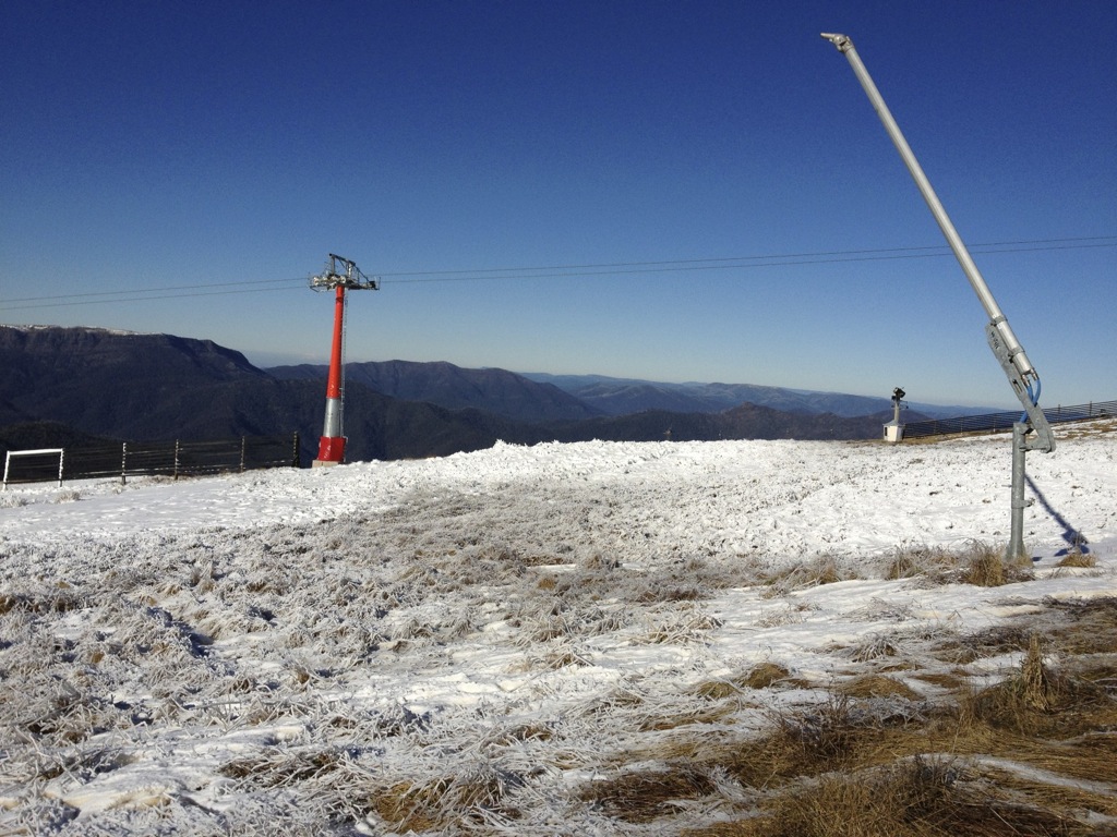
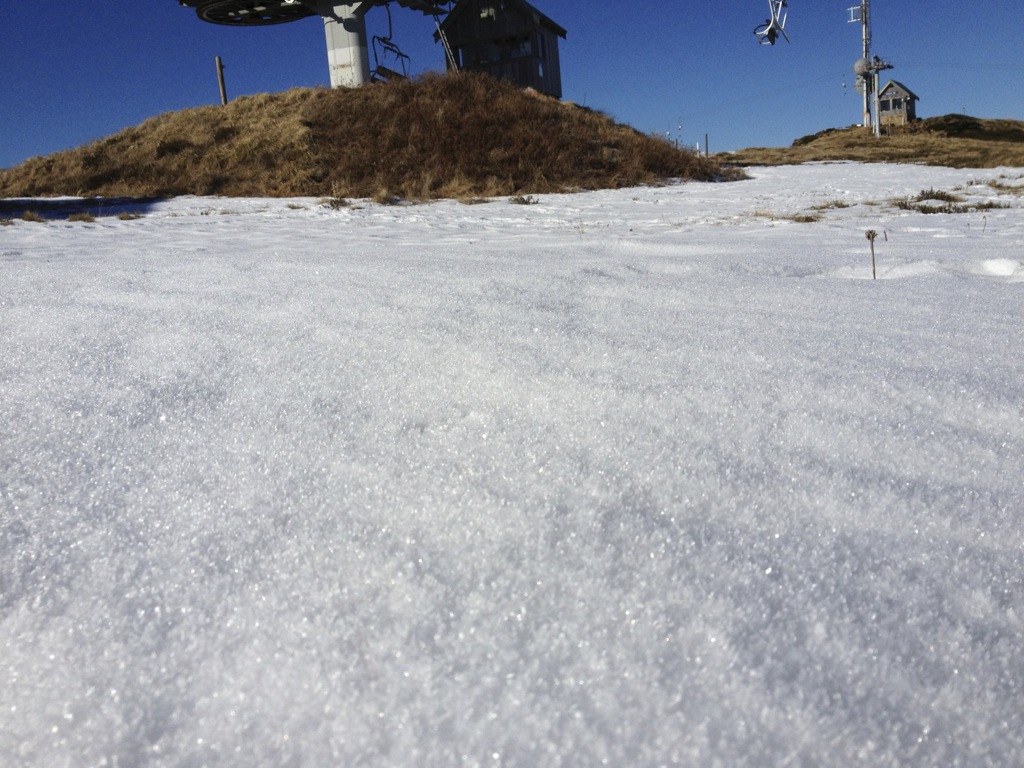
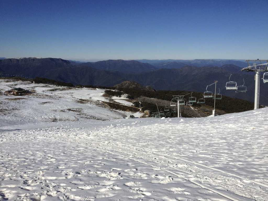
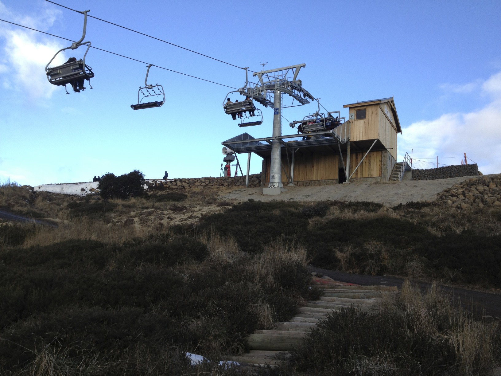
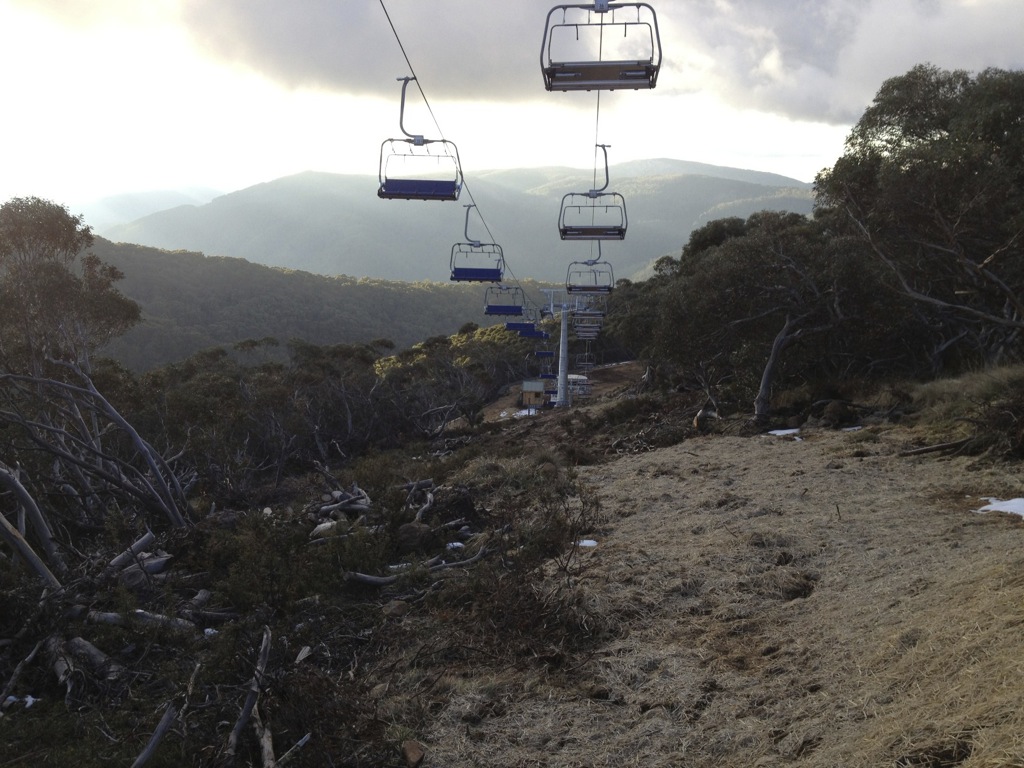
We got a little carried away having fun on Bourke St with our niece and nephew and missed the opening ceremony for the new chairlift. So we didn’t get to ride it but there was still plenty of light left so we went for a hike to look around.
New LiftSummit / Grimus AreaNew LiftNew Lift
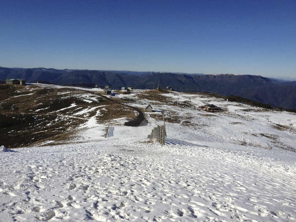
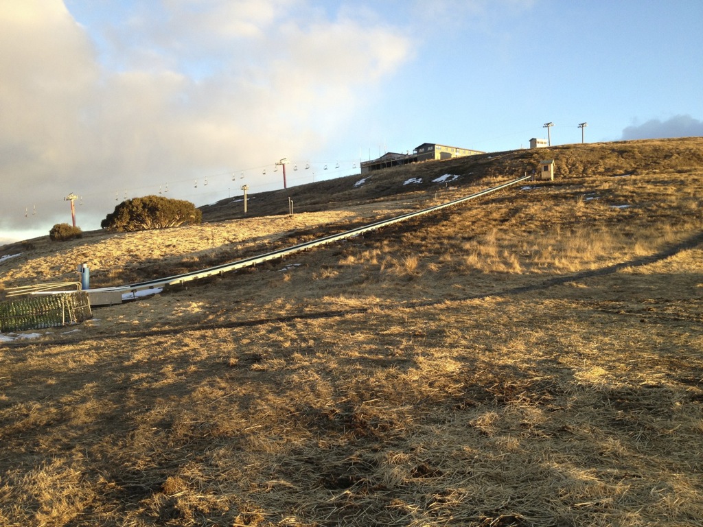
Along with the new lift there has been the addition of new automated snowmaking – as Shakey Knees has conclusively proven, snowmaking is viable on the Northside of the mountain, and it also showed that removing a ski lift from being over the middle of the run transforms it, so it is great to see this logic now being applied to the Burnt Hut area. The temporary carpets that were used on Burnt Hut while waiting for DSE permission on the new lift have now been relocated, one replacing the old Dam Rope Tow, and another replacing the Trainer T-Bar.
Carpet RelocatedTirol / Shakey Knees
The sum total of these works are in my opinion a great addition for beginner skiers at Mt Buller. The key to this area will be the snowmaking, as being on the sunny aspect natural snow can’t be guaranteed, but as I mentioned earlier Shakey Knees has proven over the last few seasons that this is a realistic outcome.
The irony of Mt Buller’history and how it was developed that the best area to learn skiing is currently where the buses park and having a ski school halfway up a mountain is far from ideal. There is a lot of beginner and pedestrian traffic currently in the village that would be far better served over in the Horse Hill/Burnt Hut area. Naturally the reliability woes of the Horse Hill chair over the last few years have added to this, but overall these changes I think are great to get a volume of beginner skiing traffic into an area that is far better suited to their needs.
It started snowing lightly as we walked back go the village but this was short lived unfortunately, however I just got a message from a blog reader that the snowmaking has just started tonight on Bourke St.
If you’re up in the mountains please share your photos with us on aussieskier.com/social – just tag your Instagram pics or Viddy movies with the hashtag #aussieskier. You can see the latest pics & videos on the RHS of this page.
Last update before the long weekend – in a couple of hours we will be in the car on the way up to the hill.
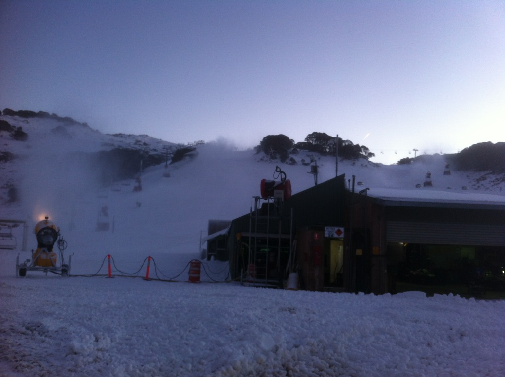
Snowmaking has been the story of the last couple of days with the resors all publishing pics of the guns in action:
In addition to this snowmaking pic Hotham has announced that they have added the Summit Quad to their openings:
Hotham Snowmaking (c) Hotham
Falls Creek have taken delivery of some new guns plus a Kassbohrer Winch Cat and have been putting them through their paces – Lifts open for the weekend will be Towers, Falls Express and Towers:
Falls Snowmaking (c) Falls
Buller is snowmaking madly in order to have an offering for the long weekend:
Buller Snowmaking (c) Mt Buller
Also a good pic came in via Instagram this morning, check out on the RHS —>
The word from the hill is that there will be lifts running tomorrow no matter what, even if for sightseeing, and if the temperatures allow there will be skiing if/when remotely possible. You can see from using the slider on the Bourke St Webcam that even though the fringes do melt during the day there has definitely been a gain over the last few days. I know it’s a bit sad to get excited about a slowly growing patch on a green run, but hey, it’s all we’ve got!
I’ll soon be in the car and will take some Instagram pics once we get closer so keep an eye on aussieskier.com/social for that.
While Hotham & Falls have capitalised on the recent snowfalls unfortunately Buller is looking a little like the poor cousin and reliant on snowmaking to open this weekend. It is interesting looking at the cams – while up high Falls & Hotham look great, the lower reaches are still a way off being in shape.
Hotham have already announced their opening weekend plans (click here) – in summary Big D, Summit and Upper Playground will be open. Falls have yet to announce their plans but I would estimate they will open Towers, Drovers plus Falls Express to service Wombat’s Ramble. Looking at the cams, Ruined Castle is still a little way off and I would expect Scott’s to be in the same boat.
Baw Baw is also looking great and I bet they are excited for the long weekend.
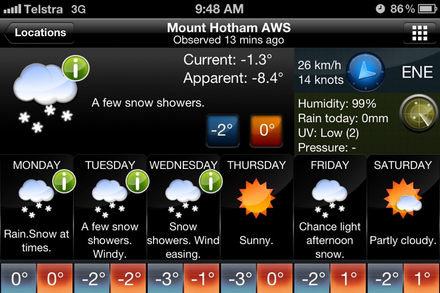
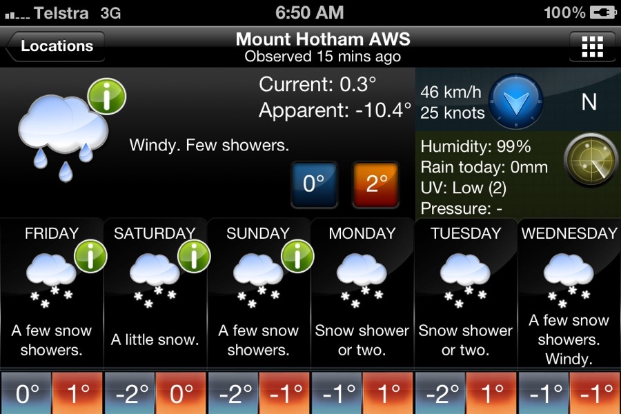
As the storm moves away a high pressure takes over until early next week, this will move very slowly and pump in cold air from the SW that will allow snowmaking plus the chance of some snow showers on the Fri/Sat. BOM report is showing some good, cold overnight temperatures with Jane’s Weather estimating the next weather system to affect us will arrive on about Wednesday.
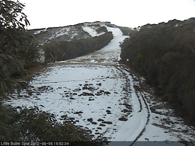
An eagle-eyed twitter follower spotted the snowmaking being turned on in the last Boggy Creek cam image of the day:
Mt Buller Boggy Creek Snow Cam
And if you look extremely hard you can see them on Wombat as well:
Mt Buller LBS Snow Cam
And minutes after this Buller posted a pic on Facebook of a gun firing at the top of Shakey Knees:
Shakey Knees Snowmaking (c) Mt Buller
Naturally Buller is pretty much starting from scratch so I wouldn’t expect an announcement on lifts for the next little while.
What I do know is that they will be busting an absolute gut to make it happen.
If you’re up in the mountains please share your photos with us on aussieskier.com/social – just tag your Instagram pics or Viddy movies with the hashtag #aussieskier
After a wild night of weather in the mountains with see-sawing temperatures I was keen to check out the webcams this morning to see what the storm had delivered. Everywhere looked white. Except Buller. Even Baw Baw had received a nice dump of snow.
I’ve always know that Buller does not do well with storms from the SE, so I emailed Jane Bunn from Jane’s Weather to find out why. Her response:
Unfortunately for Buller it was the location that was the problem.
This system was a deep low centre just off Mallacoota, moving northeastwards. It had a stream of tropical moisture coming down and wrapping around, and this sent rain across Victoria from the southeast. Anything coming in from the southeast has a lot of high terrain to get over first before it can hit Buller.
So, it was a case of drying out as the precipitation moved across the ranges, from late last night when the air was cold enough.
This is clear by looking at the rainfall totals on a map. You can literally draw a line from just north of Hotham and Falls, through to just north of Baw Baw, where the totals reduce dramatically.
We have always know that Buller has fared poorly from an SE system, but what confused me was why Baw Baw received snow when Buller didn’t. Buller & Baw Baw are usually brothers in arms when it comes to benefiting from SW storms while Falls & Hotham do well from the NW and Thredbo from the SE.
So armed with the information from Jane and questioning this particular disparity I decided to dispel this illusion and actually look at a map.
This is what I found: (Click to enlarge & excuse my dodgy photoshop please)
Buller / Baw Baw Rain Shadow
As you can see there is basically bugger all high ground to the SE of Baw Baw, whereas denoted by the length of the arrow Buller is particularly deep into the alps from that orientation and therefore in a total ‘rain shadow’.
Either way it’s a good outcome from all the other mountains apart from Buller – we should be seeing plenty of skiing on opening weekend. I got a call from Hotham’s Marketing Department saying how excited they are with this snowfall, they have also done a lot of snow farming and will be announcing later in the week what they are planning to open.
If you’re up in the mountains please share your photos with us on aussieskier.com/social – just tag your Instagram pics or Viddy movies with the hashtag #aussieskier
—-
Photo (c) Perisher Resort
With the Queen’s Birthday Long Weekend approaching that is the traditional Opening of the Australian ski resorts, all eyes are turned towards the weather.
Perisher opened Front Valley on Saturday thanks to its altitude and topography, whose snowmaking is actually assisted by inversions, but the upside-down airmass elsewhere in the alps did not allow snowmaking to add to the natural snow that fell on May 25th.
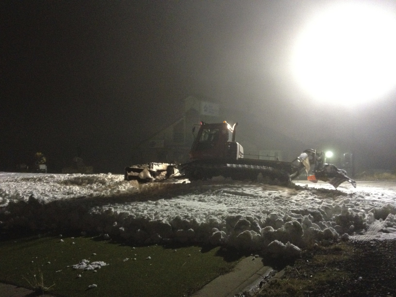
I have had it since confirmed that Buller was hell-bent on opening last Thursday, they pushed snow into the load and unload stations of Blue Bullet 1 but were thwarted both by the inversion but also the power going out due to a fallen tree – this timeframe coincided with what would have been the prime snowmaking window for that weekend but they were unable to capitalise.
Fast forward a week and I feel like we are in the same boat – a weather system is approaching, we have encouraging forecasts being thrown around for tomorrow & the excitement is building. The last storm was a particularly complex one, and readers of this blog will remember that I was rather negative and didn’t believe that it would be cold enough to snow.
One pundit who remained firm in her forecast of 20-30cm was Jane Bunn from Jane’s Weather, and as a result received the accolades from Aussie snow followers once it was proven to be correct. She has again predicted up to 30-40cm for tomorrow’s storm, so understandably when she published this on Twitter & Facebook this morning it was incredibly well received. Once again this is a complex weather system – not your usual SW Arctic Blast, and requires analysis from experienced eyes.
The Weather Nerds are not as confident on the timing of the arrival of the cold, they believe it will be later tomorrow instead of Jane’s prediction of tonight. Frog’s Snowatch is a little more conservative with a call of 5-15cm tomorrow, starting with a high 1700-1800m snow level and falling to 1500m later. Weatherzone Snow is up & running for the winter which is great – their synopsis is very similar to The Frog. The Vic BOM is more generic in its description, but it’s worth noting that even though they whip up a lot of hysteria with the word ‘Blizzards’, this term is meant to describe high winds accompanying Snowfalls. I’ve seen them call for ‘Snow Showers’ and receive over 30cm.
However it is still quite warm in the Alps with rain due prior to the cold air, and as regular readers of this blog will know that I’m familiar with the term ‘it always gets worse before it gets better’ – in the case of Buller and it’s thin snowpack this could well melt just about everything that’s there, but if 20cm arrives tomorrow with a few nights of snowmaking to follow then I am pretty confident we will be skiing on the weekend.
Rather than cluttering the blog with new reports on this weather system I will keep updating this post with new information – I will add this at the top of the post.
If you’re up in the mountains please share your photos with us on aussieskier.com/social – just tag your Instagram pics or Viddy movies with the hashtag #aussieskier
We are going to offer a FREE copy of The Powder Bible to the best photo and video submission from each resort this long weekend.
Video: The theme is ACTION – simply shoot the best trick, jump, wipeout of the day, upload to Viddy with the tag #aussieskier plus the tag for your favourite resort and you’re entered!
Photo: The theme for the photos is FAMILY & FRIENDS – tag your Family & Friends ski photos with #aussieskier plus the tag for your favourite resort, then upload to Instagram and you’re entered! It’s that easy.
This Press Release just arrived from Hotham Marketing Department regarding their plans for the Queen’s Birthday Opening Weekend:
Hotham Opening
Following good early snowfalls and excellent snowmaking conditions, Hotham Alpine Resort is excited to be the first resort in Victoria to announce lift openings for Season 2012.
On Saturday June 9, Hotham will open three lifts – Big D Quad Chairlift, Summit Trainer Poma and Upper Playground Double Chairlift.
To celebrate the season opening, a special deal on lift only passes will see $5 from every Adult Lift Only pass donated to Merlin Entertainment Groups very own charity, “Merlin’s Magic Wand”. Merlin is the new owner of Hotham Alpine Resort.
Merlin’s Magic Wand is a global children’s charity, aiming to provide magical experiences for those who are seriously ill, disabled or disadvantaged. At Hotham we hope that the funds raised may assist some of these children to access our beautiful resort this winter to enjoy a skiing or snowplay experience. The funds also go towards transport for the children to Merlin attractions.
Lift prices are:
1 DAY LIFT ONLY Adult: $49 – with $5 from every ticket to be donated to Merlin’s Magic Wand
Youth: $39
Child: $24
* Kids 5 and under ski free when accompanied by a paying adult
To celebrate the start of the Snow Australia Learn to Ski & Board Month, Hotham is offering great deals for beginner lessons…
1 DAY LEARN TO SKI (LIFT & LESSON)
Adult: $79
Youth: $69
Child: $69
Snowsports Lessons are available for levels 1 to level 3 from the Hotham Central Snowsports Centre for adults & youths with children lessons from the Big D, Kids Snowzone.
Good to see what Hotham are offering, I will post as soon as I hear from Falls Creek and I suspect that Buller will be touch-and-go when it comes to announcing as they will be relying on snowmaking the next few nights.
If you’re up at Hotham for the long weekend please share your photos with us on aussieskier.com/social – just tag your Instagram pics or Viddy movies with the hashtag #aussieskier
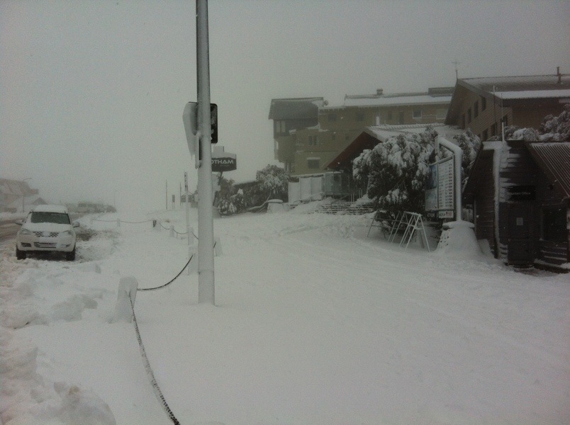
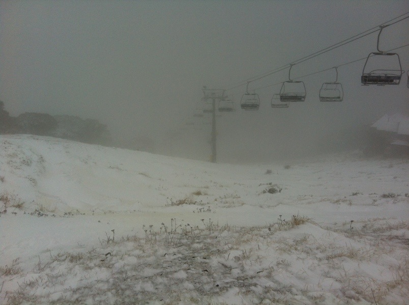
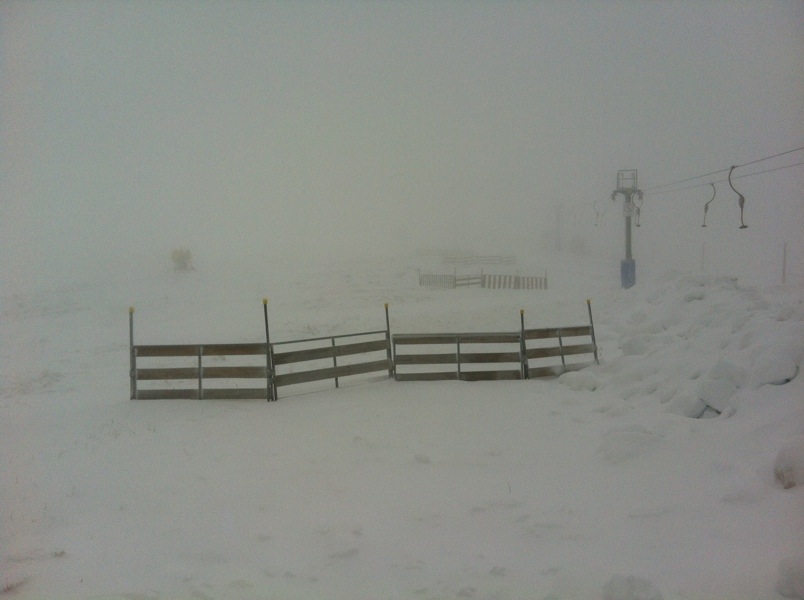
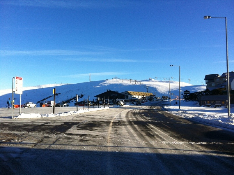
As everyone has no doubt already figured out this storm has delivered. It is pretty hostile and it is not surprising the road was shut. Visibility would have been horrid across the top.
Not many pics but this is a definite season starter. Things were starting to look a bit ordinary for the weekend. It would be surprising if there wasn’t some grooming happening tonight to pack in some of the drifts that have built up.
(Click pics to enlarge:)
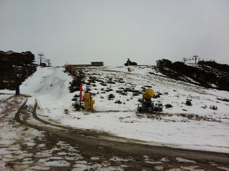
I think we can all be assured that Playground no longer looks like this:
This forecast looks the most promising yet from a snowmaking perspective as well.
If you’re up in the mountains please share your photos with us on aussieskier.com/social – just tag your Instagram pics or Viddy movies with the hashtag #aussieskier


 Perisher Resort")