UPDATE: Friday 7:30am
It’s wet in Melbourne and cold in the mountains, a good sign. Buller’s Village cam has signs of white & Hotham is reporting snow on their Facebook/Twitter feeds which is good news, it still doesn’t look like there is much in the front, but at least it will be snow.
—
Thursday night is probably a bit late to start writing a post about the weather for the weekend, but my enthusiasm waned with the forecast yesterday.
It looks like it was a pretty stunning week at Buller – Lorraine Lock from snow-blind posted some lovely photos from today. While the other resorts looked to have been pretty murky during the week, Buller was bathed in sunshine, and blessed with near zero crowds. I know it’s a bit easy to get ahead of yourself & wax lyrical when there are effectively only 2 runs open, but I bet those up there this week would have had fun. Unfortunately the high pressure that dominated the week also led to large inversions overnight so no snow was able to be made, however from looking at Richard’s Report it would seem that Thredbo was able to make snow last night.
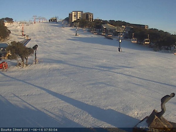
I must say I do enjoy the early morning viewing of the Bourke St webcam on a sunny day. Its Eastern exposure creates a lovely picture on a fine morning, just what I need to see first thing:

We do have some weather coming. A bit of a ‘clipper’ front late tonight or tomorrow, with another very weak front on Sunday, and something more substantial due on Tuesday. Earlier in the week the ‘clipper’ had some potential but this has been downgraded on the models.
Jane’s Weather has summarised it as follows:
ALPINE AREAS
Today: Dry.
Tomorrow: A burst of snow on the upper slopes, rain on the lower. Just local showers to follow (snow on the upper slopes). 5 cm of snow.
Saturday: The chance of showers, falling as rain. 1 to 2 mm of rain.
Sunday: The chance of showers, falling as rain, then an increase in these at night as a rain/snow mix up high. 3 to 5 mm of rain.
Monday: Most likely to be dry. Snow starts at night or early Tuesday and should quickly lower throughout the alpine. This system looks like around 20 cm at the moment.
Click here for her full outlook. Weatherzone concurs, with particularly bleak snow levels on the weekend.
The Weather Forum regulars keep referencing a Westerly flow, which is not good news for Bullerites – as was discussed to my dismay a couple of years ago.
I have a feeling that things will be pretty average over the weekend. I’ll still head up as I have quite a few chores to do at the lodge, but I do think that it could be a little crappy. Plus my most waterproof gear is in at Remote Repairs getting patched up and DWR’d so I can’t see myself spending huge amounts of time outside.
The good news is that it would seem that there will only be enough rain to be annoying, and not enough to do any real damage ahead of the snow predicted for Tuesday. Buller was painfully close to being able to open more terrain last weekend, so if we see a decent net gain between now and Tues/Wed I would anticipate areas like Summit, Shakey Knees and Family Run to open, which would be most handy in the lead up to the school holidays.
If you did get out on the mountain this week, let us know how it was in the comments below.
Remember to ‘Like’ aussieskier.com on the top RHS of this page & follow us on Twitter for the latest updates.
Also you can share this with your friends using the buttons below:


