Meanwhile it looks to be clouding over this afternoon, in anticipation of a light snowfall tonight which will be followed by another on Sunday. More details from Jane’s Weather:
ALPINE FORECAST
REST OF TODAY Snow level: about 1400 metres during the afternoon, lowering to 1200 metres from this evening.A mix of snow showers and sunny areas, but a burst of snow and strong winds, develops from west to east this afternoon, continuing tonight. SATURDAY Snow level: 1100 to 1200 metres.Snow showers, easing. Strong winds easing. SUNDAY Snow level: 1200 metres lowering to 1000 metres later. Snow showers (but the chance of sun), then a new burst of snow and strong winds from the afternoon. MONDAY Snow level: 1000 metres, rising to 1200 metres later. Snow showers, easing. Strong winds easing.
TUESDAY Snow level: 1200 metres. Snow showers (but the chance of sun), then a new burst of snow and strong winds from the afternoon or evening (or possibly delaying until Wednesday).
HOW MUCH?
Friday into Saturday: 5 cm.
Sunday into Monday: around 10 cm.
Tuesday/Wednesday: not guaranteed but 5 to 10 cm.
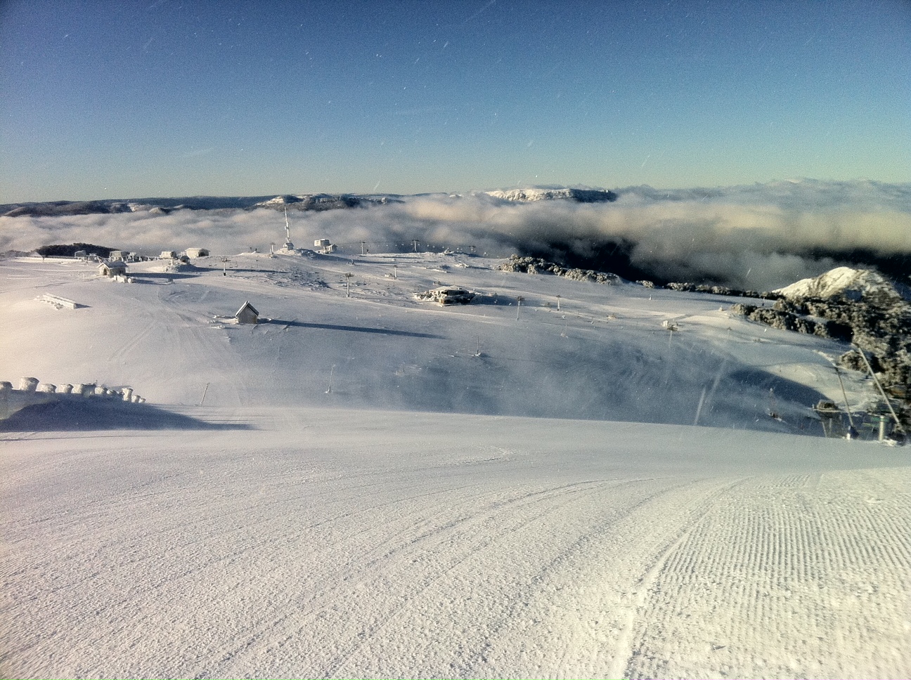
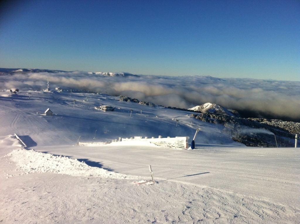
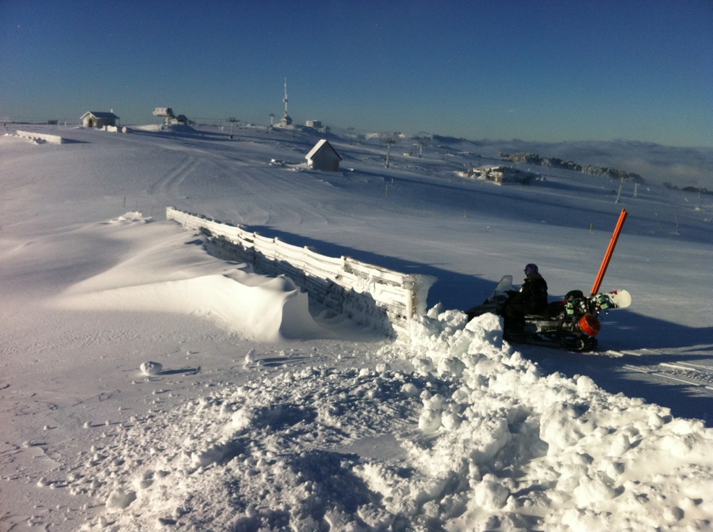
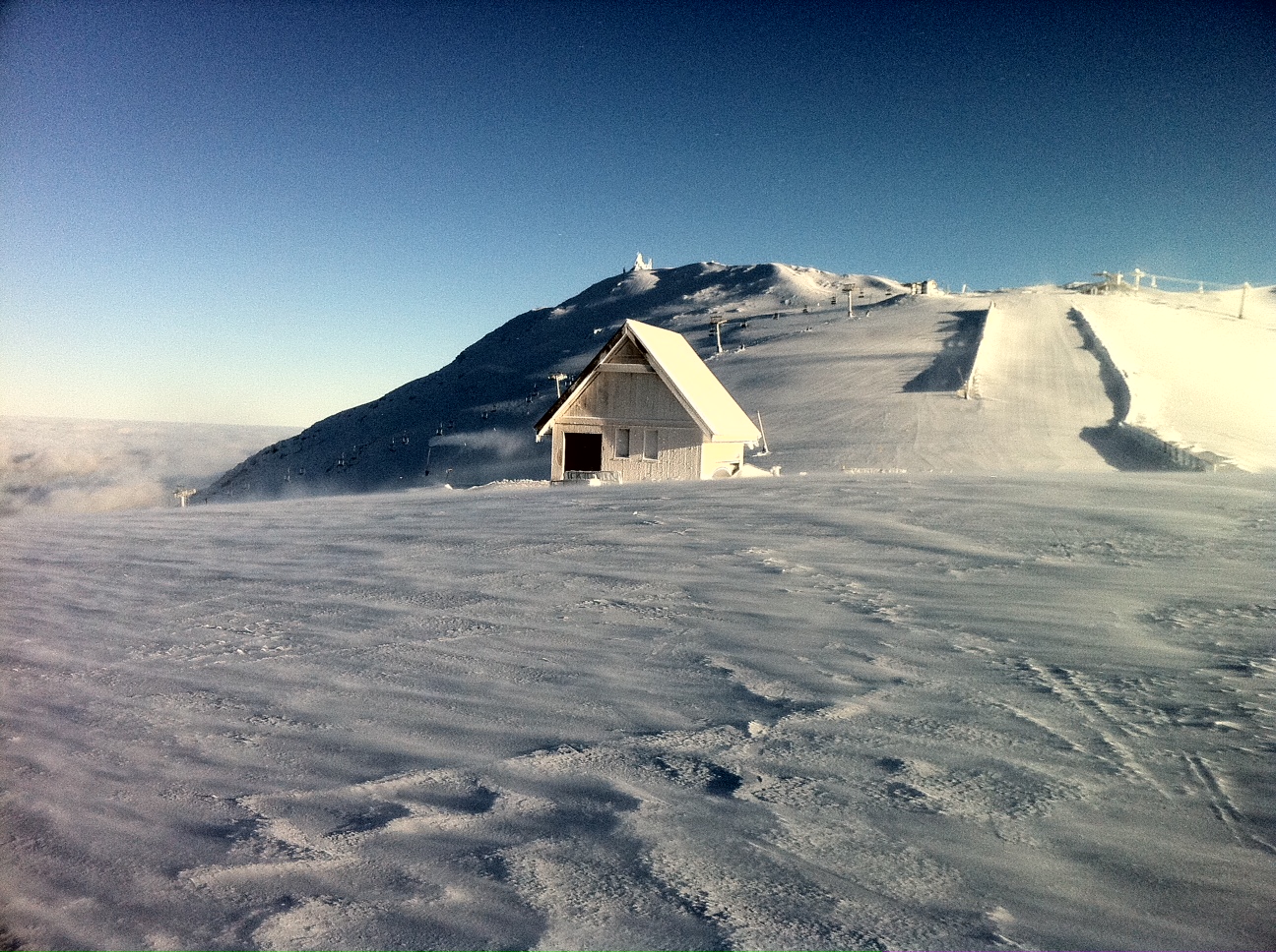
UPDATE: Friday 10:30am – Yet even more pics!!!
Buller 8th July 2011Buller 8th July 2011Buller 8th July 2011Buller 8th July 2011Buller 8th July 2011Buller 8th July 2011Buller 8th July 2011
A huge thanks to all that have been sending these in – it’s much appreciated!!!!!!!!
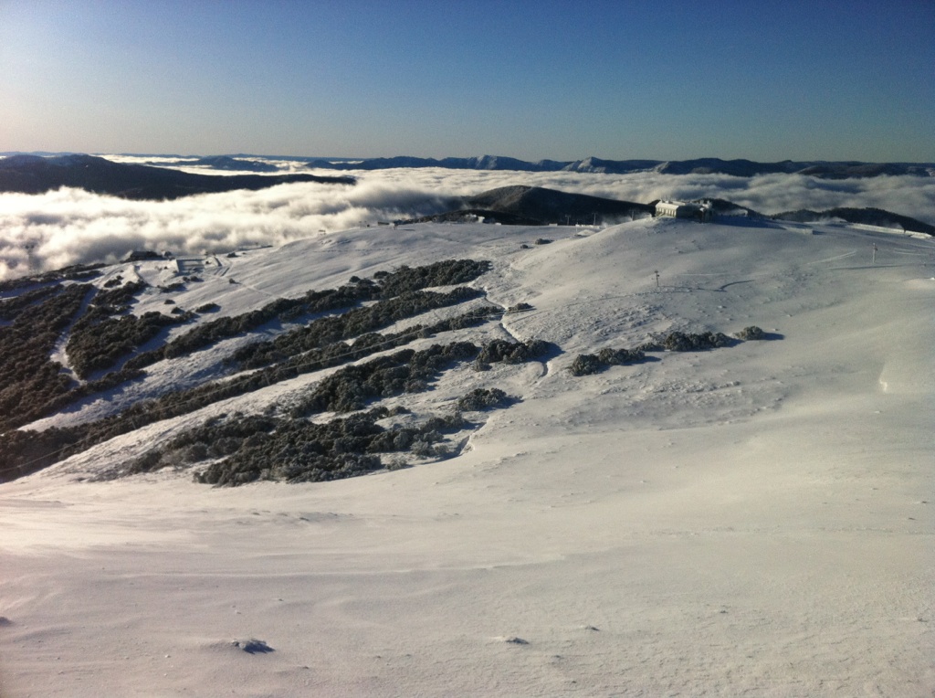
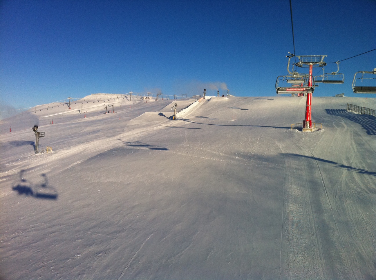
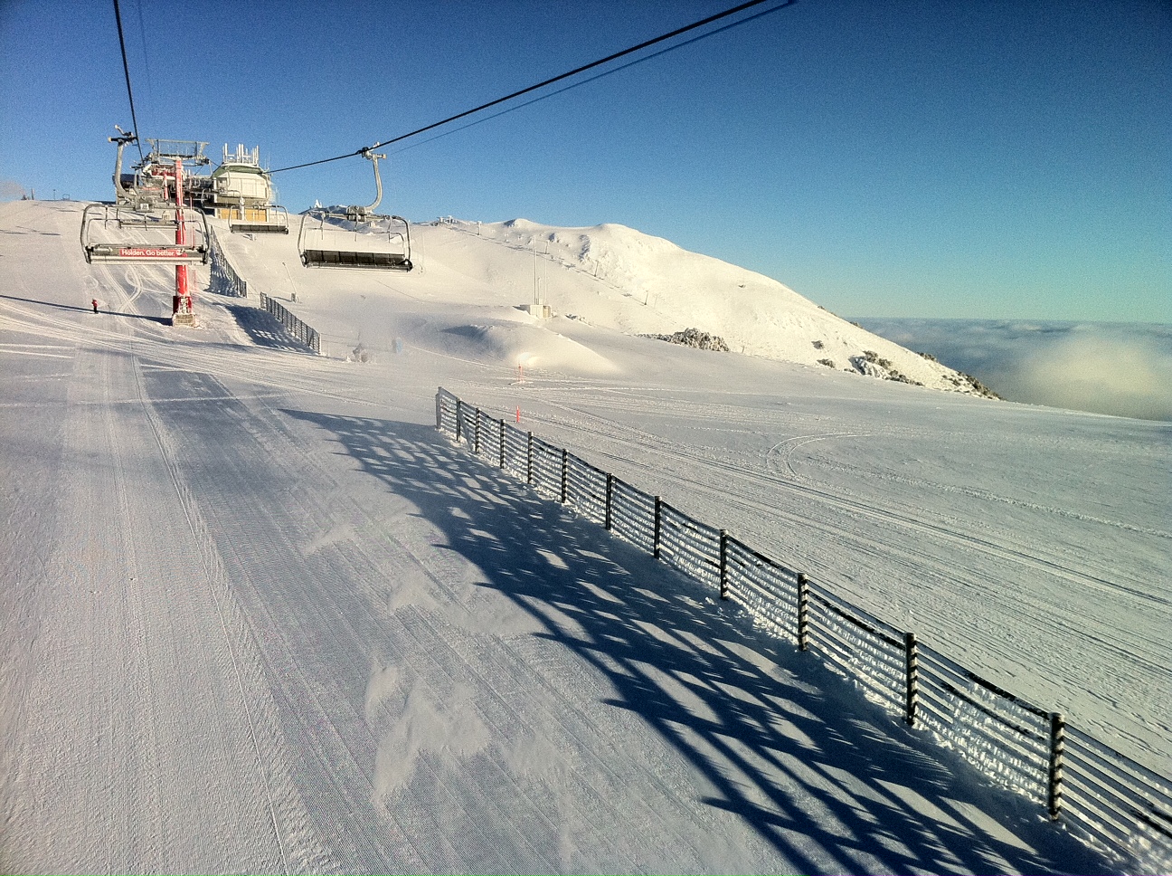
UPDATE: Friday 9am: More Pics:
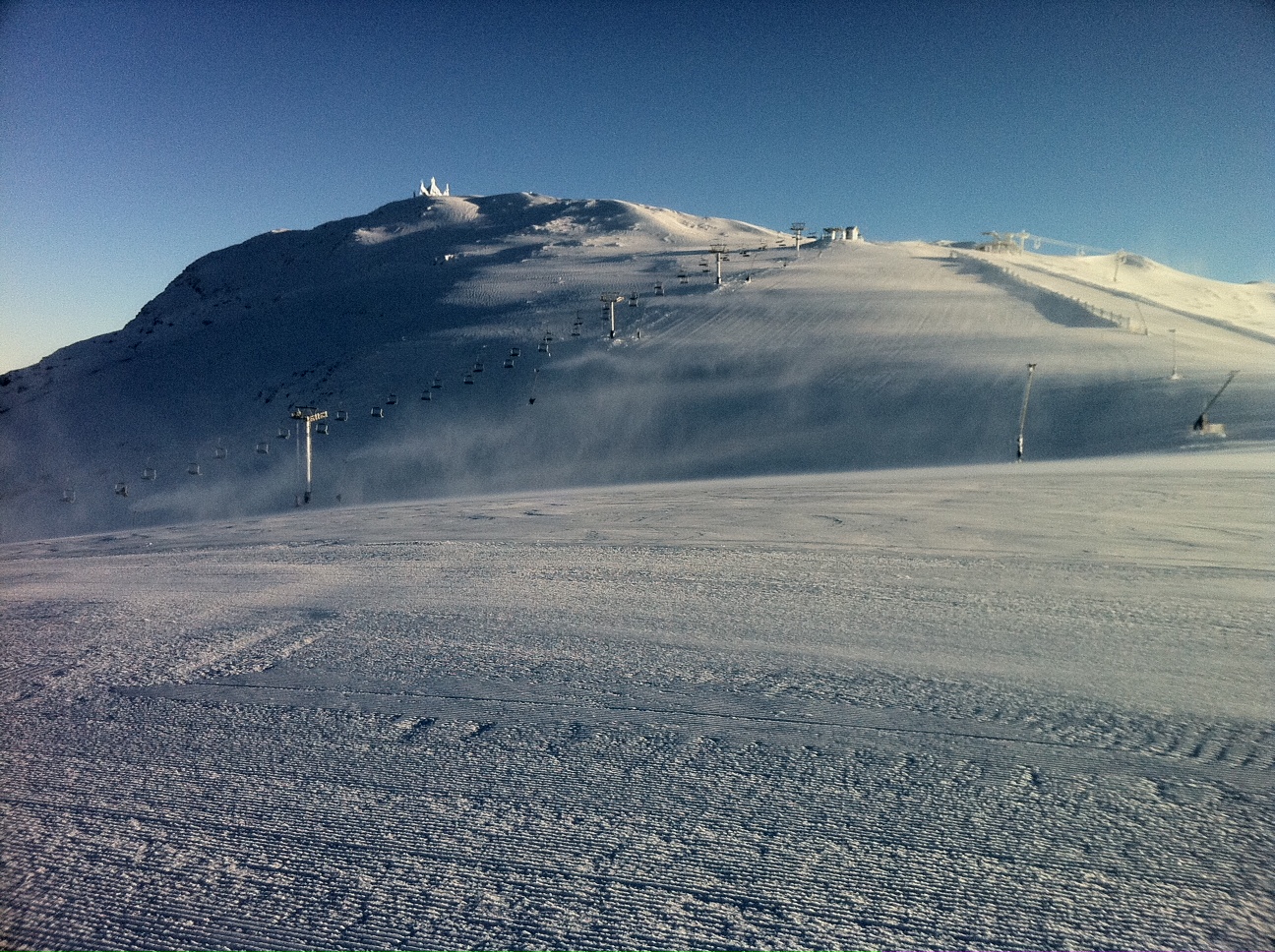
SummitSummit SlideBaldyBaldyKoflersSummit
UPDATE: Friday 8am This just arrived in my Inbox:
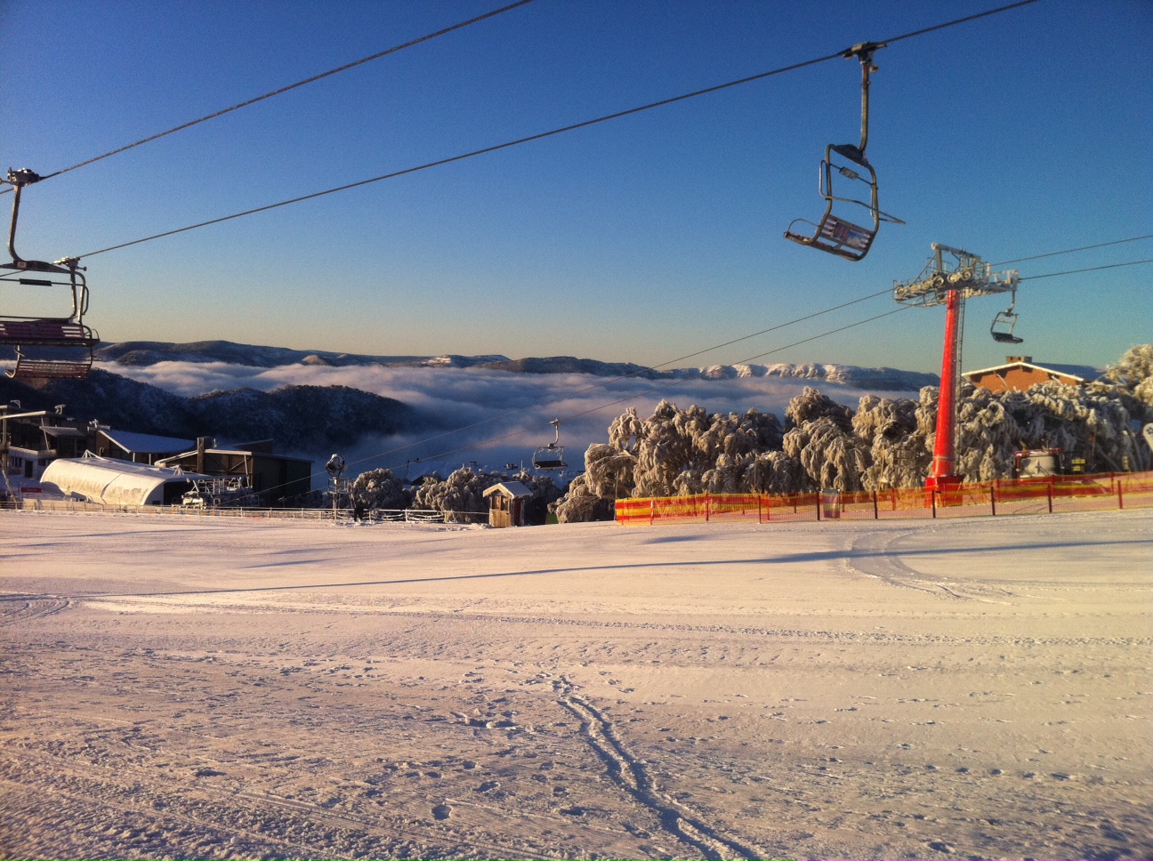
Bluebird
Accompanied with this:
Howqua, Horsehill Chair, Spurs Trainer T-bar & Burnt Hut carpets today & Standard maybe tomorrow….maybe
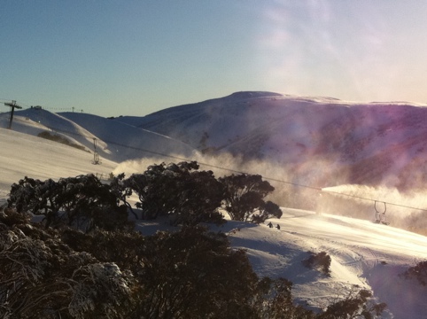
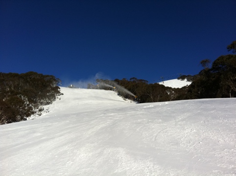
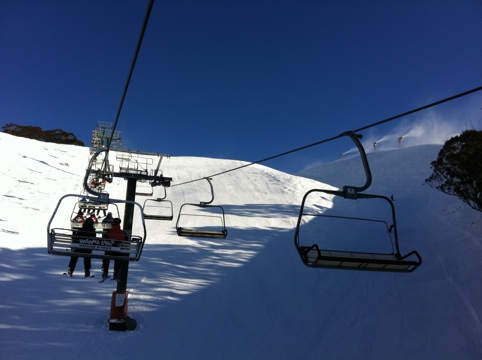
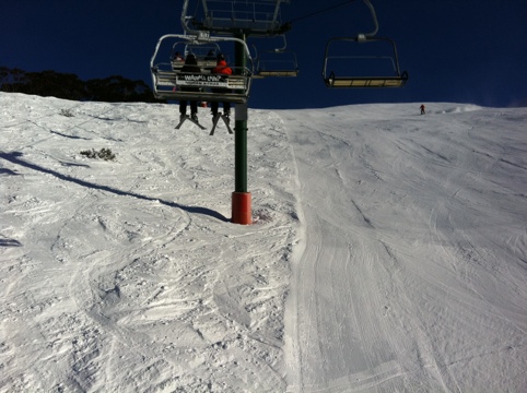
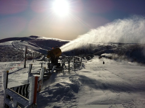
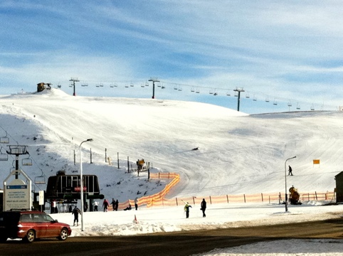
An absolutely stunning day up here. The cloud that was around yesterday was gone not long after sunset and it is still perfect conditions for getting out there.
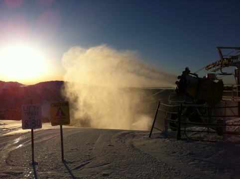
The temps are helping to keep the snow really nice and also to allow for the snowmakers to keep going.
UPDATE: Basin Rail Park being built tonight. The Park Crew are out there now getting it done.
Snowmaking already cranking. Could see them going on Sun Run before sunset and running on Basin.
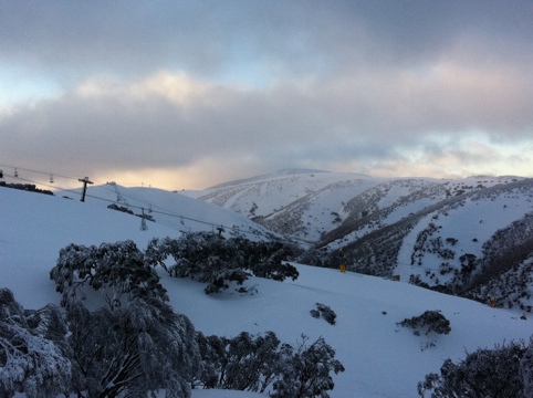
Woke to clearing skies and it has stayed that way all day. Everything is looking awesome now that it is covered in white. Skiing was great all day. Would expect that the snowmakers will be getting an early start tonight as well.
Things are coming together with the entire resort opening by the weekend apparently according to Hotham FB today. Nice to see Blue Ribbon opening so early.
If you planned to try and get first tracks down One Tree Hill on Saturday don’t bother, it’s already been done. Golden Point as well.
Hotham Alpine Resort has more great news to report with a further 31cm of snow falling overnight, bringing our three day snowfall total to 64cm so far with still more snow in the forecast!
As a result of this perfect alpine weather including snowladen blizzards, Blue Ribbon Chairlift will open tomorrow and as of Saturday, the whole mountain will be open with Gotcha, Keogh’s and Orchard chairlifts all set to see some action too. Skiers and boarders will have reason to celebrate as these four lifts didn’t open after mid August in 2010.
The Basin Rail Park will be open this weekend with the first event of the A la Carte in the Park series that night, The Cheese and Crackered Rail Jam. Cobungra Platter Beginner lift at Dinner Plain also opened today.
The average natural snowdepth is currently 98cm – looking good for riding on a solid metre base by the weekend! Hotham’s grooming team has been hard at work to get the whole mountain open so early.
Early openings of Heavenly Valley Chairlift will also start this Saturday with the lift spinning from 7.30am for first tracks. This program is no extra cost with a valid lift pass and operates from Wednesday – Sunday each week (snow and weather dependent).
Apologies for the lack of updates over the last couple of days, have been a little under the weather.
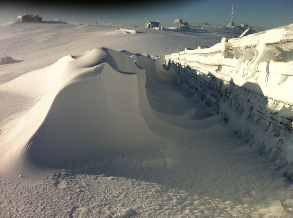
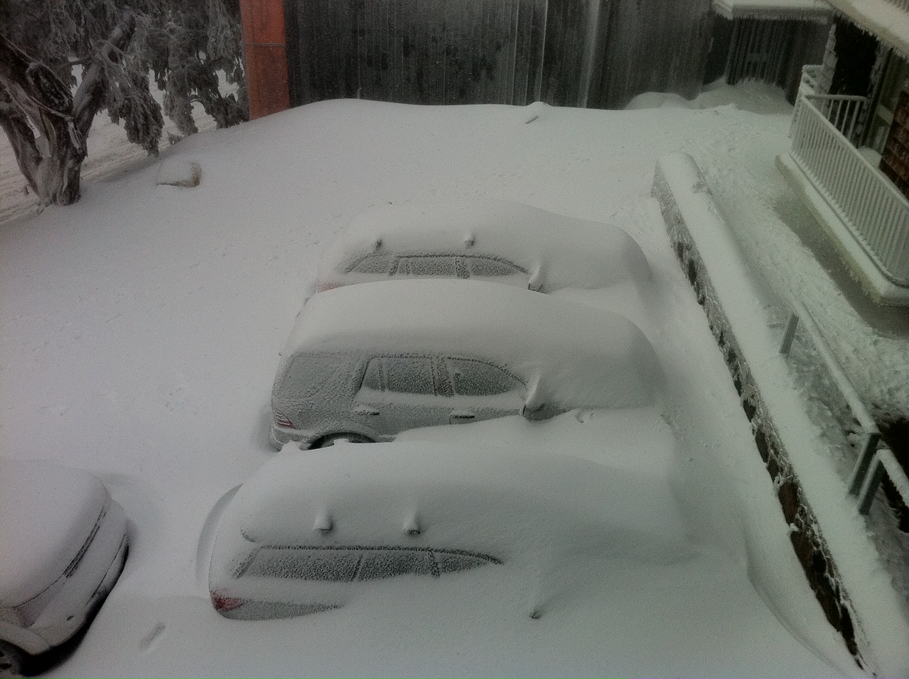
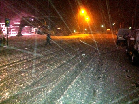
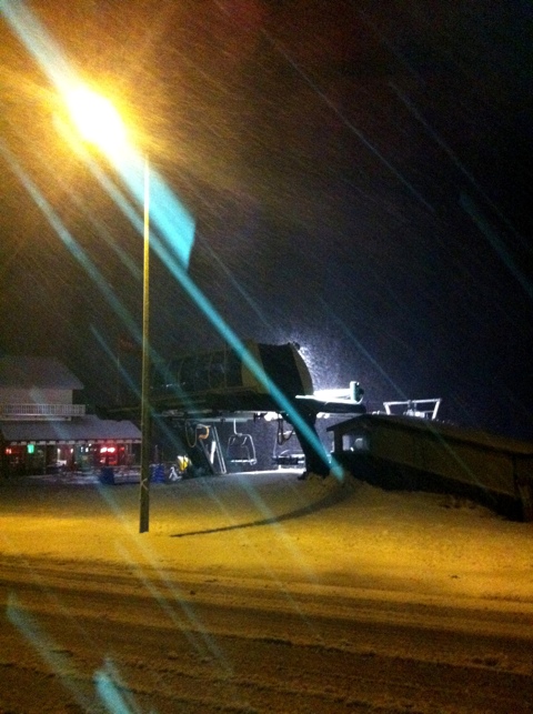
It has been quite a momentous weather system, Our northern neighbours seem to have picked up the lions share of the snow, however Buller hasn’t been left out completely, though the reported snow depths may leave you thinking otherwise. The numbers are scrupulously accurate as reported, however due to the heavy winds that accompanied this snow event there are places with a lot more snow than others, as this photo would suggest:
Twin Towers Car Park
My rule of thumb has always been the snow depth at the Family Run snow gauge. However this has now been moved due to the snowmaking being installed on Family Run – it is now higher, more near the entrance to Powder Keg so I will have to see how that change affects my ‘calibration’. That said, it is reporting 61cm as of this morning which would indicate a rise of approx 40cm from the recent storm system, which is nothing to sneeze at, despite being less than the other resorts. Yesterday was another example of Buller’s propensity to get shafted during a Westerly flow.
Lorraine Lock from snow-blind has been doing a great job of keeping us all up to date with the conditions this week – If you want a run down of how it all panned out, look through her last half dozen or so posts.
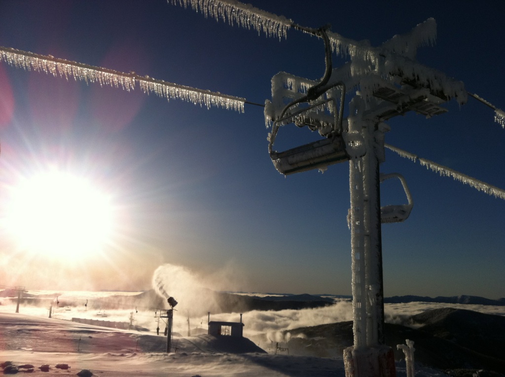
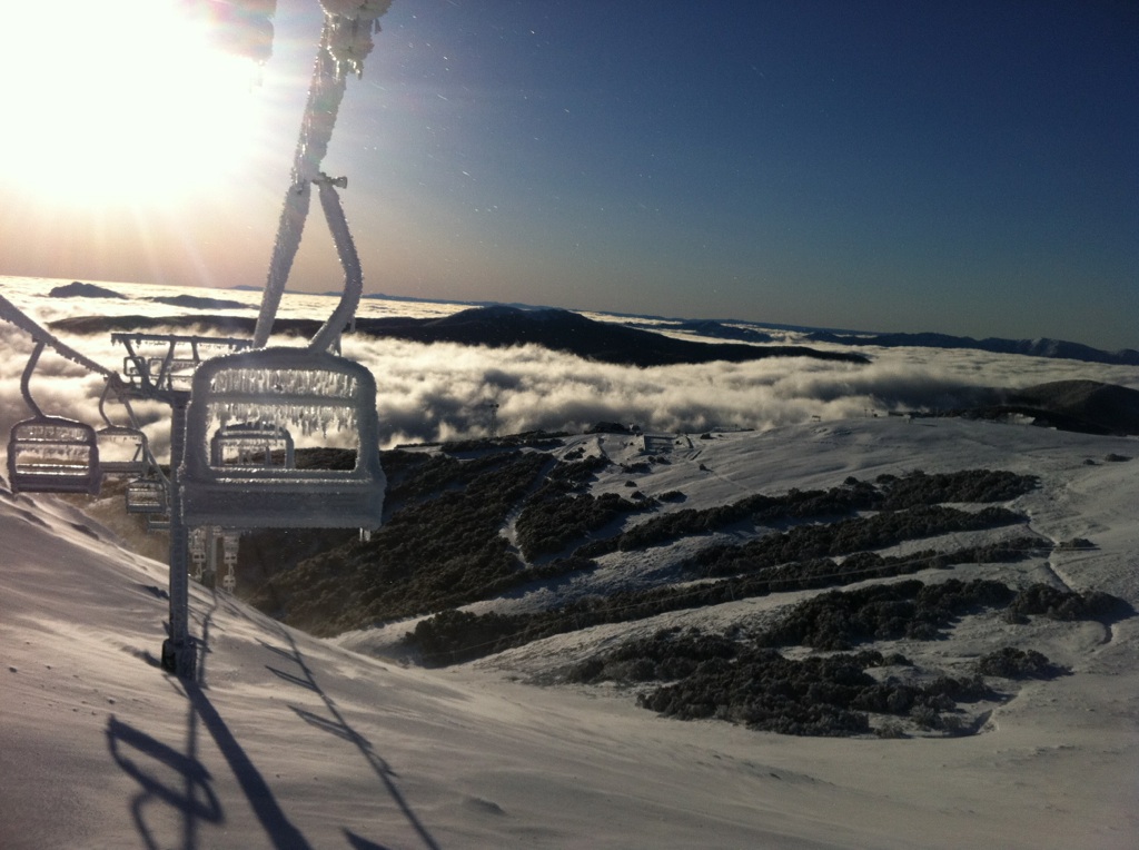
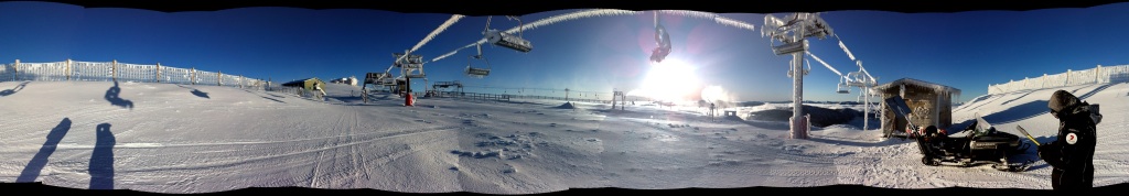
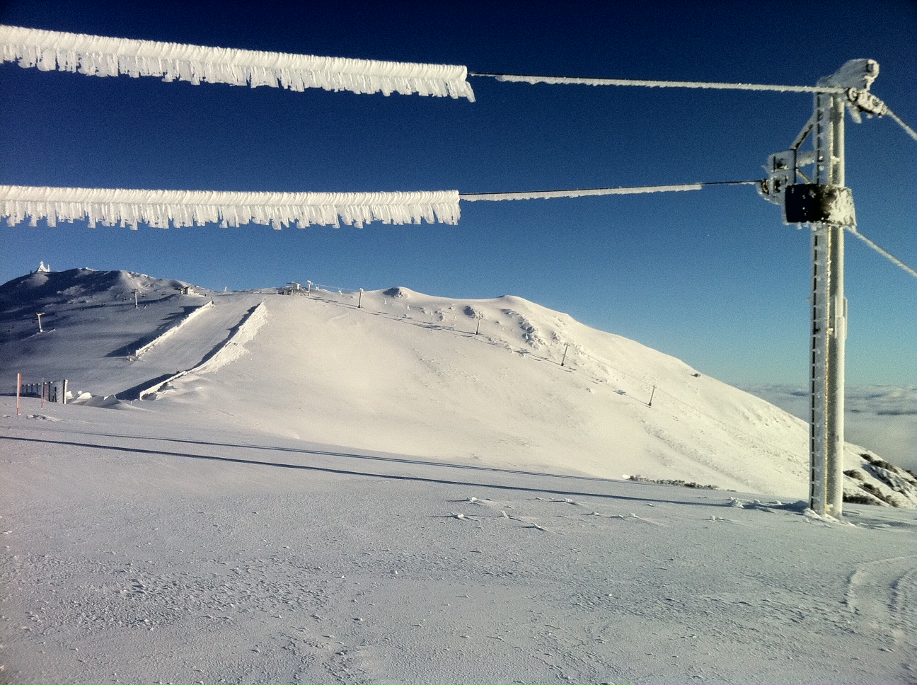
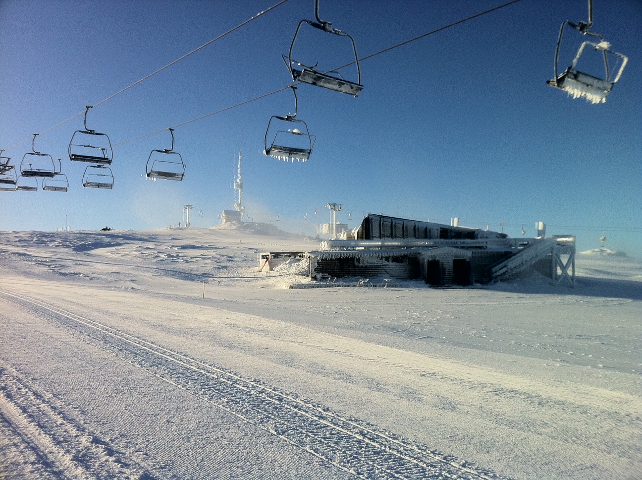
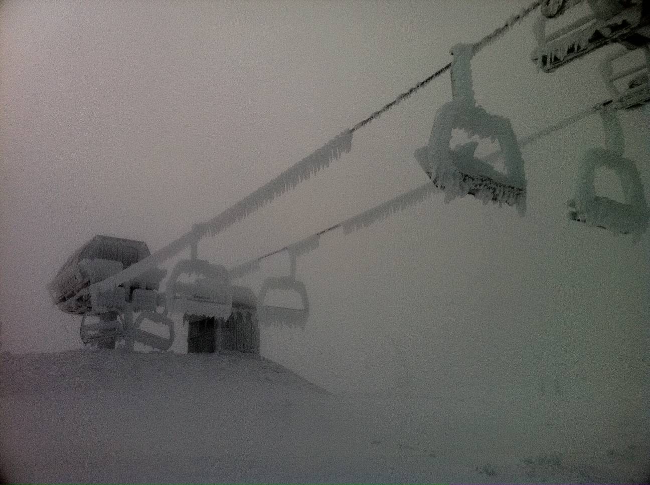
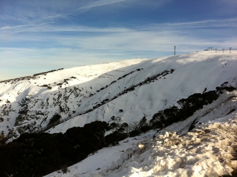
I spoke to my contact who is out on the mountain, at the moment the biggest issue by far is icing. Due to the moist nature of yesterday’s weather the icing on the lifts has been unbelievable, as bad as many people have seen. Summit was not able to be opened today due to the danger of the Howqua chair above the lift queue, and the possibility of shedding hundreds of kilos of ice. Here’s what it looked like:
Howqua Ice
As of lunchtime today, assessment of further terrain hadn’t really occurred as de-icing was the main priority for ops staff. As they get on top of it we will see what is able to be opened.
In the meantime the temps are cold and the snowmakers are going for broke. As I hear more I will update this post in anticipation of a fun weekend.
Further snow is forecast on Sunday, so the final week of the holidays could be one of the better ones in recent years.
Please use the comments below if you have anything of your own to report about the conditions, and don’t forget to ‘Like’ us on Facebook and follow us on Twitter to get the latest condition reports delivered straight to your desktop.
Apologies for going missing over the past few days while this storm is rolling through.
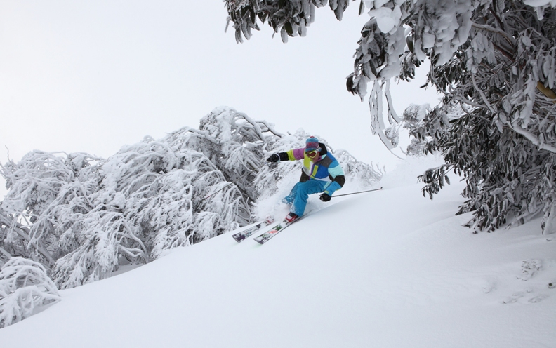
Yesterday it was pretty hostile. If you were prepared for a bit of an adventure there were some really nice areas of windblown and some very sizable drifts.
Today saw the winds drop down a little. Still seeing the snow drifting in a big way though. It was great that Heavenly opened up and it should be very nice up in there tomorrow with all of today’s snow plus what is lining up for tonight.
The next few hours are looking very good from all reports. Haven’t seen a radar myself but spoken to quite a few very excited people.
It sounds like it has been a pretty wild day in the alps. We woke to large fresh snow totals in NSW but more modest numbers in Victoria, however from all the people I spoke to at the various mountains it snowed constantly throughout the day.
It is difficult to give a number to the fresh snow accumulation due to the wind – at Buller it was blowing strongly from the West, stripping the likes of Family Run of all its snow, but I did hear of lovely drifts in the trees adjacent to Shakey Knees and alongside Skyline.
The forecast calls for a pretty relentless series of fronts to as far out as Tuesday next week. However we will concentrate on the ones that are more known, and we can expect solid snowfalls tonight, with another front tomorrow night.
These are projected to bring heavy snow to the Alps which will no doubt open more terrain. Buller is expected to open Skyline tomorrow, and I was told not to be surprised if there is significant openings for the weekend including areas like Howqua and Southside.
Of course it’s all in Mother Nature’s hands, but given that it is school holidays at the moment the resorts will be particularly keen to keep the hordes happy with new terrain as soon as the conditions allow.
As always, Jane’s Weather has a good precis of the situation, I won’t post it here as all you need to know is it is going to snow siginificantly until the weekend, with the possibility it could extend beyond.
I will keep this post updated as news comes to hand. If you have anything to report please use the comments below.
I am also being active on Twitter, so please follow @aussieskier for the latest updates & also re-tweets from trusted snow people.
UPDATED: 4 Jul 7:30pm:
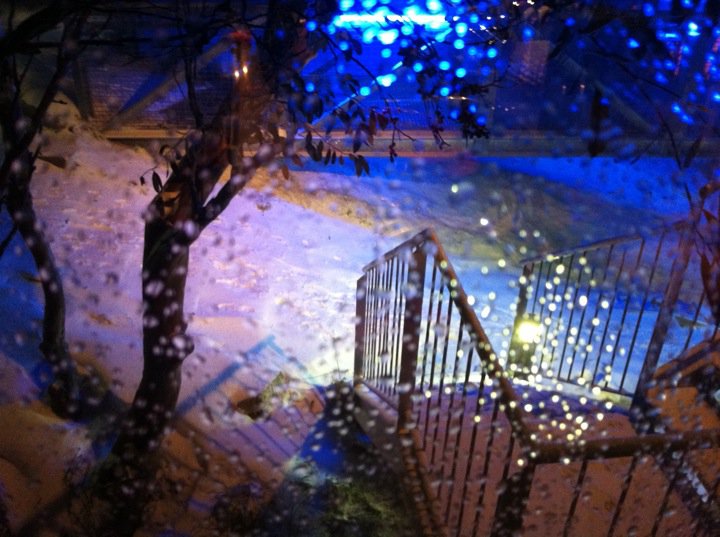
Just like they all said it would, it started snowing this afternoon.
This photo was sent to me at about 7pm, earlier this afternoon the path was brown:
Buller Snow 4th July
After a damp weekend, things got cold overnight & some resorts reported 3-4cm. It sounded like a pretty miserable weekend around the resorts, from all accounts Buller was drizzly and yuck yesterday with 10mm of rain falling, and Falls & Hotham suffered further with their AWSs showing 35 & 40mm of rain as of 9am respectively. However from the phone calls I’ve had it did not sound like the rain did much damage at Buller which is good news.
After lunch the tweets started accelerating from the various resorts that it was indeed snowing, and it would seem that it started in earnest at Buller from about 4pm. According to my friends up on the hill it has come down in a number of particularly heavy bursts, but punctuated by lulls. However looking at the radar & satellite pictures it would appear that it is set to become more consistent later this evening and into the week.
I’m going to take the snowfall depth predictions with a grain of salt, it looks like it will snow consistently tonight, tomorrow and Wednesday, and that alone will improve the situation and hopefully open more terrain at all resorts, which will be welcomed by the school holiday goers. You can find plenty of predictions with the usual suspects – Jane’s Weather, Weatherzone, Snowatch, Ski.com.au forums etc.A quick squizz at all those links is bound to bring a smile to your face.
As always, please use the comments below if you’re on the ground at the resorts and have anything to add, and share this page with your friends with the buttons below.
Don’t forget to Like aussieskier.com on the top RHS of this page, and above all please do follow us on Twitter. This is a great way to get bite sized updates as things happen – it’s much quicker for me to re-tweet something relevant rather than write a comprehensive post like this.
We have been pretty fortunate over the last month with regular storms and periods of poor weather. There is nothing worse at the start of a season than relentless clear skies which make for snowmaking and nothing else. I was going through some old photos over the weekend and found some pictures from the school holidays during the awful season of 2001. My squad and I climbed up Little Mt Buller and the only white stuff you could see for a 360 degree panorama was the snowmaking on LBS/Wombat:
LBS/Wombat 2001
Not all the precipitation this year has been of the white variety, but as all regulars will know – a good season in Australia means poor weather/visibility, so rug up and deal with it, and wait for spring if you want nice weather.
This year looks to be no exception. The weather over the weekend looked pretty awful with the arrival of a rain band as predicted later this afternoon. This looks to have turned to heavy, wet snow at Hotham Village level as reported earlier today, but by the distinct lack of enthusiasm on my Facebook feed I doubt very much that it has turned from rain at Buller – and by looking at the combination of BOM AWS and Radar rain would seem the obvious conclusion. Not that you would know from the official channels, for almost the last fortnight Buller’s social media communication has totally sidestepped the issue of snow, weather & conditions and is spruiking lame gimmicks instead. Oh well, guess that’s what I’m here for.
The forecast for the week looks encouraging, however it could be a mirror of the week before last. That particular storm was kind of like a shit sandwich – rain, followed by snow, followed by rain, after which we ended up just about exactly where we started. This week’s storm is evidently starting as rain, but looks to continue to snow for as far as anyone is game to forecast.
REST OF TODAY:Light, patchy rain turning to proper rain this afternoon. From the evening: a wet snow/rain mix around 1500 metres but snow above this elevation, heavy at times later.
MONDAY: A wet snow/rain mix around 1500 metres, but snow above this elevation, heavy at times early. Easing during the day but increasing to heavy again at night, falling as snow throughout the alpine elevations.
TUESDAY: Heavy snow throughout, easing by the afternoon.
WEDNESDAY: Heavy snow throughout.
THURSDAY: Snow easing early.
HOW MUCH?
20 to 30 mm of rain this afternoon.
Sunday night into Monday morning: 10 to 20 cm snow above 1500 metres.
Monday night into Tuesday morning: 10 to 20 cm snow throughout.
Wednesday: 20 to 30 cm snow throughout.
So that is 40 to 70 cm from tonight through to Thursday.
Then more snow later Friday into Saturday.
Just like in business I tend to halve snow predictions to see if I am still happy with them, and in this case even with far less than forecasted we will be a lot better off.
Weatherzone is on board, with particularly encouraging snow levels through to next weekend, Snowatch is a little less enthusiastic, though I note that it was updated yesterday morning – no doubt a day with the family is a much better option than poring over the charts for the Frog on a miserable Sunday. The Weather Nerds are all on board, the main question for them is how far the series of fronts will extend.
Anyway, this is all old hat to me. I washed my car today, of course there will be a week of wet weather.
Overall it looks encouraging, and no doubt will be well received by the hordes of holiday makers on the hill. After a lovely wedding last night and an excellent Bombers win as well, I would imagine that I will be up at Buller every weekend until October, unless the temptation of a quick long-weekend Heliskiing in NZ gets the better of me. That said, things have been pretty grim in NZ and it will only be in the next week or so that they receive their first significant natural snows of the winter. This has to be a bit of a kick in the guts for the Christchurch/Canterbury region, as if their tourist industry hasn’t been harmed enough by the earthquakes. The Aussie dollar goes a long way these days, and what better way to help our neighbours out than to pop across and check out the club fields – we had a great trip over there last year.
I will be keeping a close eye on things this week & regularly updating the site, as it looks to be the kind of weather event that could really kick start the season (yes, yes I know I said that a fortnight ago), but if you have your own thoughts on the forecast or some observations from up on the mountains, please use the comments below to let me know our opinion.
Don’t forget to ‘Like’ aussieskier.com on the top RHS of this page, and use the links below to share this article with your friends.
UPDATE: Drift is opening tomorrow. Good to see more terrain coming on line.
Nothing much has really changed as far as the conditions go. It has been a case of warm day, inversion and then come back again to do the same thing the next day.
With the Victorian school holidays about to start more terrain would be ideal but what can you do.
At least there is some cloud in the sky today. Hopefully this approaching front gives something.