[ad#Adsense Banner]
UPDATE: Thursday 10am
It doesn’t seem to be in much doubt that the weather will start wet tomorrow, and turn cold on Saturday, but the Jury’s out as to how much it will rain/snow, and when the transition will come.
A FANTASTIC update on Jane’s Weather today with great details on what we can expect, all backed up with the relevant charts. She’s not too confident about the weekend, but thinks that cold air will linger until next week’s more promising systems, which is also good for snowmaking.
BOM isn’t overly optimistic, Weatherzone is a little happier with the situation (snow levels look grat for next week), as is The Frog.
So it really looks like it’s a question of the timing of the cold air, how much rain will precede it, and how much snow will follow it. Late Saturday and Sunday look like they will be favourable for snowmaking however.
Later today I’ll get on the phone to the hill and report on how things are looking, and I usually arrive up there at about 8pm on a Friday so will report myself on the progress of the cold front & of course the skiing conditions.
An Observations Thread has also been started so that will be another good place to look to see how the weather is progressing.
UPDATE: Wednesday 7:30pm:
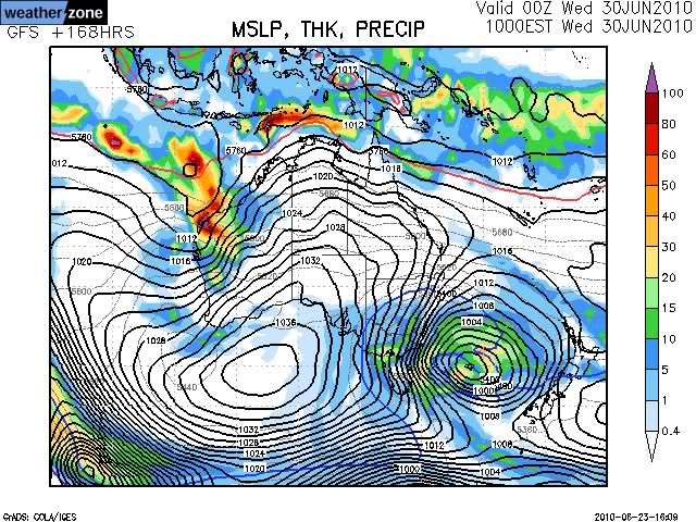
The Weather Nerds are getting particularly excited by the squiggles on charts like this:

The Frog is bullish on the amount of snow we will get on Saturday, and also sees more around Tues/Wed next week.
Fingers crossed that everything eventuates nicely and kicks the season off with a bang.
UPDATE: Wednesday 11:30am:
Jane’s Weather is continuing to predict wet weather ahead of the front, now looking like hitting on Fri night, and cold temps but little snow afterwards. At least we might be able to make snow for the weekend.
The guys on the Weather forum are getting excited by the system early next week. ‘Season Starter’ has been mentioned.
Buller Village Cam is now back online, the time stamp will be fixed for the weekend. This cam runs 24/7 and is an invaluable resource for watching the weather as the fronts hit. Unfortunately the AWS is still offline.
UPDATE: Tuesday 8:30PM:
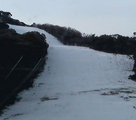
I just screen grabbed this off the Mountainwatch Little Buller Spur Cam:

Looks better than I expected. We won’t need a huge amount of snow to get this open. Hoping for some good snowmaking too in the next day or so. I fear that it may not be ready for the weekend, but surely it can’t be too far off.

There’s currently 1040hpa worth of high pressure parked over SE Australia. A cold, clear night last night, but too cold for snowmaking as is often the case in this kind of weather, as a temperature inversion left the outskirts of Melbourne frosty, but the resorts above zero.
The weather is changing later in the week, with a system due on Thurs Night/Friday, and another on Monday.
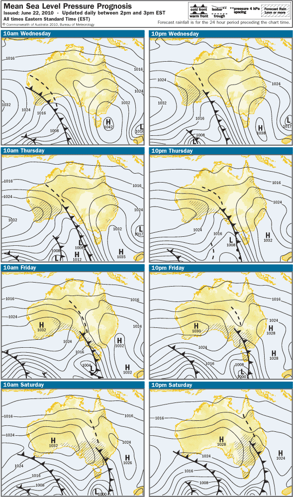
BOM says rain Friday, Snow Saturday, which is backed up by the Freezing Levels shown on Weatherzone
Jane’s Weather isn’t too confident about the first front, but sees a good chance for snow early/mid-next week
Snowatch also is predicting that it will start wet but then cool down and snow.
Plenty of commentary on the ski.com.au Predictions thread, and an Observations thread will open up when the system arrives.
Unfortunately the BOM AWS for Mt Buller and the Village Square Cam are both down, which is a shame as these are great tools for tracking the progress of a cold front. I’ll update this post if/when they are fixed.
Meanwhile The Wang went for his first ski at Perisher for the season.
So it doesn’t look overly flash to start with, but hopefully more snow than rain unlike last weekend, and snow continuing in to next week.
I’ll keep this post updated through the week as the weather systems get closer.
[ad#Adsense Banner]


