UPDATED: 5th Jul 7:30pm
It sounds like it has been a pretty wild day in the alps. We woke to large fresh snow totals in NSW but more modest numbers in Victoria, however from all the people I spoke to at the various mountains it snowed constantly throughout the day.
It is difficult to give a number to the fresh snow accumulation due to the wind – at Buller it was blowing strongly from the West, stripping the likes of Family Run of all its snow, but I did hear of lovely drifts in the trees adjacent to Shakey Knees and alongside Skyline.
The forecast calls for a pretty relentless series of fronts to as far out as Tuesday next week. However we will concentrate on the ones that are more known, and we can expect solid snowfalls tonight, with another front tomorrow night.
These are projected to bring heavy snow to the Alps which will no doubt open more terrain. Buller is expected to open Skyline tomorrow, and I was told not to be surprised if there is significant openings for the weekend including areas like Howqua and Southside.
Of course it’s all in Mother Nature’s hands, but given that it is school holidays at the moment the resorts will be particularly keen to keep the hordes happy with new terrain as soon as the conditions allow.
As always, Jane’s Weather has a good precis of the situation, I won’t post it here as all you need to know is it is going to snow siginificantly until the weekend, with the possibility it could extend beyond.
I will keep this post updated as news comes to hand. If you have anything to report please use the comments below.
I am also being active on Twitter, so please follow @aussieskier for the latest updates & also re-tweets from trusted snow people.
UPDATED: 4 Jul 7:30pm:
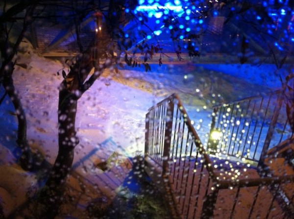
Just like they all said it would, it started snowing this afternoon.
This photo was sent to me at about 7pm, earlier this afternoon the path was brown:

After a damp weekend, things got cold overnight & some resorts reported 3-4cm. It sounded like a pretty miserable weekend around the resorts, from all accounts Buller was drizzly and yuck yesterday with 10mm of rain falling, and Falls & Hotham suffered further with their AWSs showing 35 & 40mm of rain as of 9am respectively. However from the phone calls I’ve had it did not sound like the rain did much damage at Buller which is good news.
After lunch the tweets started accelerating from the various resorts that it was indeed snowing, and it would seem that it started in earnest at Buller from about 4pm. According to my friends up on the hill it has come down in a number of particularly heavy bursts, but punctuated by lulls. However looking at the radar & satellite pictures it would appear that it is set to become more consistent later this evening and into the week.
I’m going to take the snowfall depth predictions with a grain of salt, it looks like it will snow consistently tonight, tomorrow and Wednesday, and that alone will improve the situation and hopefully open more terrain at all resorts, which will be welcomed by the school holiday goers. You can find plenty of predictions with the usual suspects – Jane’s Weather, Weatherzone, Snowatch, Ski.com.au forums etc.A quick squizz at all those links is bound to bring a smile to your face.
As always, please use the comments below if you’re on the ground at the resorts and have anything to add, and share this page with your friends with the buttons below.
Don’t forget to Like aussieskier.com on the top RHS of this page, and above all please do follow us on Twitter. This is a great way to get bite sized updates as things happen – it’s much quicker for me to re-tweet something relevant rather than write a comprehensive post like this.
Later tonight I’m going to expand on my series of weather watching articles. So far I’ve discussed what a waste of time long range forecasts are, but how useful medium/short range forecasts can be. Tonight I’ll share the links and tools for tracking a weather system in real time, just as many snow lovers would have been doing today.


